
Images


July 4, 2016 - Southwestern United States
 Tweet
Tweet
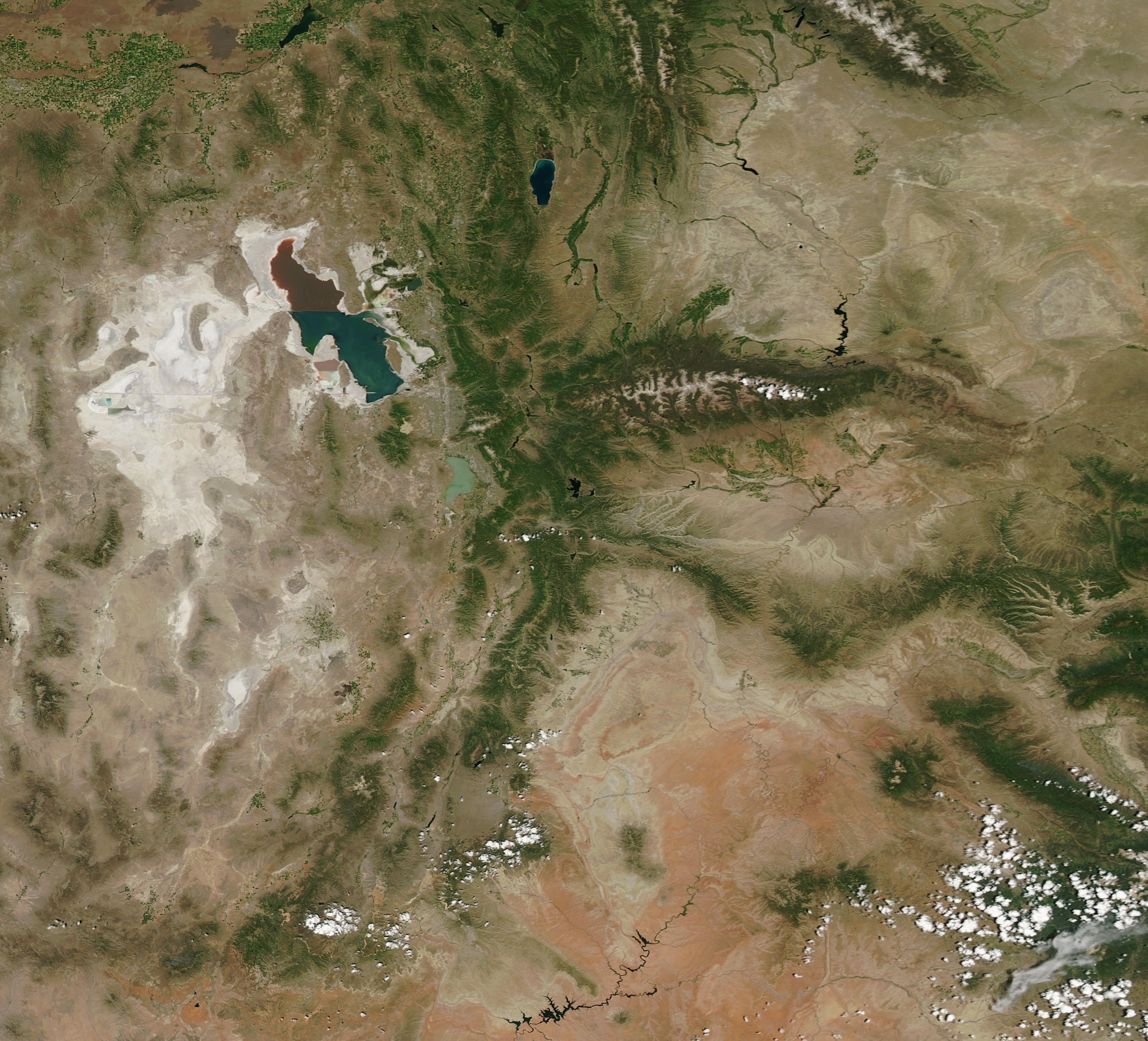
On June 26, 2016, the Moderate Resolution Imaging Spectroradiometer (MODIS) aboard NASA's Aqua satellite flew over the southwestern United States, capturing a true-color image of the region on a sunny, cloud-free, early summer day.
The state of Utah fills the majority of the image, with Wyoming in the northeast and Colorado lying east of Utah. The major -and most striking- feature seen is the Great Salt Lake which sits west of the green ridges of the Uinta Mountains and south of the Wasatch Range.
The Great Salt Lake is a shallow endorheic lake (which means it has no outflow except evaporation), and it relies on the snowmelt from the neighboring mountains for most of its inflow. Seventy-five miles long and almost 35 miles wide, the lake provides a migratory stopover for millions of birds and provides over a billion dollars a year to Utah's economy in recreational activities, brine shrimp production, and mineral extraction. It is truly an important resource for the state, the region, and the wider ecosystem.
A white paper published by researchers from Utah State University in February 2016 suggests that the lake's water levels are fragile and that the Great Salt Lake is shrinking substantially. The lake levels have naturally fluctuated over the years, with an increased depth when high snowmelt and rain, combined with lower temperatures, help fill the basin and minimize evaporation and a decreased depth in times of drought. The white paper, however, says that although there have been droughts and floods in recent decades, the impacts of water diversion have decreased the lake's level by 11 feet, and suggests caution in proposals to further use the lake's water supply.
As the lake shrinks, not only will the economy of the region, recreational opportunities, bird migration, and aquatic life be negatively impacted, but the risk of dust storms will increase, adding additional risks to human health.
Image Facts
Satellite:
Aqua
Date Acquired: 6/26/2016
Resolutions:
1km (147.3 KB), 500m (357 KB), 250m (1.1 MB)
Bands Used: 1,4,3
Image Credit:
Jeff Schmaltz, MODIS Land Rapid Response Team, NASA GSFC
