
Images


November 12, 2016 - Typhoon Meari in western Pacific
 Tweet
Tweet
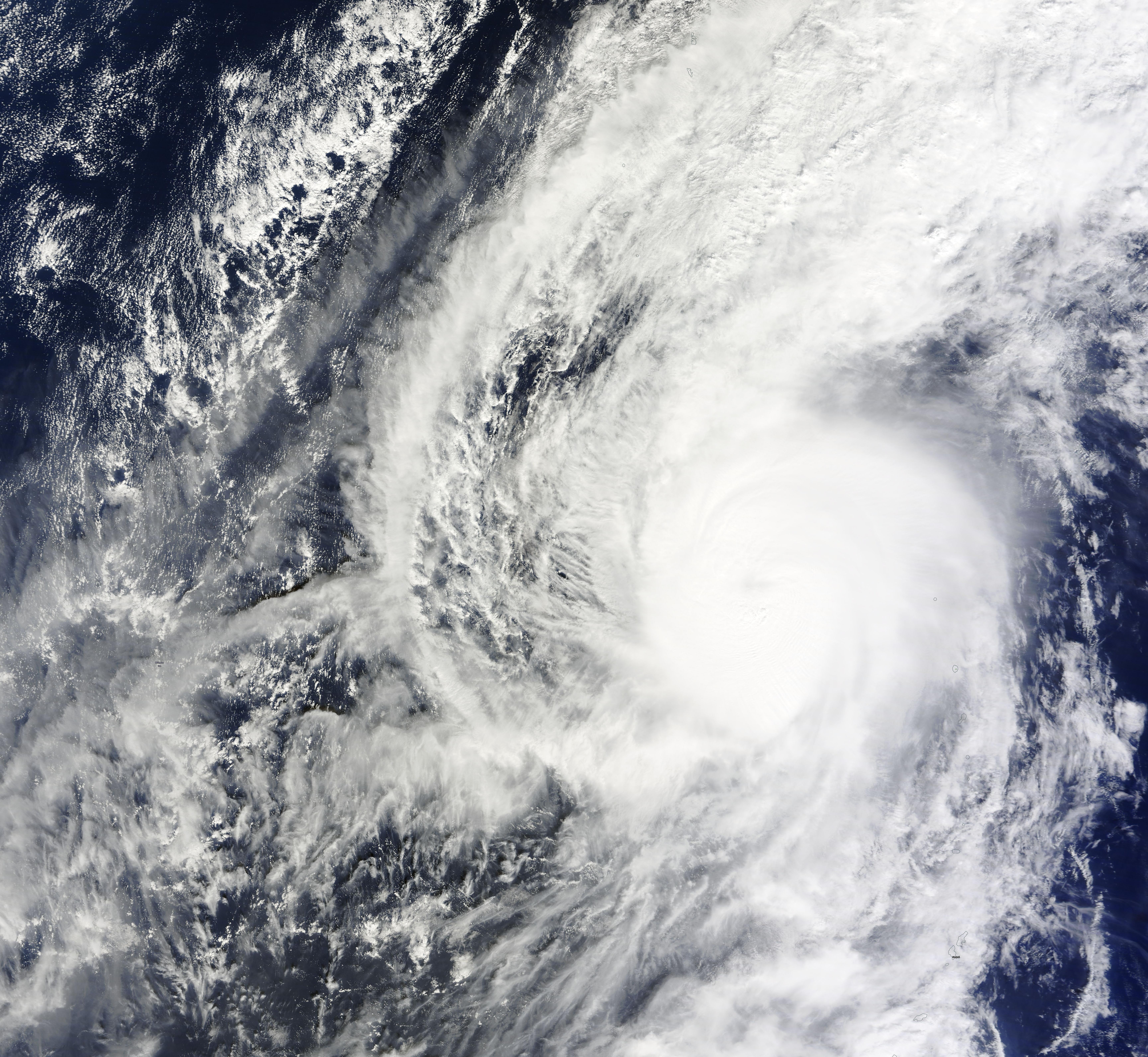
On November 6, 2016, the Moderate Resolution Imaging Spectroradiometer (MODIS) captured a true-color image of Typhoon Meari spinning over the western Pacific Ocean. At the time the image was captured, Meari sported a cloud-filled eye and a tight but asymmetrical apostrophe shape. The storm was located approximately 327 miles south-southwest of Iwo To and was tracking northwestward.
The Joint Typhoon Warning Center (JTWC) first noted the system as a Tropical Depression on November 2, and the storm was named Tropical Storm Meari on the next day. Meari intensified to Typhoon status on November 4. Typhoon Meari reached its peak strength on November 6, with wind of about 105 mph (168 km/h), according to Accuweather. The storm became extratropical on November 7. The short-lived storm stayed well offshore and caused no threat to any populated areas.
Image Facts
Satellite:
Terra
Date Acquired: 11/6/2016
Resolutions:
1km (1.3 MB), 500m (3.8 MB), 250m (4.5 MB)
Bands Used: 1,4,3
Image Credit:
Jeff Schmaltz, MODIS Land Rapid Response Team, NASA GSFC
