
Images


January 1, 2017 - Southern California
 Tweet
Tweet
Southern California shivered under record low temperatures in mid-December 2016. According to the National Weather Service, Los Angeles, Lancaster Airport recorded -8.8˚C (16˚F) on the morning of December 18, which broke a previous record of -8.3˚C (17˚F) which was set in 1995. Santa Maria Airport also reported that the previous record of -2.2˚C (28˚F) fell that same evening, recording a low of -2.7˚C (28˚F).
The cold snap prompted Southern California Gas Company to issue an advisory asking customers to reduce natural gas usage to help prevent the risk of natural gas and electricity shortages. About 60% of the electricity used in California comes from power plants fired by natural gas, and more than 95% of Southern Californians heat their homes with natural gas.
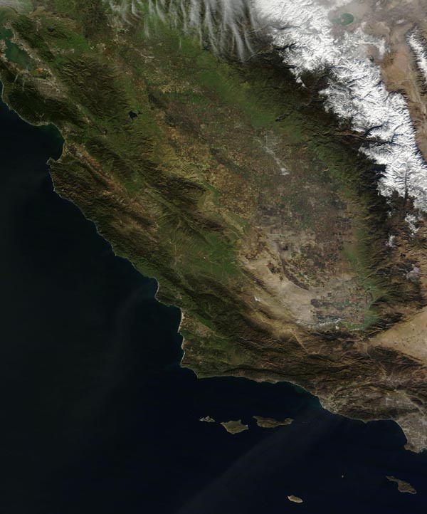
The Moderate Resolution Imaging Spectroradiometer (MODIS) aboard NASA’s Terra satellite captured a true-color image of a well-chilled Southern California on December 19. Snow caps the Sierra Nevadas while the Coastal Range remains green. The Great Valley (also called Central Valley) – a major agricultural region – wears a winter tan, indicating many fallow fields. Gray pixels in the Valley mark human habitation and development, such as the cities of Sacramento (north), Fresno, and in the far south, Bakersfield.
The southern section of the Great Valley appears to be veiled by a light haze or possibly the remnants of dissipating morning fog. In the far south of the image a triangular area of camel-colored tan marks the Mojave Desert. A plume of dust appears to arise from the desert and blows over the Pacific Ocean.
Image Facts
Satellite:
Terra
Date Acquired: 12/19/2016
Resolutions:
1km (70.8 KB), 500m (188 KB), 250m (473 KB)
Bands Used: 1,4,3
Image Credit:
Jeff Schmaltz, MODIS Land Rapid Response Team, NASA GSFC
Southern California shivered under record low temperatures in mid-December 2016. According to the National Weather Service, Los Angeles, Lancaster Airport recorded -8.8˚C (16˚F) on the morning of December 18, which broke a previous record of -8.3˚C (17˚F) which was set in 1995. Santa Maria Airport also reported that the previous record of -2.2˚C (28˚F) fell that same evening, recording a low of -2.7˚C (28˚F). The cold snap prompted Southern California Gas Company to issue an advisory asking customers to reduce natural gas usage to help prevent the risk of natural gas and electricity shortages. About 60% of the electricity used in California comes from power plants fired by natural gas, and more than 95% of Southern Californians heat their homes with natural gas.
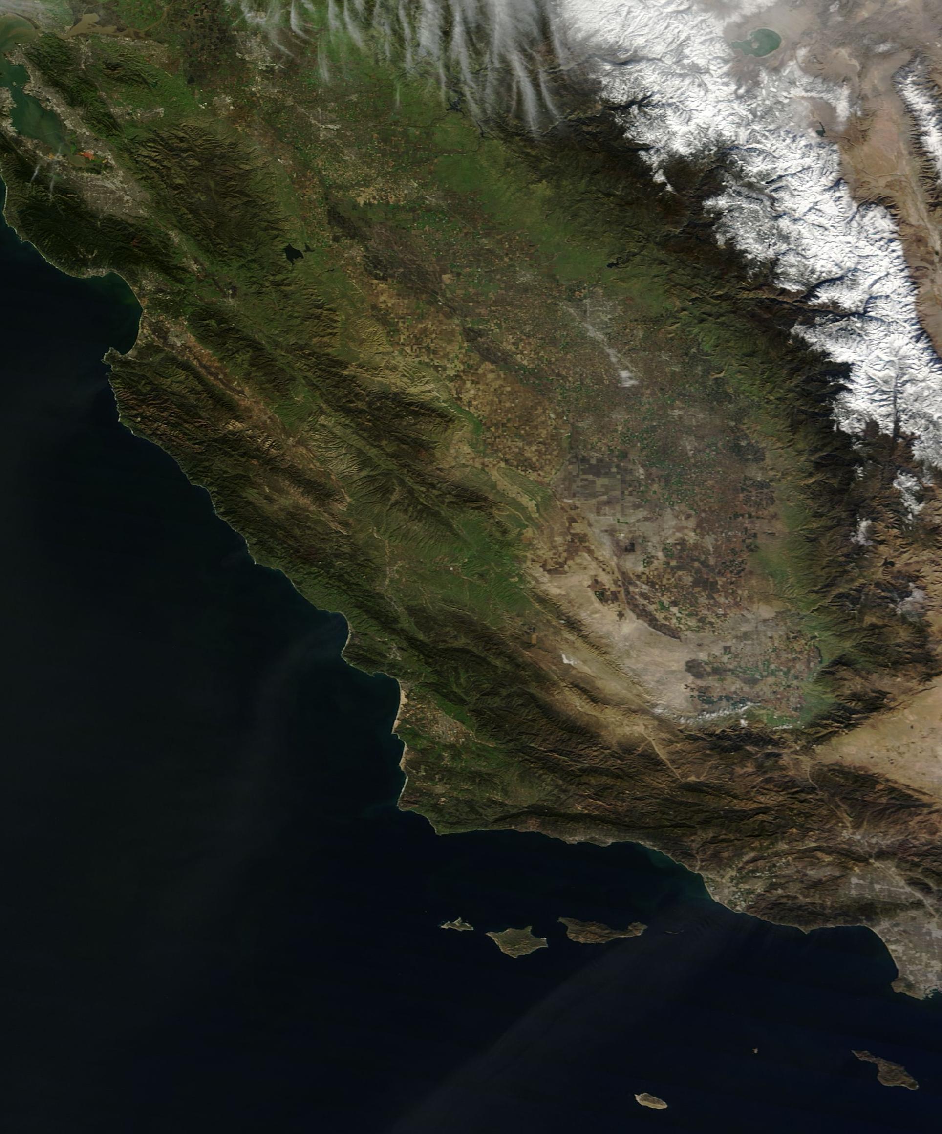
The Moderate Resolution Imaging Spectroradiometer (MODIS) aboard NASA’s Terra satellite captured a true-color image of a well-chilled Southern California on December 19. Snow caps the Sierra Nevadas while the Coastal Range remains green. The Great Valley (also called Central Valley) – a major agricultural region – wears a winter tan, indicating many fallow fields. Gray pixels in the Valley mark human habitation and development, such as the cities of Sacramento (north), Fresno, and in the far south, Bakersfield.
The southern section of the Great Valley appears to be veiled by a light haze or possibly the remnants of dissipating morning fog. In the far south of the image a triangular area of camel-colored tan marks the Mojave Desert. A plume of dust appears to arise from the desert and blows over the Pacific Ocean.
Image Facts
Satellite:
Terra
Date Acquired: 12/19/2016
Resolutions:
1km (70.8 KB), 500m (188 KB), 250m (473 KB)
Bands Used: 1,4,3
Image Credit:
Jeff Schmaltz, MODIS Land Rapid Response Team, NASA GSFC
