Images
April 5, 2017 - Japan
Tweet
The nation of Japan lies in the Pacific Ocean off of the coasts of China, Korea, and Russia. Made up of over 6,800 islands, the archipelago stretches from The Sea of Okhotsk in the north to the East China Sea in the southwest. The four largest islands are, from north to south, Hokkaido, Honshu, Shikoku, and Kyushu.
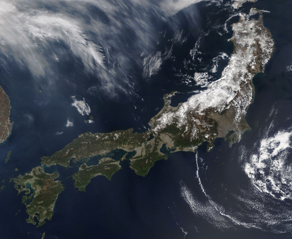
On April 4, 2017, the Moderate Resolution Imaging Spectroradiometer (MODIS) aboard NASA’s Terra satellite captured a true-color image of Japan.
The island of Honshu is featured in this image, dressed in snow along the mountainous north and west. Shikoku lies off the southeast coast, and Kyushu sits south of Honshu.
Dust, haze, and cloud streak the atmosphere, especially west of Japan. The haze and dust come at a time of year when cold winter air exacerbates air pollution in some Asian cities. March is also an active month for dust storms in the Gobi and Taklimakan deserts.
Image Facts
Satellite:
Terra
Date Acquired: 4/4/2017
Resolutions:
1km (1.2 MB), 500m (3.6 MB), 250m (3.1 MB)
Bands Used: 1,4,3
Image Credit:
Jeff Schmaltz, MODIS Land Rapid Response Team, NASA GSFC


