
Images


May 28, 2017 - England and Wales
 Tweet
Tweet
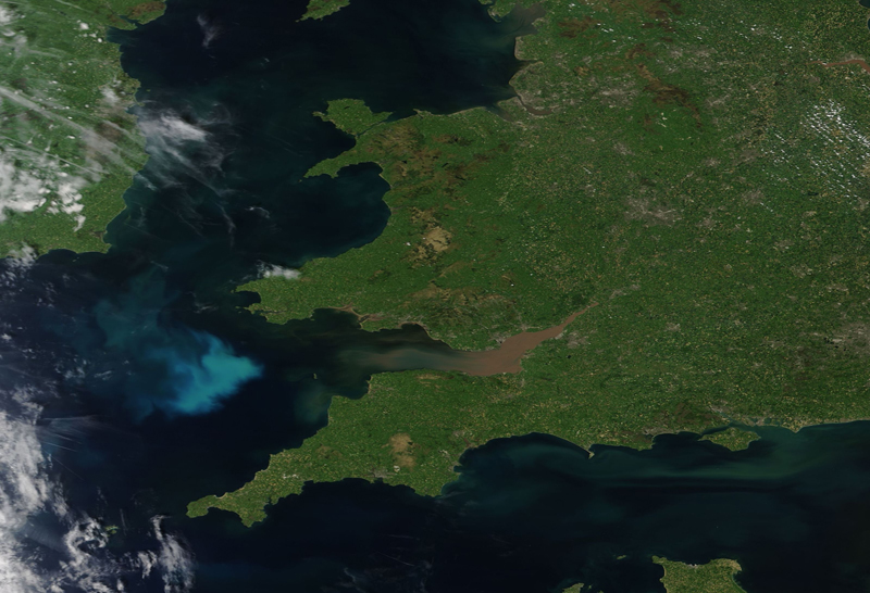
The Moderate Resolution Imaging Spectroradiometer (MODIS) aboard NASA’s Terra satellite captured a true-color image of England and Wales on May 26, 2017.
The island of Great Britain contains Scotland, England, and Wales. Scotland sit on the most northerly part of the island and is not seen in this image England fills most of the island, while Wales sits in the southwest section and is known for its mountainous terrain and complex coastline. Bristol Bay forms the southernmost border between Wales and England – and is notable in this image as it is filled with tan sediment. In the Irish Sea, almost due west of Bristol Bay, a bright swirl of color marks a late spring phytoplankton bloom.
Image Facts
Satellite:
Terra
Date Acquired: 5/26/2017
Resolutions:
1km (344.9 KB), 500m (902.5 KB), 250m (755 KB)
Bands Used: 1,4,3
Image Credit:
Jeff Schmaltz, MODIS Land Rapid Response Team, NASA GSFC
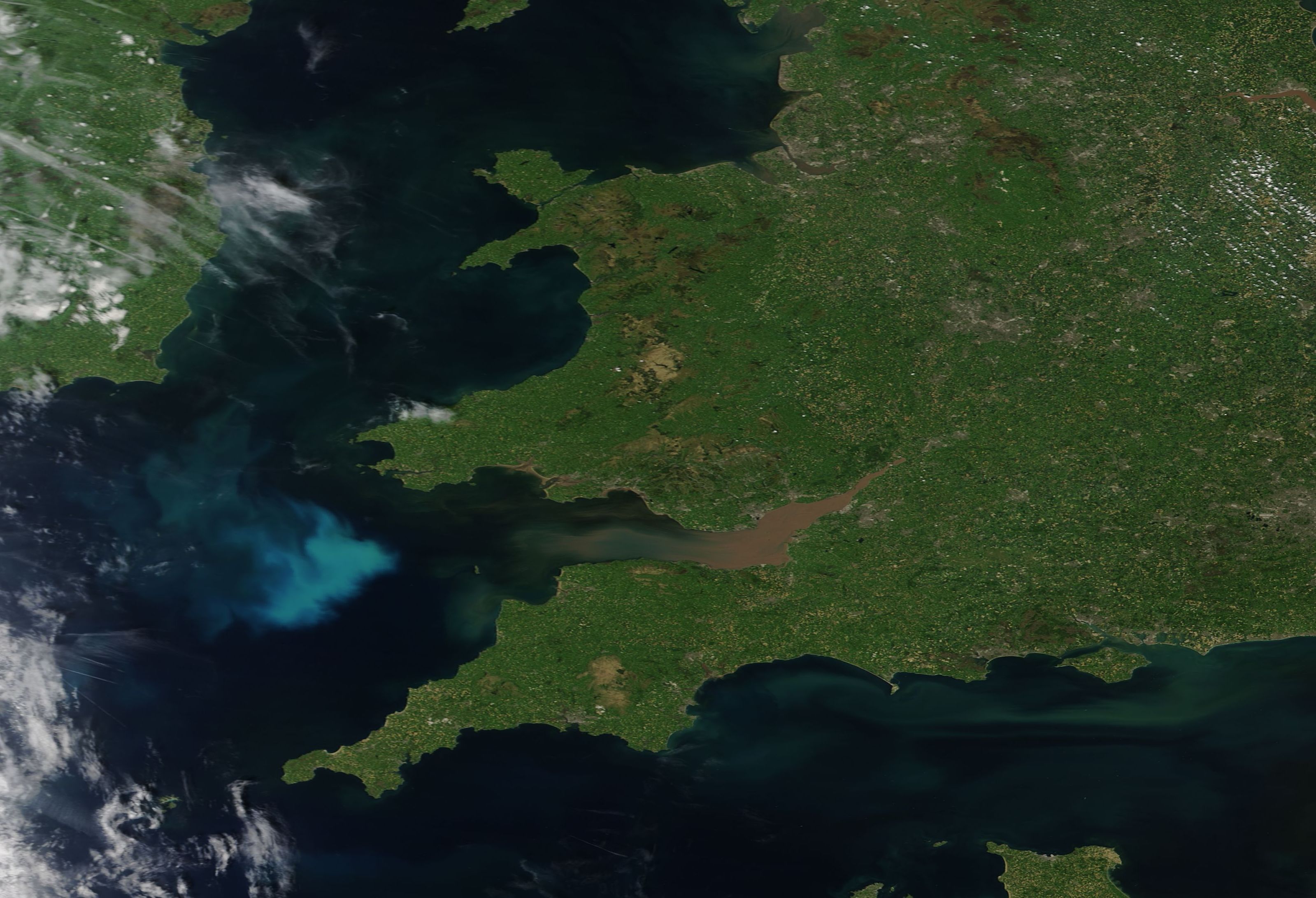
