
Images


August 11, 2017 - Snow on South Island, New Zealand
 Tweet
Tweet
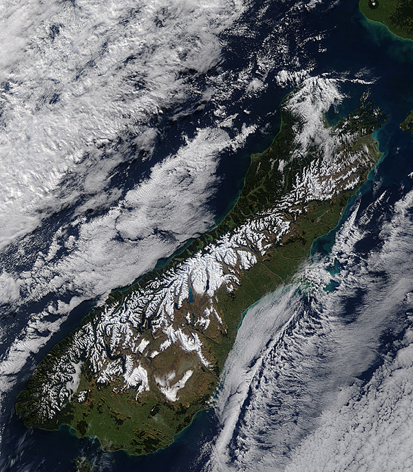
On August 4, 2017, the Moderate Resolution Imaging Spectroradiometer (MODIS) aboard NASA’s Terra satellite acquired a dramatic true-color image of a frigid winter’s day in New Zealand’s South Island.
A blanket of snow lies across the Southern Alps, a rugged chain of mountains that run about 310 miles (500 miles) along the western spine of South Island. The range claims sixteen peaks over 9,800 feet (3,000 meters) in height with the tallest, Mount Cook (Aoraki) standing at 12,218 feet (3,724 meters). The sharply-chiseled mountain range wears a dusting of snow year-round as well as a large number of glaciers, but the late-winter days of August typically brings the heaviest snowfalls.
To the east of the Southern Alps the rolling farmlands of Southland and Otago appears tan from the primarily senescent vegetation of winter. The large, flat Canterbury Plains remains green. Banks of marine stratocumulus clouds lie over the blue waters of the Tasman Sea (west) and Pacific Ocean.
Image Facts
Satellite:
Terra
Date Acquired: 8/4/2017
Resolutions:
1km (279.2 KB), 500m (1007.3 KB), 250m (2.5 MB)
Bands Used: 1,4,3
Image Credit:
Jeff Schmaltz, MODIS Land Rapid Response Team, NASA GSFC
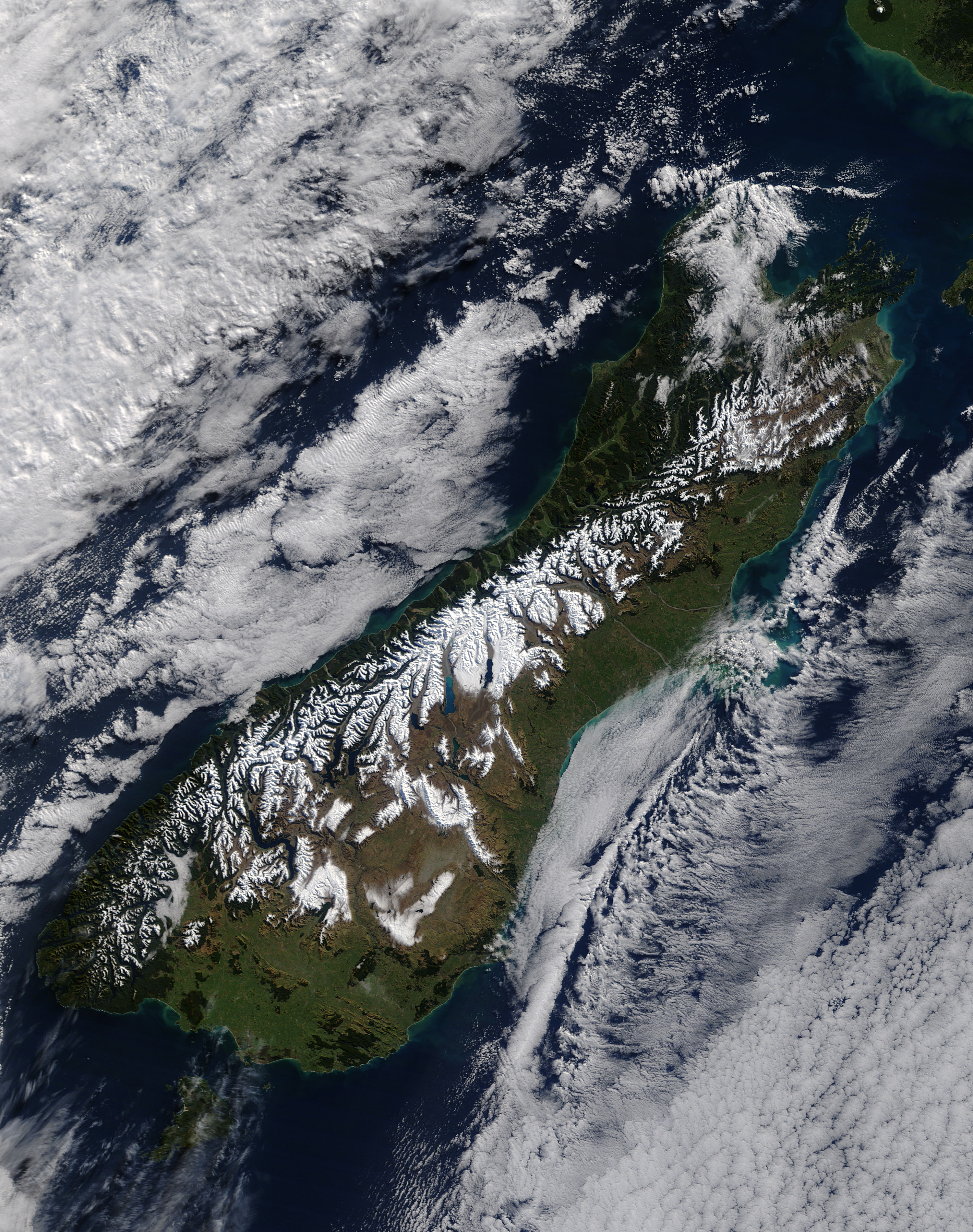
