
Images


October 20, 2017 - Typhoon Khanun (24W) approaching China
 Tweet
Tweet
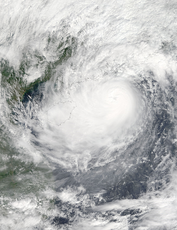
On October 15, 2017, Typhoon Khanun was rapidly approaching China as the Moderate Resolution Imaging Spectroradiometer (MODIS) aboard the Terra satellite snapped a true-color image of the scene. Maximum sustained winds at that time were about 75 mph (120 km/h), and convective bands carrying rain and storms stretched well inland ahead of the storm center and also covered the island of Hainan.
Typhoon Khanun made landfall in Xuwen in southern China’s Guangdong Province around 19:25 UTC (3:25 p.m. EDT) on October 15 at slightly less-than-peak strength, carrying winds of about 62 mph (100 km/h). It quickly lost power and dropped to tropical-storm strength less than four hours after landfall, then rapidly became a tropical depression.
The final warning on Tropical Depression Khanun was issued on October 16 at 0300 UTC (11 p.m. EDT, Oct. 15) by the Joint Typhoon Warning Center. At that time, Khanun was located near 20.3 degrees north latitude and 109.3 degrees east longitude, in the Gulf of Tonkin. The Gulf is located between Vietnam to the west and Hainan Island, China, to the east. Maximum sustained winds had dropped to 28.7 mph (4.3 km/h).
Image Facts
Satellite:
Terra
Date Acquired: 10/15/2017
Resolutions:
1km (625 KB), 500m (1.9 MB), 250m (4.7 MB)
Bands Used: 1,4,3
Image Credit:
Jeff Schmaltz, MODIS Land Rapid Response Team, NASA GSFC
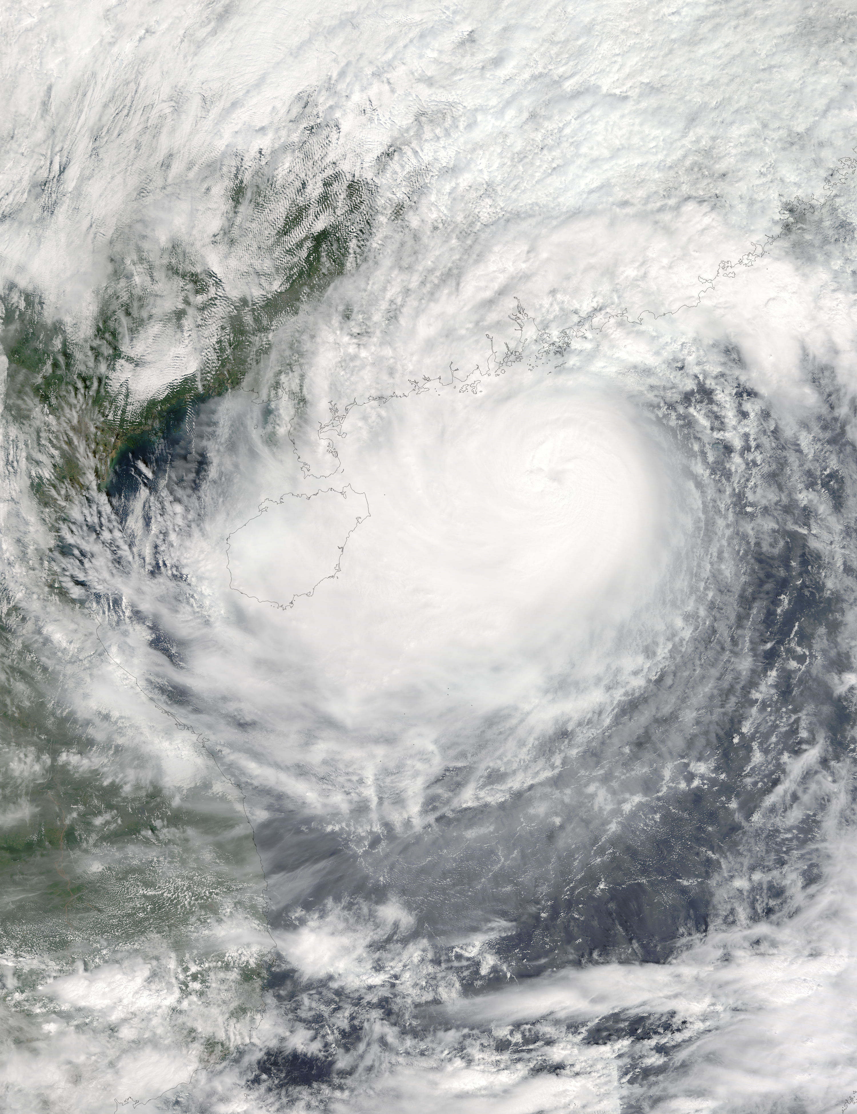
