Images
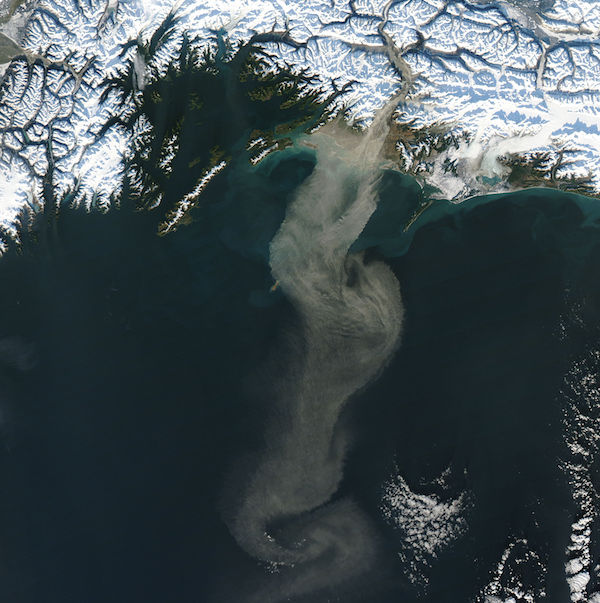
November 19, 2017 - Dust storm off southern Alaska
Tweet
Strong winds continued to blow across southern Alaska through mid-November, 2017, creating spectacular dust storms. The Moderate Resolution Imaging Spectroradiometer (MODIS) aboard NASA’s Aqua satellite captured this true-color image of a thick plume of dust pouring out of the Copper River valley and over the Gulf of Alaska on November 15.
When glaciers grind against underlying bedrock, they produce a silty powder with grains finer than sand. Geologists call it “glacial flour” or “rock flour.” This iron- and feldspar-rich substance often finds its way into rivers and lakes, coloring the water brown, grey, or aqua. When water levels are low – which is typically in the fall in Alaska - the flour can dry out on riverbanks and deltas and become dust for winds to lift into the air.
Image Facts
Satellite:
Aqua
Date Acquired: 11/15/2017
Resolutions:
1km (84.7 KB), 500m (301 KB), 250m (817.4 KB)
Bands Used: 1,4,3
Image Credit:
Jeff Schmaltz, MODIS Land Rapid Response Team, NASA GSFC


