
Images


April 27, 2018 - Japan
 Tweet
Tweet
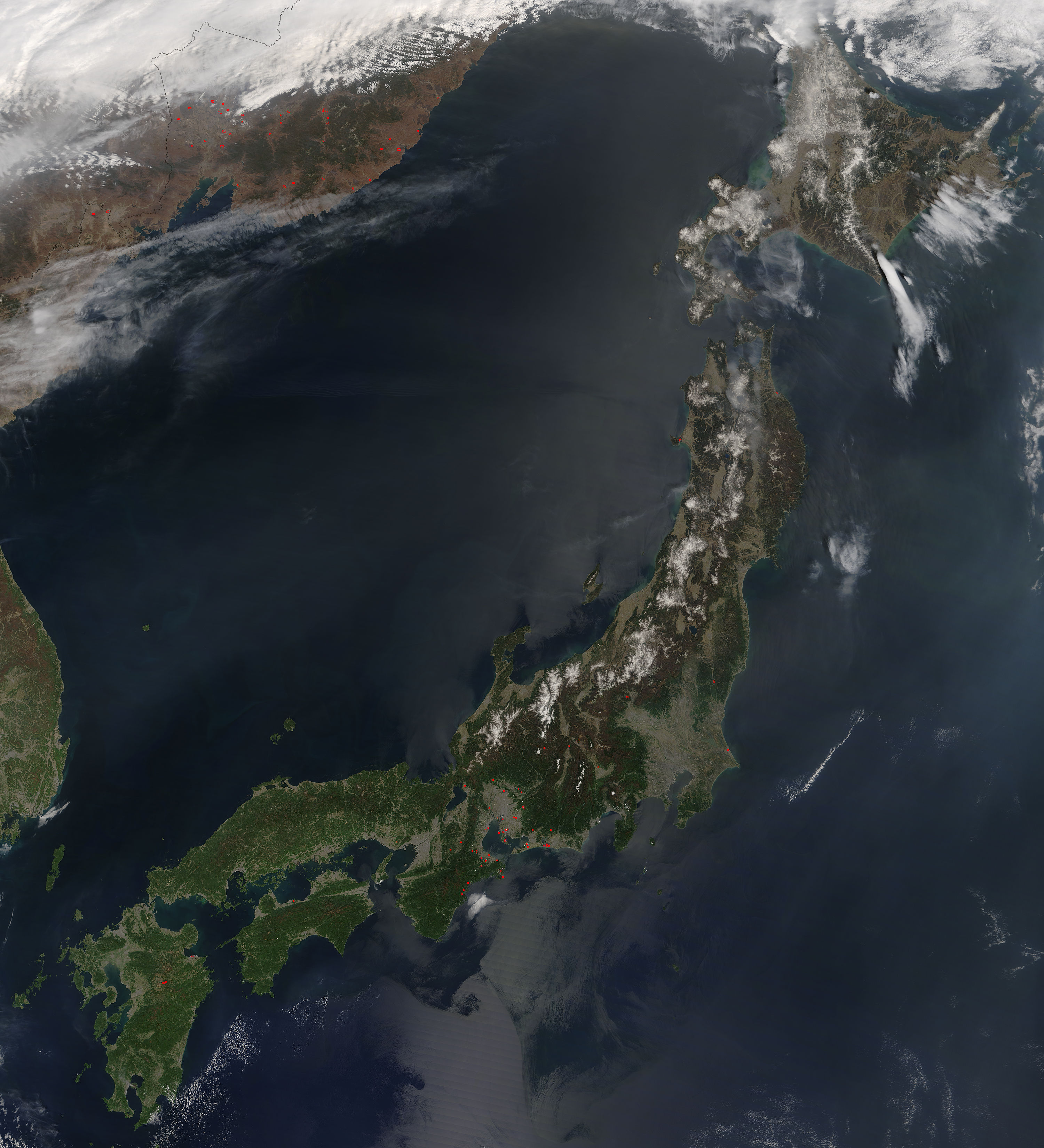
The island nation of Japan contains more than 6,800 islands stretched between the North Pacific Ocean and the Sea of Japan. The volcanic origins of this archipelago give rise to the steep, rugged terrain common to most of the islands. While most of the volcanoes are considered extinct, Japan’s location at the junction of 4 tectonic plates (the Pacific, Philippine, Eurasian, and North American) ensures substantial seismic and volcanic activity. About 10% of all active volcanoes in the word – more than 100 total – are found in Japan. One island - the largest island, Honshu - is home to 47 active volcanoes.
On April 21, 2018, the Moderate Resolution Imaging Spectroradiometer (MODIS) on board NASA’s Terra satellite acquired a true-color image of southern Japan. The three main islands seen in this image are, from north to south: Honshu, Shikoku, and Kyushu. To the west, across the Sea of Japan (also called the East Sea), eastern South Korea can be seen while to the northwest parts of North Korea, China, and eastern Russia are visible.
Numerous red hot spots are scattered across the image, particularly near Ise Bay on Honshu and in eastern Russia. Each red hot spot is an area where the thermal bands on the MODIS instruments detected areas where the temperature is substantial higher than background. When accompanied by smoke, as can be seen in eastern Russia, such hot spots are typical of actively burning fires.
Image Facts
Satellite:
Terra
Date Acquired: 4/21/2018
Resolutions:
1km (344.4 KB), 500m (1.2 MB), 250m (3.2 MB)
Bands Used: 1,4,3
Image Credit:
Jeff Schmaltz, MODIS Land Rapid Response Team, NASA GSFC
