
Images


May 7, 2018 - New Zealand
 Tweet
Tweet
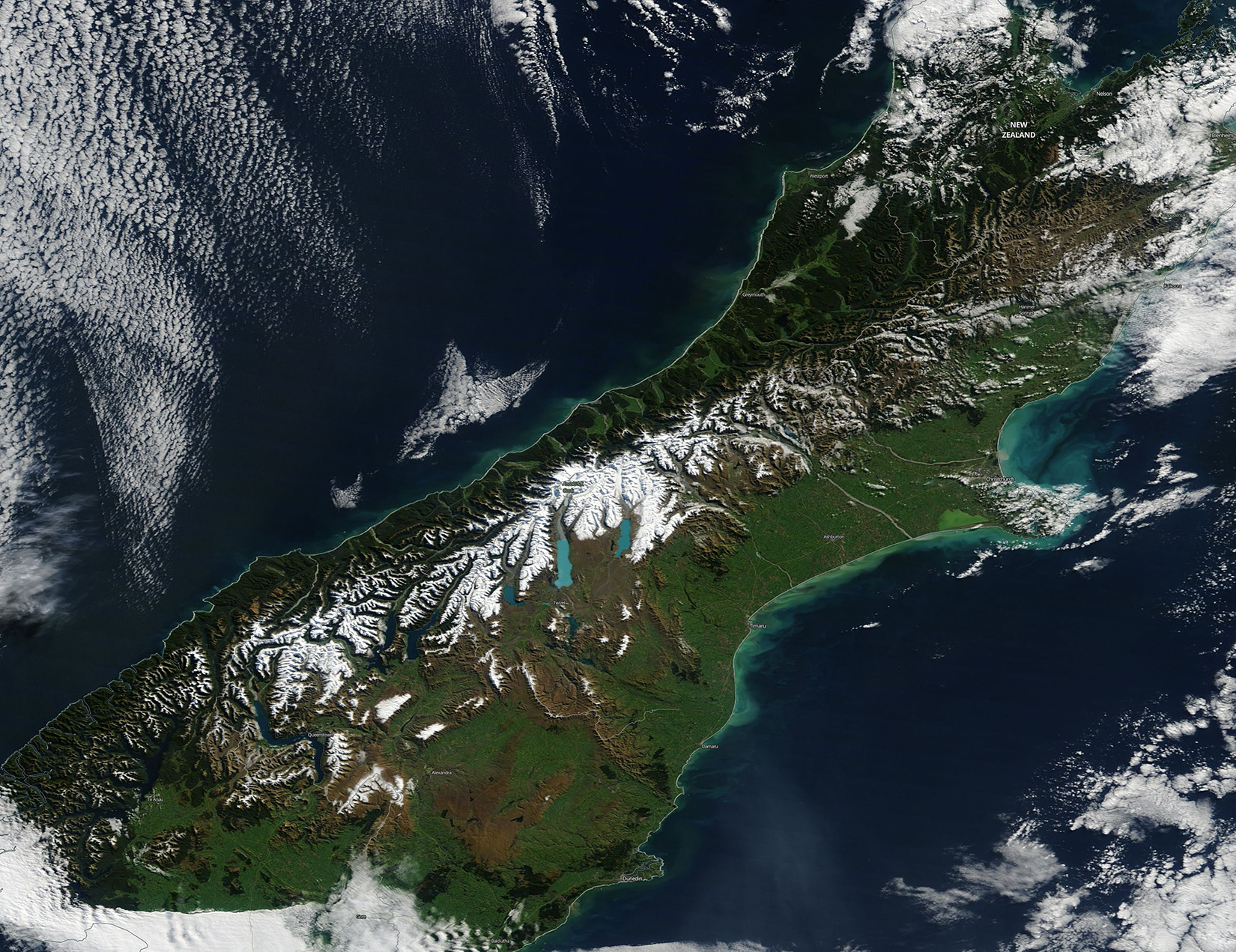
Clear skies over New Zealand’s South Island allowed the Moderate Resolution Spectroradiometer (MODIS) aboard NASA’s Terra satellite to acquire a stunningly sharp true-color image on May 2, 2018.
The snow-capped peaks of the Southern Alps run roughly parallel to the northeastern shore of the island and are punctuated by striking electric blue of glacial lakes. The highest peak of New Zealand, Aoraki/Mount Cook, sits in this mountain rage, rising to 12,315 feet (3,754 meters).
The slim coastal land west of the mountains receives copious rainfall – more than any other place in South Island – and is covered by temperate rain forests. The lush vegetation of the rain forests appears deep green in this image. Immediately east of the mountains – in the rain shadow of the Southern Alps – the landscape appears tan. This indicates dry conditions and a lack of vegetation. Moving toward the east, the broad plains appear bright green. The plains are nutrient-rich and support the growth of vegetation, despite relatively low rainfall.
Image Facts
Satellite:
Terra
Date Acquired: 5/2/2018
Resolutions:
1km (321.6 KB), 500m (869.9 KB), 250m (1.4 MB)
Bands Used: 1,4,3
Image Credit:
Jeff Schmaltz, MODIS Land Rapid Response Team, NASA GSFC
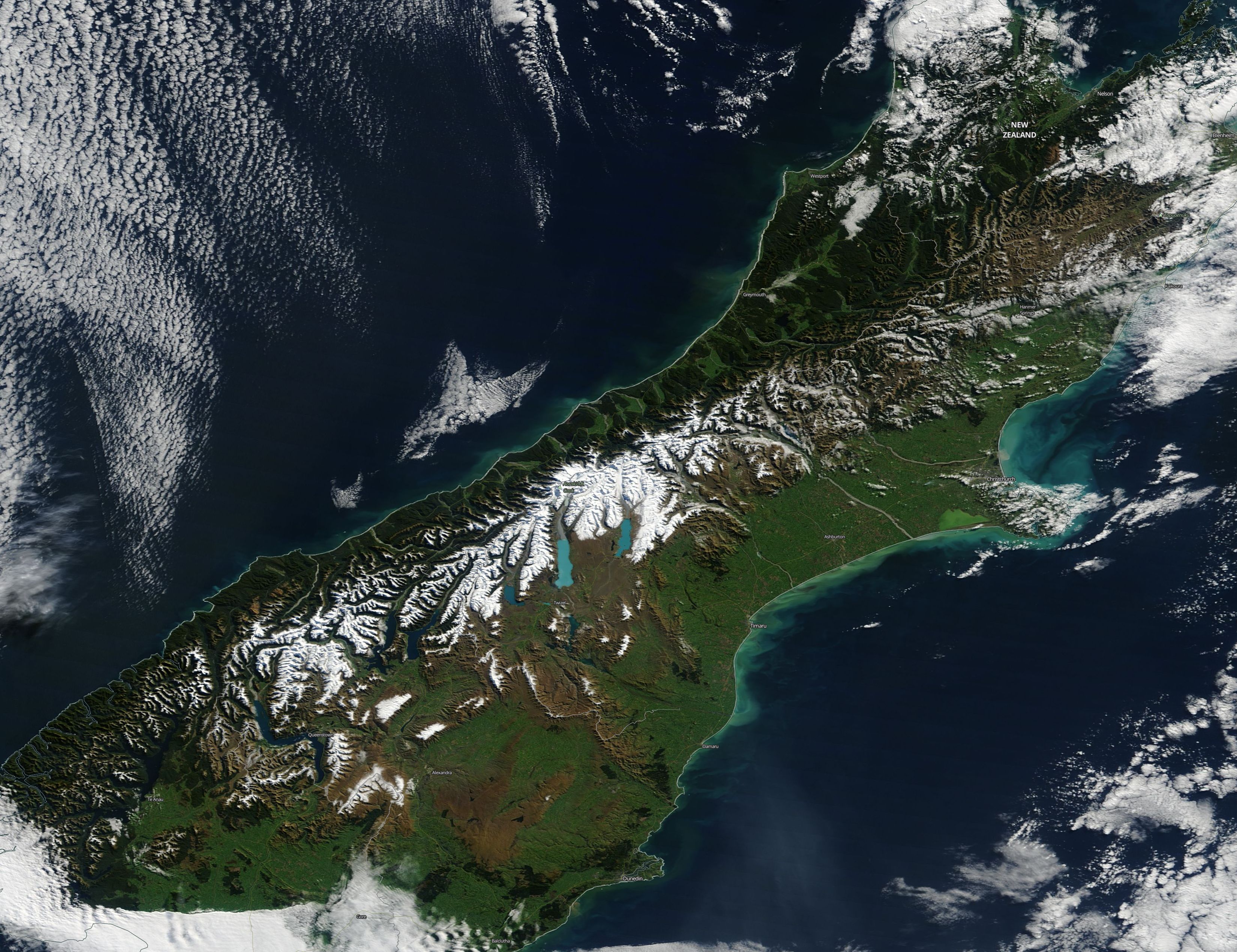
