
Images


May 19, 2018 - North Channel
 Tweet
Tweet
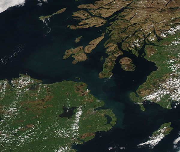
The North Channel separates northeastern Ireland from western Scotland and links the Irish Sea (south) to the North Atlantic Ocean.
This shallow strait reaches only 13 miles (21 km) wide at its narrowest point, which is between Torr Head, Northern Ireland and the Mull of Kintyre, Scotland. Most of the Channel is only 10 – 40 meters (33 – 131 feet) deep, although it plunges to 150 meters (492 feet) at its maximum depth. The coasts of the North Channel are rough and indented, most notably by the funnel-shaped Belfast Lough on the Irish coast and by the Sound of Jura, Kibrannan Sound, and the Firth of Clyde in Scotland.
The coasts are so tantalizingly close that proposals to build a bridge or a tunnel to connect the two have abounded since the late 1700’s. The idea has been raised again recently, when, according to the BBC News, the Scottish government said in March, 2018, that it was ready to initiate discussions about the feasibility of building a bridge between Scotland and Northern Ireland. Several routes have been proposed, with the shortest – the Mull on Kintyre to the Antrim coast – favored, although the remote location of the Mull of Kintyre suggests that a longer “fixed link”, as the bridge proposal is called, has stirred suggestions of alternate sites.
The Moderate Resolution Imaging Spectroradiometer (MODIS) aboard NASA’s Aqua satellite acquired a true-color image of the North Channel on May 16, 2018.
Image Facts
Satellite:
Aqua
Date Acquired: 5/16/2018
Resolutions:
1km (65.4 KB), 500m (159.8 KB), 250m (291.3 KB)
Bands Used: 1,4,3
Image Credit:
Jeff Schmaltz, MODIS Land Rapid Response Team, NASA GSFC
