
Images


June 4, 2018 - Northern Territory, MacDonnell Ranges
 Tweet
Tweet
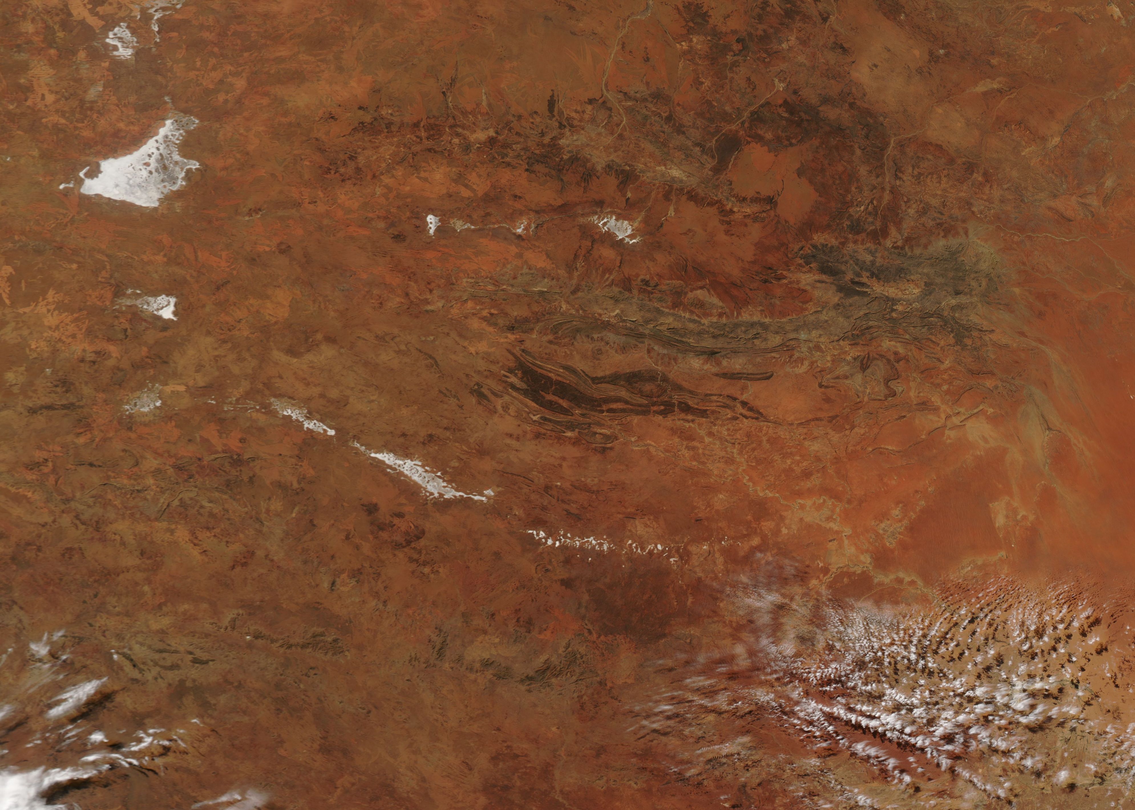
Near the center of Australia and in the heart of Northern Territory, a series of bare sandstone and quartzite ridges fold upward from the arid red-rock outback. These mountains, known as the MacDonnell Ranges stretch for about 230 miles (380 km) and rise to over 4,000 feet (1,219 meters) high. The tallest peak is Mount Ziel, which rises to 4,954 feet (1,510 meters).
The third-largest town in Northern Territory, Alice Springs, sits within the mountain on both sides of the banks of the usually-dry Todd River. The red sand dunes to the south east, just on the edge of this image, mark the intensely dry Simpson Desert. To the southwest of the MacDonnell Range are the upfoldings that mark the George Gill Range, home to Watarrka National Park and Kings Canyon, both popular with tourists and hikers.
The Moderate Resolution Imaging Spectroradiometer (MODIS) aboard NASA’s Aqua satellite acquired a true-color image of the region on June 1, 2018.
Image Facts
Satellite:
Aqua
Date Acquired: 6/1/2018
Resolutions:
1km (707.2 KB), 500m (1.8 MB), 250m (1.3 MB)
Bands Used: 1,4,3
Image Credit:
Jeff Schmaltz, MODIS Land Rapid Response Team, NASA GSFC
