
Images


July 9, 2018 - Volga River Delta and the Caspian Sea
 Tweet
Tweet
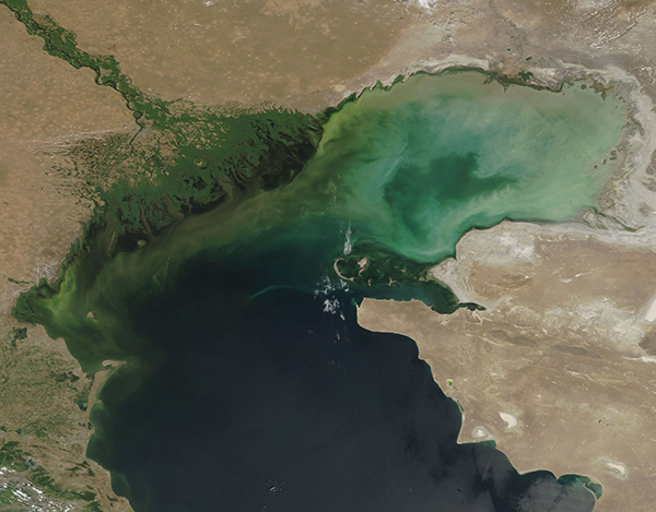
On July 2, 2018, the Moderate Resolution Imaging Spectroradiometer (MODIS) on board NASA’s Terra satellite acquired a spectacular true-color image of Russian’s Volga Delta as it pours into the Caspian Sea.
The Volga River drains more than 1.3 million square km (about 502,000 square miles) of catchment area, including farmland, industrial sites, wildlands and cities. At its terminus, the braids of the Volga fan outward, creating a broad, fertile delta as it flows into the saline Caspian Sea. More than 500 channels from the river itself through the delta and into the sea.
The fertile Volga Delta sustains a rich fishing industry as well as home for endangered endemic species including several species of sturgeon. It is an important breeding and migratory route for birds as well as the northernmost natural location where the lotus (Nelumbo nucifera) thrives. Lotus are more typically found in the tropics.
The swirling colors in the northwestern section of the Caspian Sea are created by a combination of sediment flowing into the waters (from the Volga and from land runoff) and from growth of phytoplankton. These plant-like microscopic organisms often reproduce in large numbers when temperature, hours of light, and nutrients are suitable, resulting in huge blooms that can easily be seen from space.
Image Facts
Satellite:
Terra
Date Acquired: 7/2/2018
Resolutions:
1km (324 KB), 500m (803.1 KB), 250m (587.9 KB)
Bands Used: 1,4,3
Image Credit:
Jeff Schmaltz, MODIS Land Rapid Response Team, NASA GSFC
