
Images


August 29, 2018 - California Wildfires
 Tweet
Tweet
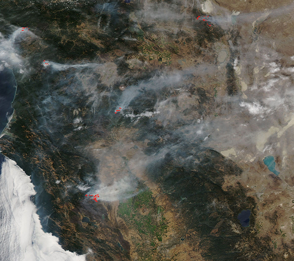
California’s devastating fire season continued to char the landscape through late August, 2018.
The Moderate Resolution Imaging Spectroradiometer (MODIS) aboard NASA’s Aqua satellite acquired a true-color image of California pock-marked with multiple wildfires on August 26. Each red hot spot marks an area where the thermal bands on the MODIS instrument detected high temperatures. When combined with smoke, such as in this image, such hot spots are diagnostic for actively burning fire.
According to the San Francisco Chronicle’s Fire Tracker, which compiles fire information for California from a number of sources including Inciweb and CAL FIRE, as of August 28 there were 12 fires that were over 500 acres in size, caused damage to structures, or caused injury or death to one or more people, actively burning in the state. The largest, the Ranch Fire had consumed 410,182 acres and was 91% contained. The River Fire, which had reached 100% containment (and thus not part of the 12 active fires listed) had consumed 48,920 acres. The Ranch Fire and the River Fire combined to create the Mendocino Complex, which has captured the title of largest fire in California history.
Image Facts
Satellite:
Aqua
Date Acquired: 8/26/2018
Resolutions:
1km (323.3 KB), 500m (822.5 KB), 250m (619.1 KB)
Bands Used: 1,4,3
Image Credit:
MODIS Land Rapid Response Team, NASA GSFC
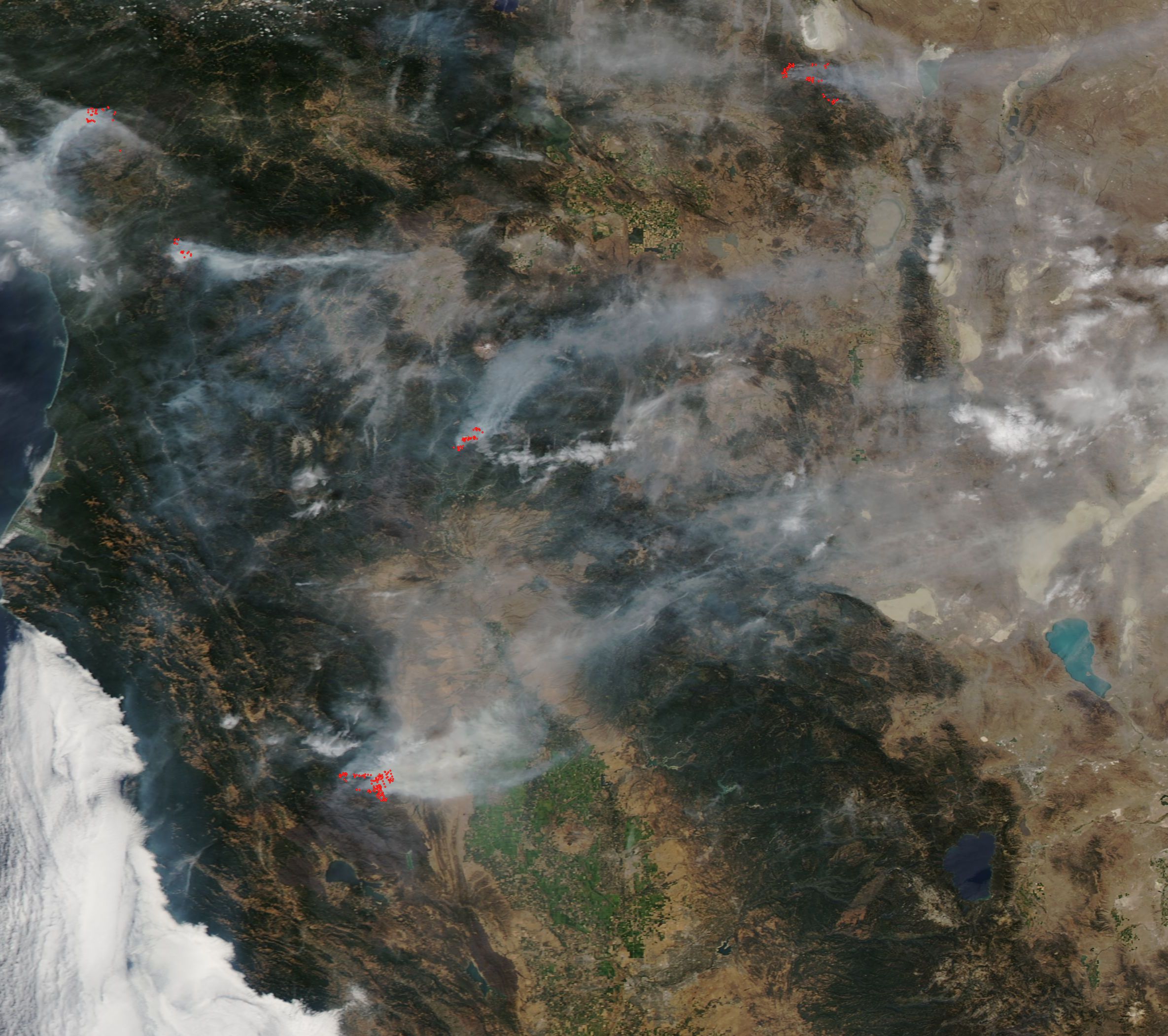
