
Images


December 20, 2018 - Lake Superior
 Tweet
Tweet
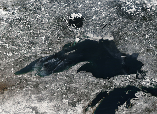
The first ice of the winter was beginning to form on Lake Superior in mid-December 2018. The Moderate Resolution Imaging Spectroradiometer (MODIS) on board the Aqua satellite acquired a true-color image of the frigid scene on December 15, 2018.
Lake Superior is the largest of the Great Lakes, stretching about 160 miles (257 km) wide and 350 miles (563 km) long. It is also the Earth’s largest freshwater lake measured by surface area and the third-largest freshwater lake by water volume. The lake is shared by Ontario, Canada (north) and Wisconsin, Michigan, and Minnesota in the United States. Superior has the highest elevation of all of the Great Lakes, draining into the St. Mary’s River.
Although Lake Superior is the northernmost lake and has the coolest average water temperature of all the Great Lakes—40°F (4.4°C)—it rarely freezes over completely in winter time. Typically ice cover measures the between 40 to 95 percent. According to the National Oceanic and Atmospheric Administration (NOAA)’s Coast Watch, by mid-December less than 1 percent of the surface of Lake Superior was covered with ice. In the image this can be seen as the highly reflective white area near the northwest coast.
Image Facts
Satellite:
Aqua
Date Acquired: 12/15/2018
Resolutions:
1km (895.3 KB), 500m (2.4 MB), 250m (2.7 MB)
Bands Used: 1,4,3
Image Credit:
MODIS Land Rapid Response Team, NASA GSFC
