
Images


December 30, 2018 - Smoke and Haze over India
 Tweet
Tweet
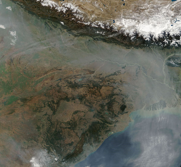
Haze hung over northeastern India and Bangladesh in late December 2018. The Moderate Resolution Imaging Spectroradiometer (MODIS) on board NASA’s Terra satellite acquired this true-color image on December 14.
The skies over the Indo-Gangetic Plain—a river valley that includes parts of Pakistan, India, Nepal, and Bangladesh—are among the haziest in the world. Despite this dubious distinction, the air quality in this region various considerably throughout the year. Spring usually brings the clearest skies of the year, while the worst air quality is often in the fall, when agricultural fires are set in high numbers to burn off crop residue, prepare the soil for new crops, and manage pasturelands.
The cool months of December and January are best known for producing thick fogs and aerosols hazes. Cooking and heating stoves in rural areas add smoke; so do a smattering of agricultural fires that continue through the winter. Urban areas contribute nitrates and sulfates that come from vehicles, coal-fired power plants, and other industrial sources.
Image Facts
Satellite:
Terra
Date Acquired: 12/24/2018
Resolutions:
1km (507.5 KB), 500m (1.9 MB), 250m (5.8 MB)
Bands Used: 1,4,3
Image Credit:
MODIS Land Rapid Response Team, NASA GSFC
