
Images


March 16, 2019 - Tropical Cyclone Idai
 Tweet
Tweet
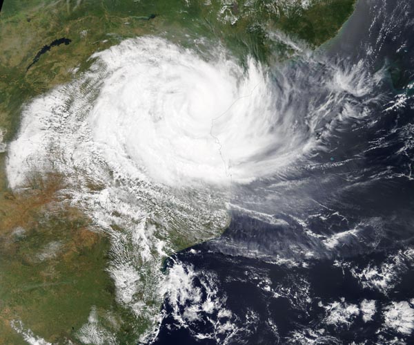
On March 15, the Moderate Resolution Imaging Spectroradiometer (MODIS) aboard NASA’s Terra satellite provided a true-color image of Tropical Cyclone Idai. At the time the image was acquired, the storm’s cloud-filled eye hung over central Mozambique and the western quadrant had already spread into Zimbabwe. Although it was over land, the system retained a ragged eye.
At 0300 UTC on March 15 (11 p.m. EDT on March 14), the Joint Typhoon Warning Center (JTWC) issued the final warning on Idai. At the time, Idai was over land and had maximum sustained winds near 90 knots (103.6 mph/166.7 km/h). It was centered near 19.6 degrees north latitude and 34.8 degrees east longitude.
Idai is expected to affect parts of the Mozambique provinces of Zambézia, Sofala, Manica, Tete and Inhambane. Moderate to strong rains accompanied by severe thunderstorms and gusty winds are expected in the north of the provinces of Niassa, Cabo Delgado and northern Tete.
JTWC has forecast Idai to rapidly weaken as it tracks across central Mozambique and into northern Zimbabwe.
Image Facts
Satellite:
Terra
Date Acquired: 3/15/2019
Resolutions:
1km (557 KB), 500m (1.8 MB), 250m (5.6 MB)
Bands Used: 1,4,3
Image Credit:
MODIS Land Rapid Response Team, NASA GSFC
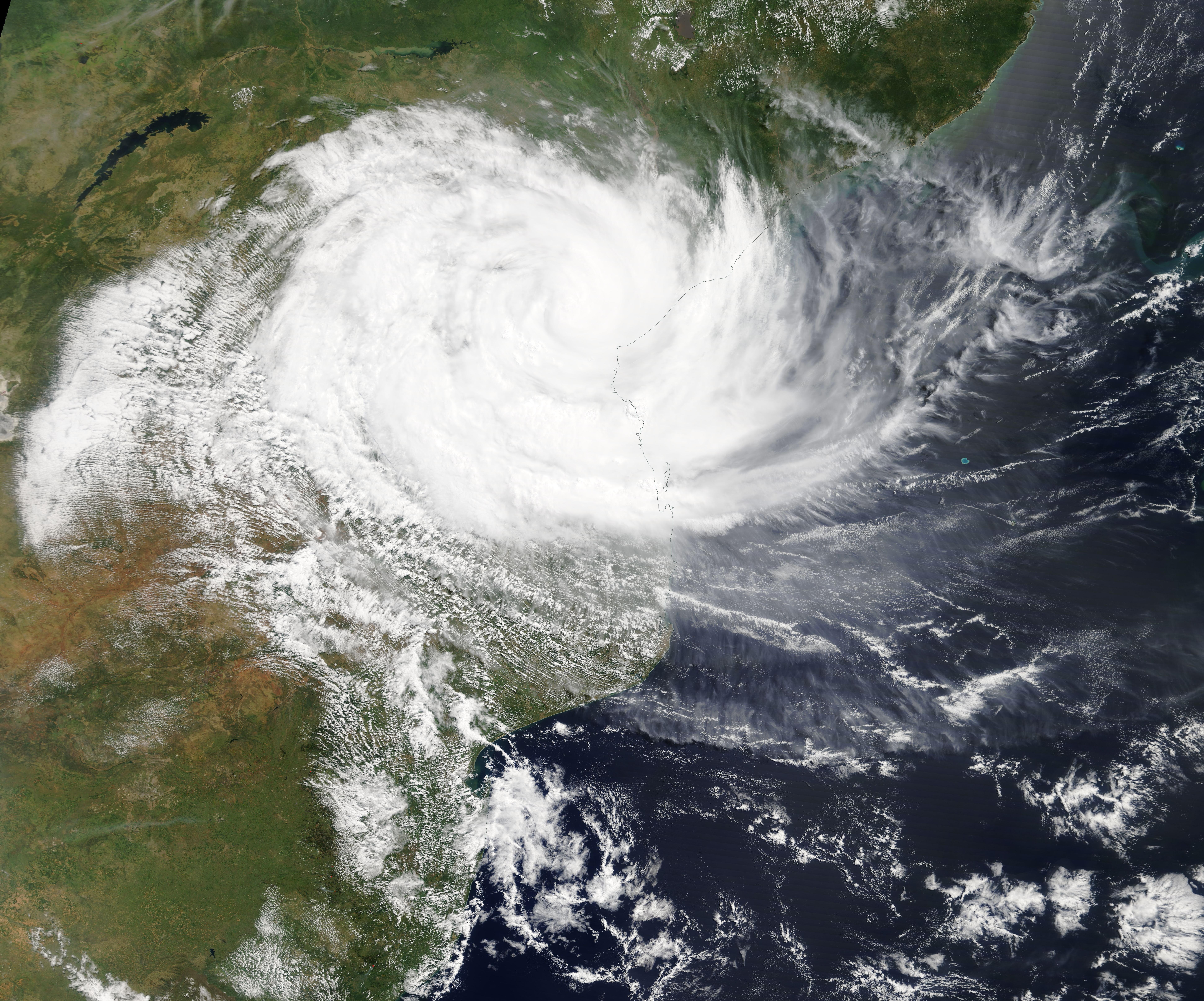
On March 15, the Moderate Resolution Imaging Spectroradiometer (MODIS) aboard NASA’s Terra satellite provided a true-color image of Tropical Cyclone Idai. At the time the image was acquired, the storm’s cloud-filled eye hung over central Mozambique and the western quadrant had already spread into Zimbabwe. Although it was over land, the system retained a ragged eye.
At 0300 UTC on March 15 (11 p.m. EDT on March 14), the Joint Typhoon Warning Center (JTWC) issued the final warning on Idai. At the time, Idai was over land and had maximum sustained winds near 90 knots (103.6 mph/166.7 km/h). It was centered near 19.6 degrees north latitude and 34.8 degrees east longitude.
Idai is expected to affect parts of the Mozambique provinces of Zambézia, Sofala, Manica, Tete and Inhambane. Moderate to strong rains accompanied by severe thunderstorms and gusty winds are expected in the north of the provinces of Niassa, Cabo Delgado and northern Tete. JTWC has forecast Idai to rapidly weaken as it tracks across central Mozambique and into northern Zimbabwe.
Image Facts
Satellite:
Terra
Date Acquired: 3/15/2019
Resolutions:
1km (557 KB), 500m (1.8 MB), 250m (5.6 MB)
Bands Used: 1,4,3
Image Credit:
MODIS Land Rapid Response Team, NASA GSFC
