Images
May 1, 2019 - Sediment in Caspian Sea
Tweet
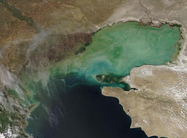
Sediment swirled in the Caspian Sea on April 28, 2019, when the Moderate Resolution Imaging Spectroradiometer (MODIS) on board NASA’s Aqua satellite acquired a stunning true-color image of the scene.
Most of the sediment pours into the Caspian Sea from the Volga River, which flows along the border of southern Russia and western Kazakhstan. Spring rain and melting snow both contribute to filling the Volga with sediment-filled run-off, which pours into the northwest portion of the Caspian Sea. In this image, the Volga River Delta appears dark brown and the waters near the Delta appear muddy tan. Bloom of algae or phytoplankton may contribute to the brighter green areas in the image. These plant-like organisms thrive in the nutrients the flow into the Caspian Sea from Europe's longest river.
Image Facts
Satellite:
Aqua
Date Acquired: 4/28/2019
Resolutions:
1km (79.5 KB), 500m (178 KB), 250m ( B)
Bands Used: 1,4,3
Image Credit:
MODIS Land Rapid Response Team, NASA GSFC


