
Images


June 2, 2019 - Southern Greenland
 Tweet
Tweet
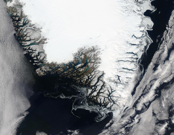
The Greenland ice melt season started early this year, with more than 20 cumulative days of melt from January 1 through May 31, 2019, occurring in some locations. According to the National Snow and Ice Data Center (NSIDC), most of this melt occurred along the edges of the southern part of the ice sheet, especially along the southwestern edge. A spike in air temperatures in April brought ice melt extent to about 8 percent by the beginning of May—a date when the 1981-2010 median melt extent hovers right around zero percent. Cooler weather in May actually permitted some refreezing, with ice melt extent at the end of May reaching closer to median.
The Moderate Resolution imaging Spectroradiometer (MODIS) on board NASA’s Aqua satellite acquired a true-color image of Southern Greenland on May 29. Most of the land remains covered in dense snow and ice. Touches of bright blue in a few of the fjords along the western edge marks areas of active melt. Spider-web-like swirls along the southern and eastern coast is softening sea ice that has been swirled by the currents. Banks of cumulus cloud stretch over the North Atlantic Ocean to the west and east of Greenland.
Image Facts
Satellite:
Aqua
Date Acquired: 5/29/2019
Resolutions:
1km (185.4 KB), 500m (546.9 KB), 250m (972.6 KB)
Bands Used: 1,4,3
Image Credit:
MODIS Land Rapid Response Team, NASA GSFC
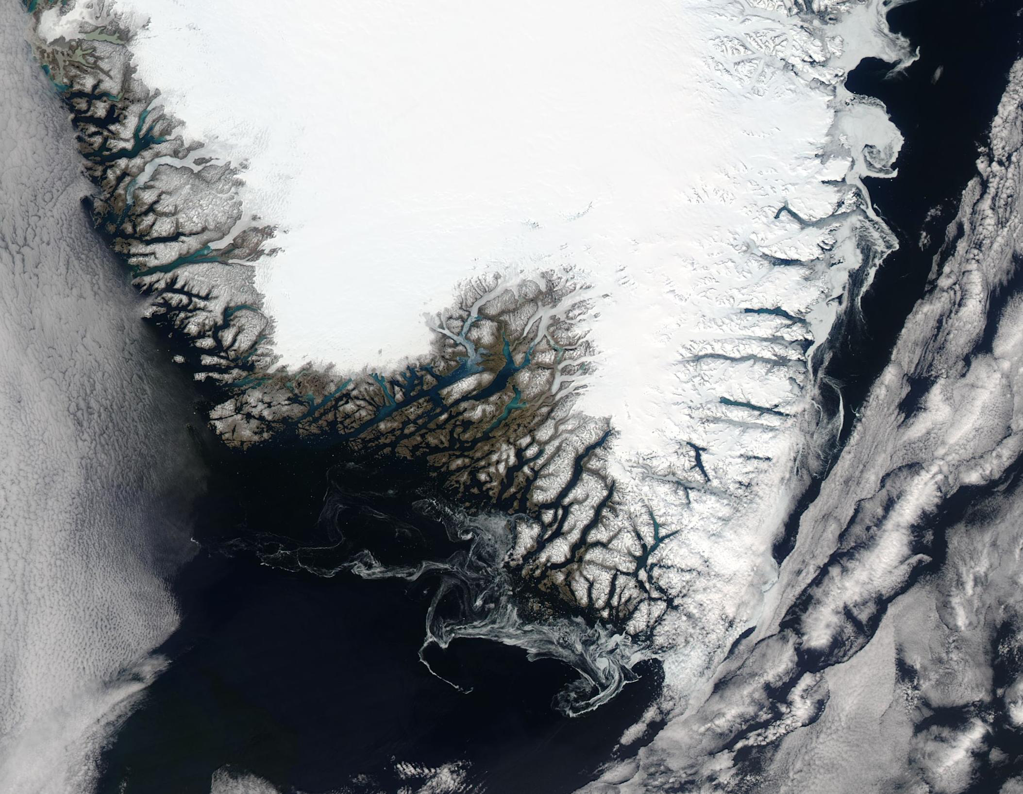
