
Images


July 4, 2019 - Southwestern United States
 Tweet
Tweet
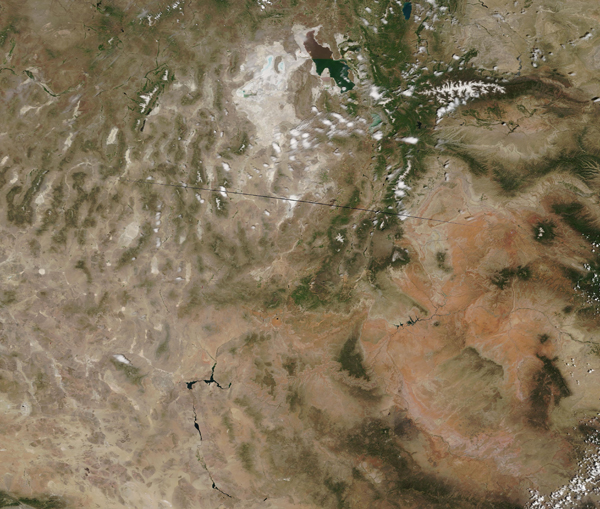
On June 27, 2019, the Moderate Resolution Imaging Spectroradiometer (MODIS) on board NASA’s Terra satellite acquired a true-color image of a sunny summer day over the Southwestern United States. This image primarily centers on Utah, with parts of northern Arizona in the southeast. Nevada fills the western section of the image.
The scene’s overall tones of tans and browns, punctuated with white and green convey the semi-arid climate of this region. Tans and brown mark unvegetated areas which see little rainfall, including the Great Basin Desert in the northwest. Most of Nevada, the western half of Utah, and parts of other nearby states sit within the Great Basin Desert. This desert continues into the Mojave Desert, seen in the southwestern corner of this image.
Vegetation grows where enough precipitation falls to permit growth, primarily in the mountains. Utah’s Uinta Mountains, located in the northeast, tower high enough to not only be covered with green forest, but are capped with white snow. The highest peak in Utah, Kings Peak, sits in this range of mountains. It towers at an elevation of 4,125 miles (13,534 feet).
Aside from the small amount of snow, most of the white in this image marks areas of salt flats, areas where extinct or nearly-extinct lakes have evaporated to leave dry, salt-crusted soils. The largest salt pan is located in Utah, close to the two-toned Great Salt Lake. Known as the Bonneville Salt Flats, they are famous for being one of the flattest places on Earth, and the spot where auto racing enthusiasts flock each year to watch new attempts to set land-speed records. These flats are remnants of a large lake that existed over much of Utah between 14,000 and 32,000 years ago. At maximum, Lake Bonneville stretched about 320 miles (520 km) long and 130 miles (220 km) wide.
In the south, the blue waters of Lake Meade, created by the Hoover Dam on the Colorado River, can be easily seen against the backdrop of tan. Below the Hoover Dam, the Colorado River narrows, then widens again, as it curves generally southward.
Image Facts
Satellite:
Terra
Date Acquired: 6/27/2019
Resolutions:
1km (858.6 KB), 500m (2.4 MB), 250m (4.6 MB)
Bands Used: 1,4,3
Image Credit:
MODIS Land Rapid Response Team, NASA GSFC
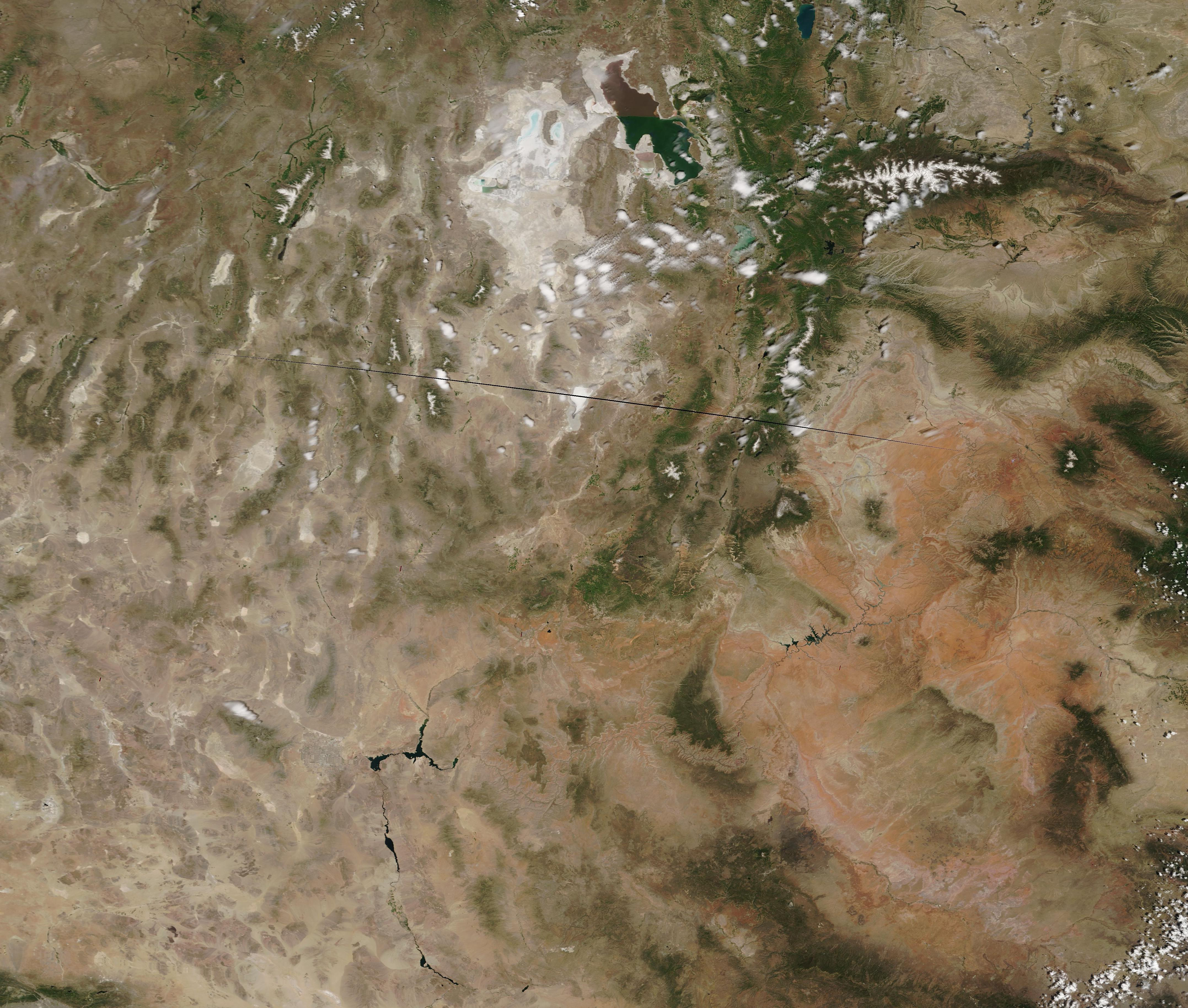
