
Images


July 7, 2019 - Saudi Arabia
 Tweet
Tweet
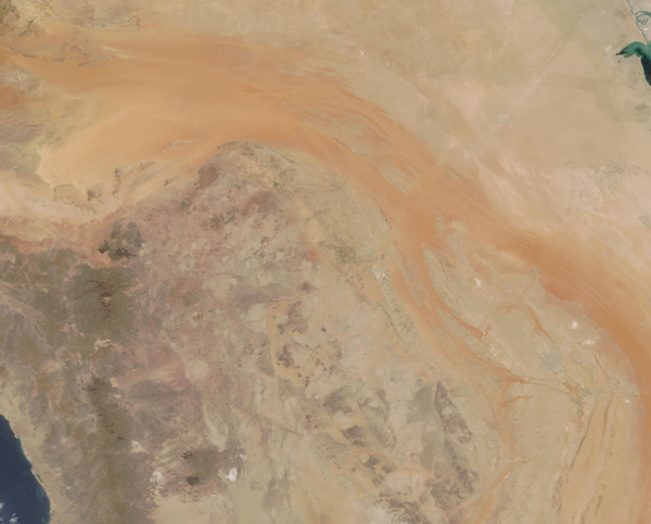
On June 28, 2019, the Moderate Resolution Imaging Spectroradiometer (MODIS) on board NASA’s Terra satellite acquired a beautiful true-color image that spanned central Saudi Arabia.
The blue waters of the Red Sea can be seen in the west and a bit of the Persian Gulf is visible in the east. In between the waters, the lands of Saudi Arabia undulate in tones of tan, brown and orange, illustrating the sand-filled, dry nature of the region. Small, roughly circular white areas mark salt pans, which are former lakes that have dried over time, leaving only mineral crusts to mark their place.
While covered primarily in sand, desert, and rugged mountains, the surface does not tell the story of Saudi Arabia. Underneath the austere landscape lies aquifers filled either with oil or with water. Both precious commodities, oil extraction and sale has driven the great wealth of the nation. In recent years, water has been extracted to allow farming in otherwise inhospitable regions. The limited supply of water, however, raises concerns that the farming practices are not sustainable in the long-term.
Image Facts
Satellite:
Terra
Date Acquired: 6/28/2019
Resolutions:
1km (539.8 KB), 500m (1.3 MB), 250m (2.2 MB)
Bands Used: 1,4,3
Image Credit:
MODIS Land Rapid Response Team, NASA GSFC
