
Images


July 21, 2019 - North Africa
 Tweet
Tweet
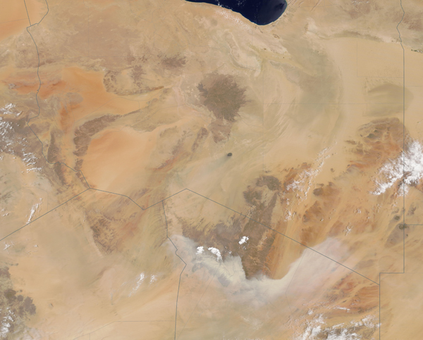
Stunning oranges, tans, and browns mark the landscape of northern Africa, illustrating the extremely arid climate. The Moderate Resolution Imaging Spectroradiometer (MODIS) on board NASA’s Terra satellite acquired a true-color image of a small section of northern Africa on July 18, 2019.
The image centers on Libya, with parts of six other countries captured as well. From the coast of the Mediterranean Sea, circling clockwise from the east, these countries are Egypt, Sudan, Chad, Niger, Algeria, and Tunisia. The skies above most of Libya appear free from aerosolized dust, allowing a beautifully clear image of the beautiful landscape. However, in the south, a long line of pale dust appears to be rolling northward across the Sahara Desert in Chad and Niger. Small banks of clouds suggest a potential storm front that may be the source of the winds that have lofted the dust from the desert floor.
Image Facts
Satellite:
Terra
Date Acquired: 7/19/2019
Resolutions:
1km ( B), 500m ( B), 250m (2.3 MB)
Bands Used: 1,4,3
Image Credit:
MODIS Land Rapid Response Team, NASA GSFC
