
Images


August 30, 2019 - Registan Desert
 Tweet
Tweet
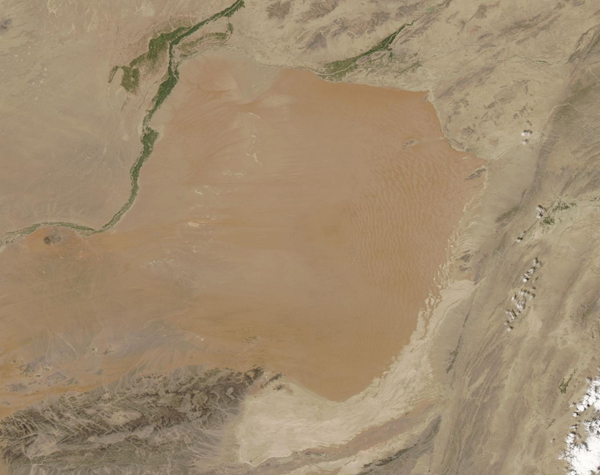
Tucked into southern Afghanistan, the Registan Desert extends from the Helmand River in the west to the border with Pakistan in the east. Extremely arid, very cold in the winter and very hot in the summer and subject to near-constant winds, the desert is a land of extremes. Where the winds constantly blow from the same direction over the relatively flat, sandy terrain, the sand piles in crescent-moon shaped dunes, with thin tips pointing in the direction of wind flow. Called barchan dunes, these dunes will migrate across the desert surface as sand grains on the crest of the dune are toppled by the wind and spill down the leeward face. As the pile of sand on the leeward side (side protected from wind) gets larger, forming a new dune, the leading edge topples once again. As this process repeats, the dune’s leading edge slowly moves forward.
On August 25, 2019, the Moderate Resolution Imaging Spectroradiometer (MODIS) on board NASA’s Terra satellite acquired a true-color image of the Registan Desert. An area of towering, shifting sand dunes can be seen in the eastern edge.
Image Facts
Satellite:
Terra
Date Acquired: 8/25/2019
Resolutions:
1km (95 KB), 500m (259.1 KB), 250m (159.1 KB)
Bands Used: 1,4,3
Image Credit:
MODIS Land Rapid Response Team, NASA GSFC
