
Images


September 28, 2019 - Burn Scars in Bolivia
 Tweet
Tweet
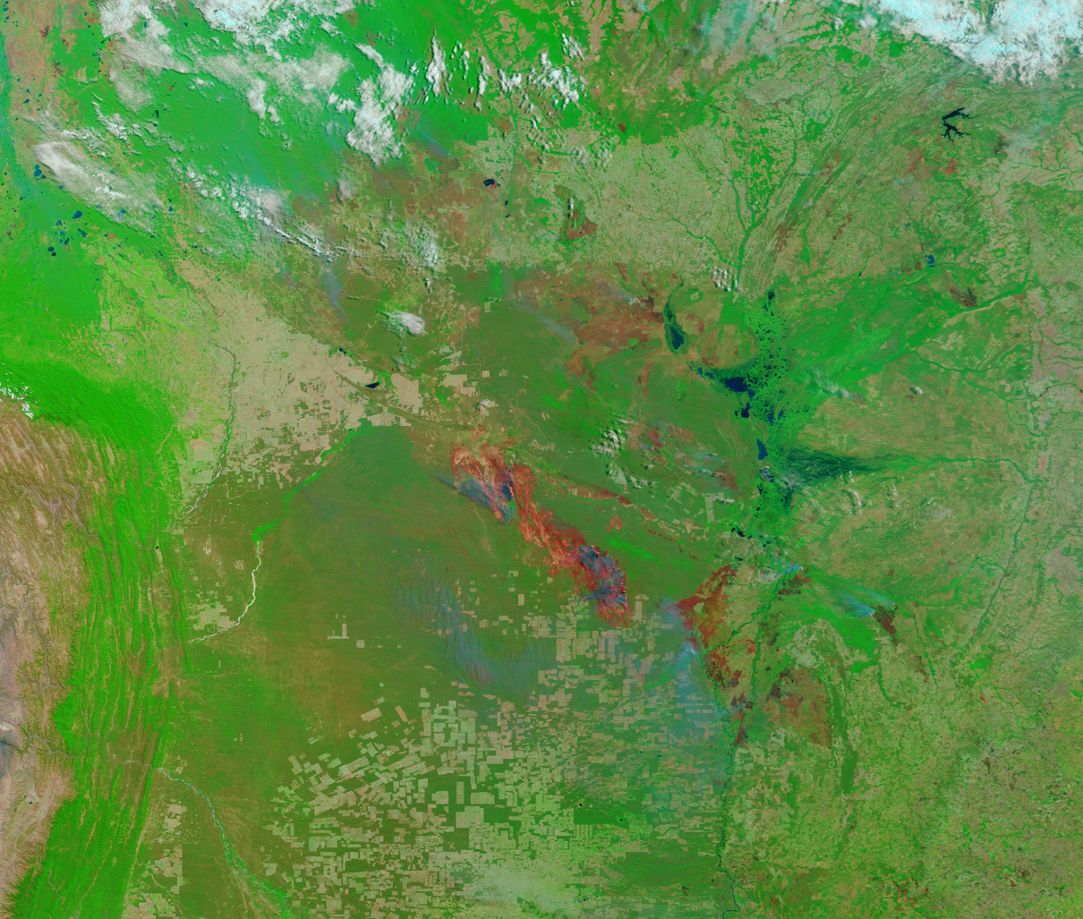
Fires continued to devastate the Amazon rainforest through September 2019. According to an article by University of Melbourne’s Julianne Santos published on September 25, the fires are currently spread across nine Brazilian states, but are also burning in some of the nine nearby countries that the Amazon spans, including Peru, Bolivia, Venezuela, and Columbia. A September 27 press release published on the website of Bolivia’s Santa Cruz region stated that fire emergency persists in thirteen municipalities in Bolivia, despite recent rainfall. Bolivia’s Secretary of Sustainable Development and Environment, Cinthia Asin, reported that 34 forest fires continue to burn, and that more than 3 million hectares (7,413,161 acres or 30,000 square kilometers) have been affected. That’s an area just slightly smaller than Belgium. Half of the fires were burning in protected areas.
On September 24, the Moderate Resolution Imaging Spectroradiometer (MODIS) on board NASA’s Terra satellite acquired a false-color image of massive fire scars in the Santa Cruz Department of Bolivia.
False-color images use a combination of visible and infrared light to give a different perspective of the landscape than true-color images and to allow certain features, such as burn scars, to be more easily visualized. In this band combination (7,2,1) vegetation appears bright lime green, water appears deep blue, and smoke appears light blue. Bare soil may appear tan or, especially for freshly-burned, vegetation-free soil, may carry a pink or reddish hue. Burn scars, where fires alter or remove vegetation and leave behind charred areas rich in charcoal and ash, may appear deep or bright red, reddish-brown, or pink, depending on the type of vegetation burned, the amount of residue, or the completeness of the burn.
This image shows extremely large burn scars sitting in the green forests north and northeast of an agricultural area. The light green, rectangular areas in the agricultural regions are large farm fields, yet they are dwarfed by the massive burn scars. Smoke rises from the edge of the forest in several areas on the edges of the burn scars.
A roll-over comparison of this image with an image acquired on September 8, 2017, is available HERE, thanks NASA's Earth Observing System Data and Information System (EOSDIS) Worldview application. Worldview provides the capability to interactively browse over 700 global, full-resolution satellite imagery layers and then download the underlying data.
Image Facts
Satellite:
Terra
Date Acquired: 9/24/2019
Resolutions:
1km (1.4 MB), 500m (3.5 MB), 250m (7.8 MB)
Bands Used: 7,2,1
Image Credit:
MODIS Land Rapid Response Team, NASA GSFC
