
Images


December 11, 2019 - Gulf of Martaban
 Tweet
Tweet
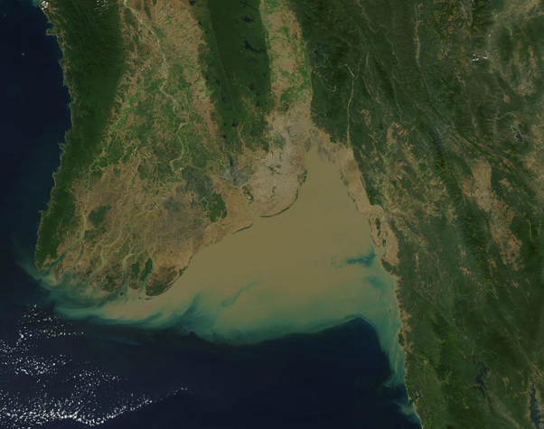
Sitting on the southwestern coast of Myanmar (Burma), the waters of the Gulf of Martaban are some of the most dynamic—and muddy—in the world.
Four large rivers, the Sittaung, Thanlwin, Yangon, and Ayeyarwady, transport about 350 million tons of sediment into the shallow Gulf each year. As these rivers pour into the Gulf, strong tides can force water back up into the rivers at a speed of roughly 3 meters per second, creating a “tidal bore”—a tide so strong it temporarily reverses the flow of the river. The resultant crests of waves flowing upriver, along with a tidal range of 7 meters (23 feet), are powerful tools for erosion and help create the chocolate-colored waters seen from space.
Dynamic water flow not only creates mud, but can—and does—change the course of the rivers, tearing down the banks in one area to build up another. While this is a natural phenomenon that has been occurring throughout recorded history, the loss of land along the Gulf of Martaban (Gulf of Mottama) has reportedly sped up since about 2016, resulting in the loss of 12 villages between 2016 and 2018 and displacing small-scale subsistence farmers and fisherman who rely of the Gulf for their livelihood.
The Gulf’s abundant mud flats are rich in mussels, crustaceans, worms, crabs and other species that provide food for birds and fish, and also a livelihood for people. It is estimated that more than 150,000 waterbirds migrate here in the winter, including half of the global population of the Spoon-billed Sandpiper—a critically endangered species. A part of the Gulf was designated as a Wetland of International Importance in 2017.
The Moderate Resolution Imaging Spectroradiometer (MODIS) on board NASA’s Aqua satellite acquired a true-color image of the Gulf of Martaban on December 7, 2019. The chocolate-colored waters extend to the Andaman Sea.
Image Facts
Satellite:
Aqua
Date Acquired: 12/7/2019
Resolutions:
1km (226.7 KB), 500m (624.5 KB), 250m (434.1 KB)
Bands Used: 1,4,3
Image Credit:
MODIS Land Rapid Response Team, NASA GSFC
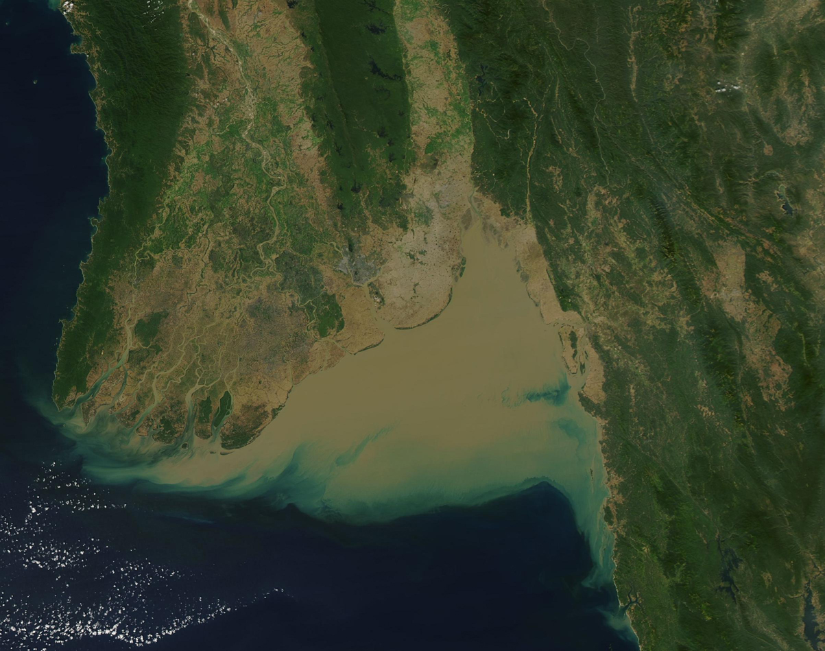
