
Images


December 12, 2019 - Fires in Australia
 Tweet
Tweet
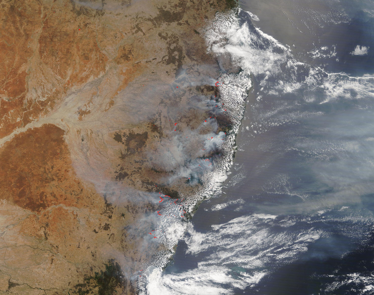
Smoke from bushfires blanketed much of southeast Australia in early December, 2019. The Moderate Resolution Imaging Spectroradiometer (MODIS) on board NASA’s Terra satellite acquired a true-color image of fires and smoke along the coast of New South Wales on December 8.
Dozens of red “hot spots” mark areas where the thermal bands on the instrument detected high temperatures. When combined with typical smoke, as in this image, such hot spots mark actively burning fires. Gray smoke reaches over the Tasman Sea as well as drifting hundreds of miles inland. By December 11, Sydney, which sits along the southern coast under a mix of smoke and cloud in this image, was shrouded in heavy smoke. Media reported that the smoke brought the air quality 11 times worse than “hazardous” levels. Some also reported that the smoke triggered fire alarms.
According to ScienceAlert “Under the Air Quality Index (AQI), which measures pollution levels in the air, readings of 100 to 149 are considered poor, 150 to 199 rates as very poor, and measurements of 200 or above are deemed hazardous to health. On Tuesday, several regions in Sydney rated above 400, some scored over 1,000, and at least two breached the 2,000 AQI threshold, with the inner west suburb of Rozelle, only a few kilometres west of the city centre, recording a phenomenal AQI reading of 2,552, almost 13 times the hazardous level.”
Image Facts
Satellite:
Terra
Date Acquired: 12/8/2019
Resolutions:
1km (1.2 MB), 500m (1 MB), 250m (3.2 MB)
Bands Used: 1,4,3
Image Credit:
MODIS Land Rapid Response Team, NASA GSFC
