
Images


December 16, 2019 - Central Interior Highlands
 Tweet
Tweet
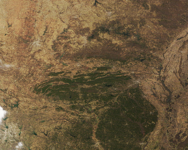
The only major mountainous region between the eastern Appalachians and western Rocky Mountains, the Interior Highlands of the United States stretch across part of Missouri, Arkansas, and eastern Oklahoma. This unique ecosystem consists of three major topographical divisions. From south to north these are the Ouachita Mountains, Arkansas Valley and Ozark Uplift.
On December 11, 2019, the Moderate Resolution Imaging Spectroradiometer (MODIS) on board NASA’s Terra satellite acquired a true-color image of the southern section of the Interior Highlands wearing the colors of late autumn. Fallow fields, grassland and open land appear tan or brown, while forests appear green.
The Ouachita Mountains are aligned on an east-west axis, unlike the Rockies or Appalachians, which rise on a generally north-to-east axis. These mountains formed about 300 million years ago when the South American Plate drifted northward, colliding with the North American Plate, and creating huge folds in the northern landmass. Immediately north of the Ouachita Mountains, the Arkansas River Valley dips downward, sandwiched between the fold mountains and the steep escarpment that marks the start of the Ozark Uplift.
Image Facts
Satellite:
Terra
Date Acquired: 12/11/2019
Resolutions:
1km (485.6 KB), 500m (1.3 MB), 250m (1 MB)
Bands Used: 1,4,3
Image Credit:
MODIS Land Rapid Response Team, NASA GSFC
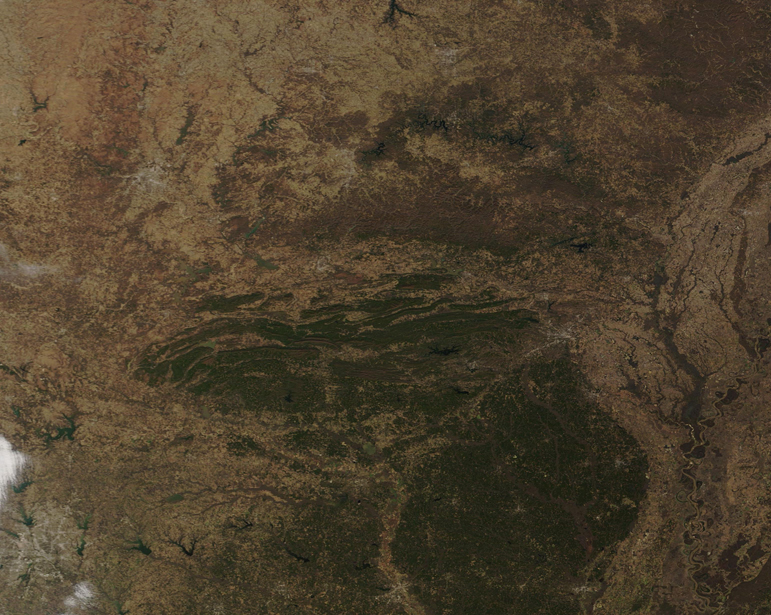
