
Images


February 28, 2020 - Sea Ice in the Gulf of St. Lawrence
 Tweet
Tweet
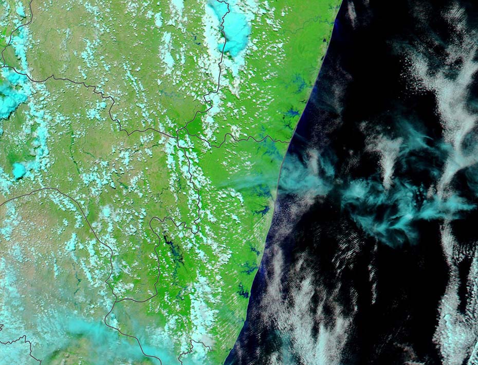
The Gulf of St. Lawrence wore a sheet of floating sea ice in late February 2020. The Moderate Resolution Imaging Spectroradiometer (MODIS) on board NASA’s Aqua satellite acquired a true-color image of the wintery scene on February 23.
Every year, Arctic sea ice shrinks and grows, reaching its minimum in September and its maximum in February or March. As sea ice nears its maximum, it often begins cover Canada’s Gulf of St. Lawrence.
Young sea ice is typically thin enough to be easily moved by winds and currents, and such ice often takes on serpentine shapes. Delicate swirls of ice are especially noticeable in this image south of Île d’Anticosti and southwest of Newfoundland. A wide area of open sea sits to the north of Prince Edward Island, while a thin layer of fast ice clings to the shoreline on the southwest side of that island.
A report published by the National Snow and Ice Data Center (NSIDC) on February 4, stated “Sea ice extent for January 2020 tracked well below average, with the monthly average tied at eighth lowest in the satellite record. While air temperatures were above average across much of the Arctic Ocean, it was colder than average over the northern Barents Sea, Alaska, the eastern Canadian Arctic Archipelago, and Greenland.”
Image Facts
Satellite:
Aqua
Date Acquired: 2/23/2020
Resolutions:
1km (75.1 KB), 500m (185 KB), 250m (453.9 KB)
Bands Used: 1,4,3
Image Credit:
MODIS Land Rapid Response Team, NASA GSFC
