Images
March 10, 2020 - Large Fire in Virginia
Tweet
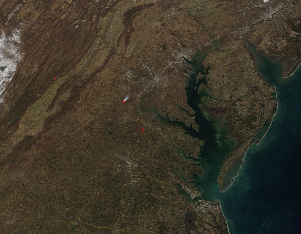
Smoke billowed from a fire near the border of Prince William, Fauquier, and Stafford Counties in Virginia on March 8, 2020. The Moderate Resolution Imaging Spectroradiometer (MODIS) on board NASA’s Terra satellite acquired a true-color image of the fire on that same day.
The prescribed burn was carried out by the Quantico Fire and Emergency Services at Marine Corps Base Quantico and presented no danger to the surrounding countryside. The Facebook feed of the Quantico Fire and Emergency Services stated that prescribed burns are used “for maintaining healthy forest lands as well as creating a fire safe forestry environment”. A steady breeze from the south and southwest carried the smoke plume directly over Fairfax County in Virginia, Montgomery County in Maryland and the District of Columbia. The plume, which briefly reduced visibility on an otherwise clear day, could be seen on weather radar and satellite imagery and residents as far away as Northwest D.C. reported smelling smoke.
Image Facts
Satellite:
Terra
Date Acquired: 3/8/2020
Resolutions:
1km (93 KB), 500m (309.4 KB), 250m (526.6 KB)
Bands Used: 1,4,3
Image Credit:
MODIS Land Rapid Response Team, NASA GSFC


