
Images


April 22, 2020 - Scotland
 Tweet
Tweet
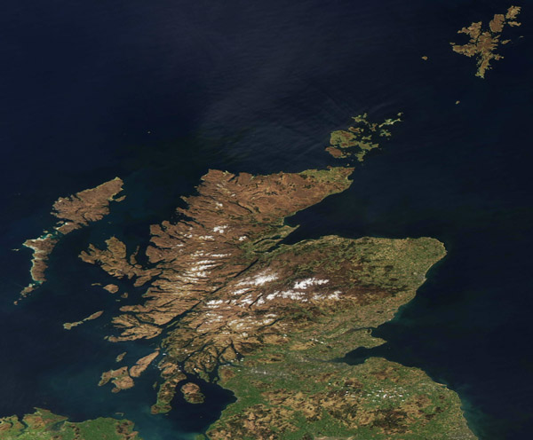
Snow clung to the peaks of the Scottish Highlands in mid-April, 2020. The Moderate Resolution Imaging Spectroradiometer (MODIS) on board NASA’s Aqua satellite acquired a true-color image of Scotland on April 20.
The geological processes that formed the rugged topography of the Scottish Highlands are ancient. The snow-capped mountains north of Glen Mor include some of the oldest rocks in Europe. After formation, tectonic forces reshaped the region hundreds of millions of years ago. The rocky landscape also shows signs of reshaping by flowing glaciers during the most recent Ice Ages.
Also known as the “Great Valley” or “Great Glen,” Glen Mor is a fault zone marked by numerous elongated lakes (or lochs), one of which is the famous Loch Ness. It’s easily visible in the center of the image, with snow-capped mountains to the north and south.
Scotland occupies roughly the northern one-third of the island of Great Britain. Besides the mainland, Scotland has more than 790 islands including the Shetlands, Orkney Islands, and Inner and Outer Hebrides. The jagged, extensive coastline covers about 2,000 miles (3,218 km).
Image Facts
Satellite:
Aqua
Date Acquired: 4/20/2020
Resolutions:
1km (118.1 KB), 500m (279.7 KB), 250m (482.7 KB)
Bands Used: 1,4,3
Image Credit:
MODIS Land Rapid Response Team, NASA GSFC
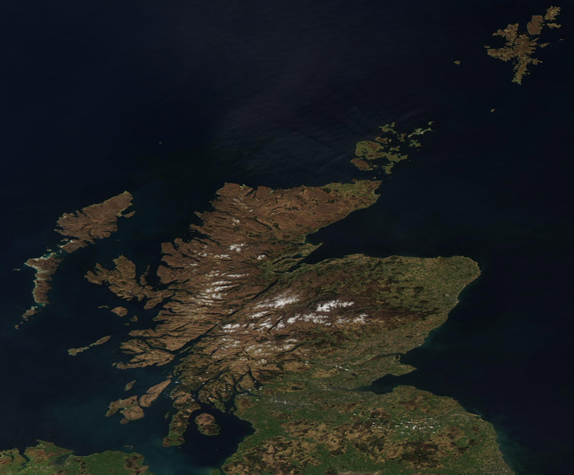
