
Images


June 12, 2020 - Fires in the Southwestern United States
 Tweet
Tweet
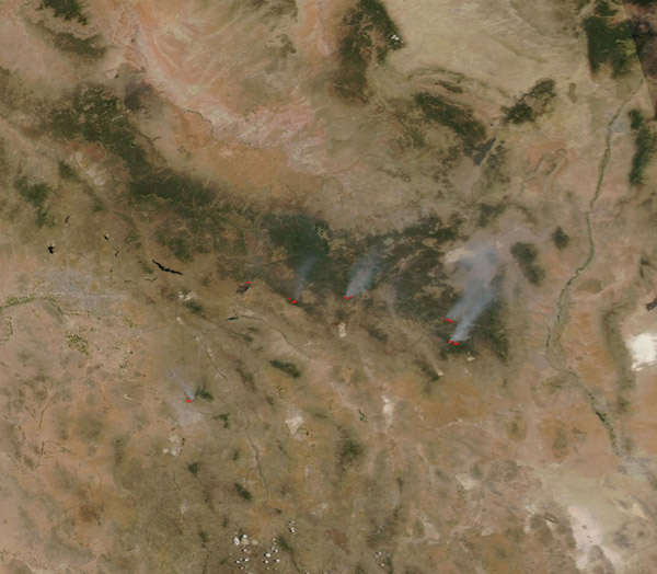
On June 10, 2020, more than a dozen fires were burning across the southwestern United States. The Moderate Resolution Imaging Spectroradiometer (MODIS) on board NASA’s Aqua satellite acquired a true-color image of the blazes on that same day.
Each red “hot spot” marks an area where the thermal bands on the instrument detected high temperatures. When combined with typical smoke, as in this image. Such hot spots are diagnostic for actively burning fire.
According to InciWeb Incident Information System, by June 11 ten wildfires and one area of prescribed fire burned in Arizona while six blazes were found in New Mexico. The two largest fires are the Sawtooth Fire and the Blue River Fire, both in Arizona.
The Sawtooth Fire ignited by lightning on May 30 in Superstition Wilderness, two miles Northeast of Peralta Trailhead, Tonto National Forest. Burning in tall grass and heavy brush, this fire had consumed 24,729 acres by June 8 and was 81 percent contained. On June 5, lightning ignited two fires within the San Carlos Apache Reservation. As of June 11, the large Blue River Fire had scorched 30,380 acres and the nearby Dry Lake Fire had singed 4,350 acres. They are burning in Ponderosa pine forest with woodland and grass and zero containment is reported. However, light wind on June 11 led to moderate fire behavior, aiding firefighters to make progress on containment and suppression. Warm, windy conditions are forecast for the next two days and this may intensify fire behavior.
Image Facts
Satellite:
Aqua
Date Acquired: 6/10/2020
Resolutions:
1km (58 KB), 500m (193.8 KB), 250m (553.1 KB)
Bands Used: 1,4,3
Image Credit:
MODIS Land Rapid Response Team, NASA GSFC
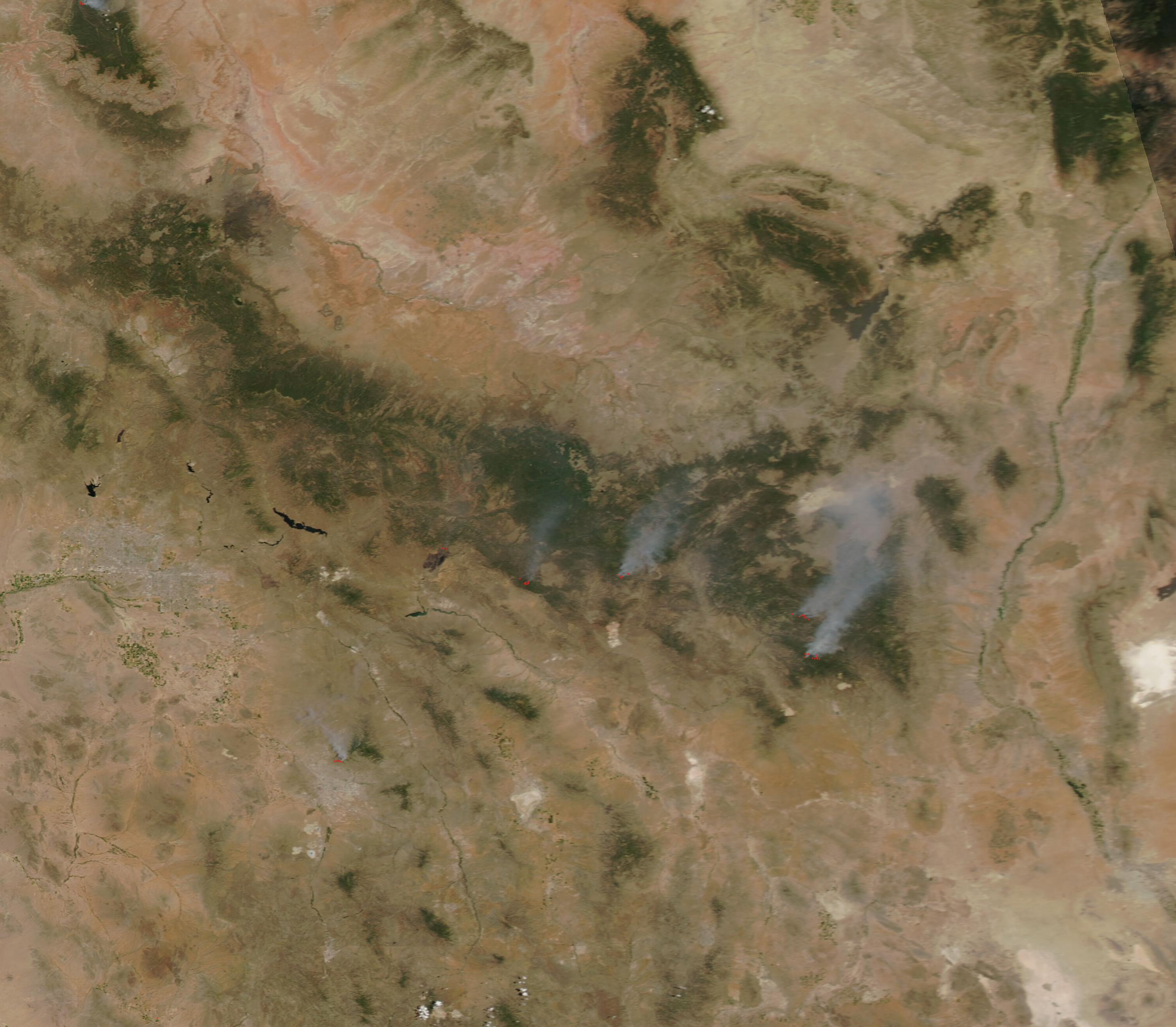
