
Images


June 30, 2020 - Clouds off West Coast of North America
 Tweet
Tweet
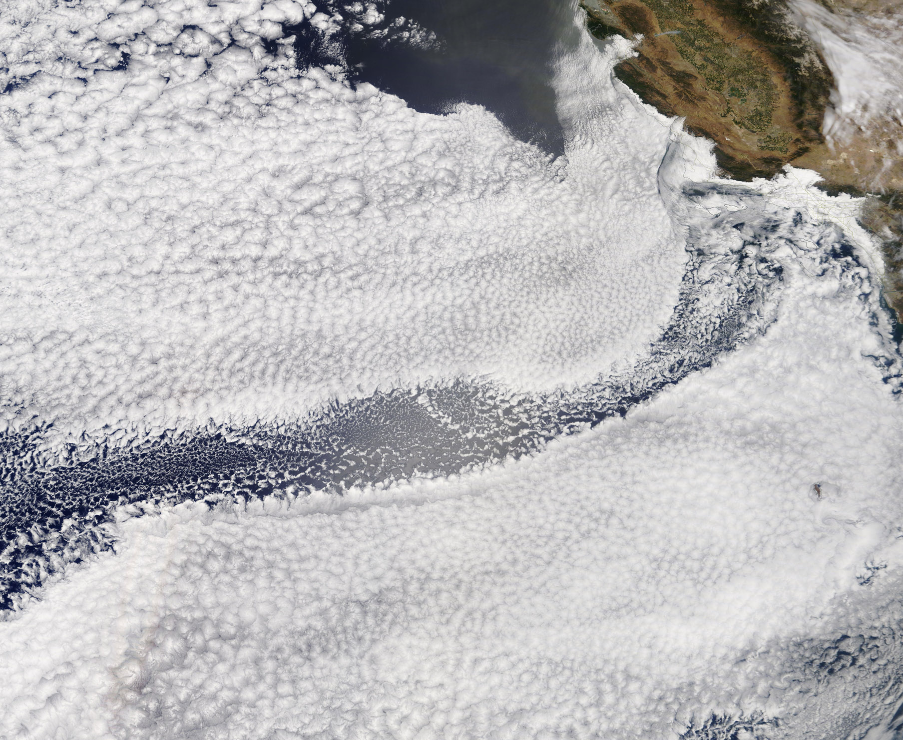
A stunning scene was written in the clouds off California’s coast on June 26, 2020, and was captured by the Moderate Resolution Imaging Spectroradiometer (MODIS) on board NASA’s Terra satellite. A large bank of marine stratocumulus cloud hung over the Pacific Ocean, spanning hundreds of kilometers from north to south and east to west. The lumpy, sheet-like bank of clouds was disrupted by a sinuous wave of nearly-clear sky.
Marine stratocumulus clouds are common over the Pacific Ocean west of California – and, indeed, off the western coasts of all continents. In the Northern Hemisphere, the prevailing winds along these coasts are often from the north or northwest. Due to the Coriolis force, these winds cause the coastal waters to be transported offshore (90 degrees to the right from the direction of the wind). This motion sets upwelling in motion – first the surface waters move west, then the deeper, cooler waters are pulled upward to replace them. This ocean upwelling creates a layer of cool water at the surface, which cools the air immediately above the water. As the moist, marine air cools, water vapor condenses into water droplets, forming the familiar low-level cloudiness. In the spring, when northwesterly winds are strongest, these clouds can move inland and Southern Californians are visited and cooled by marine stratocumulus clouds. Locally, these days of "May Gray" and "June Gloom" delays the dog days of summer and are welcomed by coastal communities.
The curving wave of nearly-clear air is mostly likely caused by a disruption of the air flow, most likely caused by steadily moving air hitting a tall, immobile object. San Clemente Island sits off the coast of California approximately where the wave starts, and that is likely the source of the turbulent wave in the flowing air.
Image Facts
Satellite:
Terra
Date Acquired: 6/30/2020
Resolutions:
1km (686.5 KB), 500m (2.1 MB), 250m (4.2 MB)
Bands Used: 1,4,3
Image Credit:
MODIS Land Rapid Response Team, NASA GSFC
