
Images


July 3, 2020 - Fires in Central Africa
 Tweet
Tweet
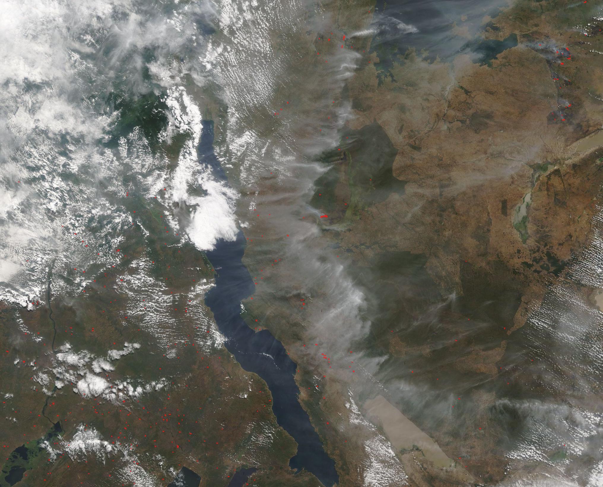
Hundreds of fires dotted the landscape while smoke and haze was so thick across parts of Central Africa in early July 2020. The Moderate Resolution Imaging Spectroradiomieter (MODIS) on board NASA’s Terra satellite acquired a true-color image of fire and smoke across Tanzania, Democratic Republic of Congo, and Zambia on July 1.
Lake Tanganyika slices across the center of the image, with its blue waters shrouded under smoke. The heaviest gray smoke covers the landscape of Tanzania, to the east of the lake. The smoke is thinner on the other side of the lake, with red hot spots visible across Democratic Republic of Congo (north) and Zambia (south). Each red hot spot marks an area where the thermal bands on the instrument detected high temperatures. Combined with typical smoke, as in this image, such hot spots are diagnostic for actively burning fire.
While it is not possible to know the reason for a fire from a satellite image, the location, abundance, and time of year make it highly likely that these are agricultural fires used to manage fields or pasture. This time every year, traditional farmers in Central Africa set fire to the remains of old crop fields to clear them and prepare for new planting, to renew pasture, or to clear forest for new agricultural use. While this practice is over 12,000 years old and still practiced by small farmers, in more recent time larger operations also have adopted fire to clear fields, especially in forested land. This “slash-and-burn” agriculture is useful for the farmer, but the high levels of smoke can be hazardous to human and animal health. Slash-and-burn is also a leading cause of deforestation in many parts of the world.
Image Facts
Satellite:
Terra
Date Acquired: 7/1/2020
Resolutions:
1km (139.7 KB), 500m (488.8 KB), 250m (1.6 MB)
Bands Used: 1,4,3
Image Credit:
MODIS Land Rapid Response Team, NASA GSFC
