
Images


August 24, 2020 - Fires in Africa
 Tweet
Tweet
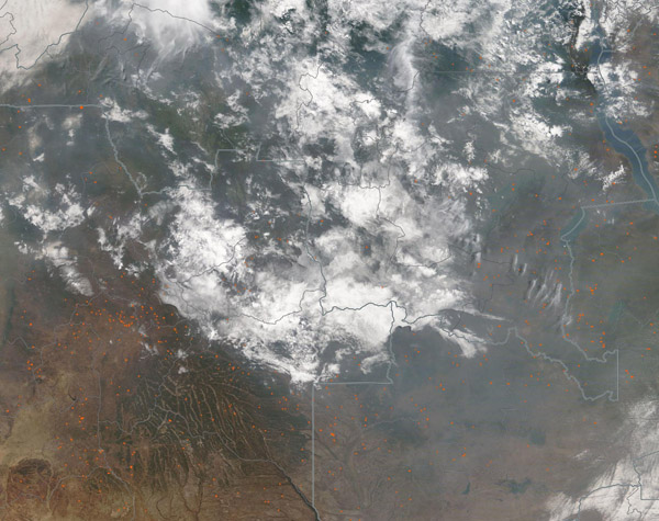
Smoke blanketed south-central Africa in late August 2020, stretching nearly 3,000 miles (4,828 km) across the continent and the South Atlantic Ocean and about 1,700 miles (2,736 km) from the northern edge of the Sahel almost to South Africa. Agricultural fires are common in the region during this time of the year, and are deliberately ignited to open lands for agricultural use, to freshen pasture, to clean the residue from fading crops, and to prepare land for planting, among other reasons. While the use of fire is a traditional, useful, and inexpensive method of land management, the widespread use of fire can create numerous hazards, including damaging deforestation and thick smoke that can be harmful to the respiratory system of humans and animals.
On August 21, the Moderate Resolution Imaging Spectroradiometer (MODIS) on board NASA’s Terra satellite acquired a true-color image of fires and smoke over a small portion of Africa that includes Angola (southwest), Zambia (southeast), and Democratic Republic of the Congo (north).
Each red “hot spot” marks an area where the thermal bands on the instrument detected high temperatures. When accompanied by typical smoke, as in this image, such hot spots are diagnostic for actively burning fire. Most of the hot spots visible cluster in and around Angola’s Ahaggar Mountains and along the border area between Zambia and Democratic Republic of the Congo. In some areas the smoke is so thick that it is difficult to see the land beneath. Several plumes of dark smoke rise from active fires and blow in near-parallel lines to the southeast. The smoke, which blankets most of the region, rises not just from these fires, but from many thousands of fires currently burning across Central Africa.
Image Facts
Satellite:
Terra
Date Acquired: 8/21/2020
Resolutions:
1km (419.9 KB), 500m (1.3 MB), 250m (4.2 MB)
Bands Used: 1,4,3
Image Credit:
MODIS Land Rapid Response Team, NASA GSFC
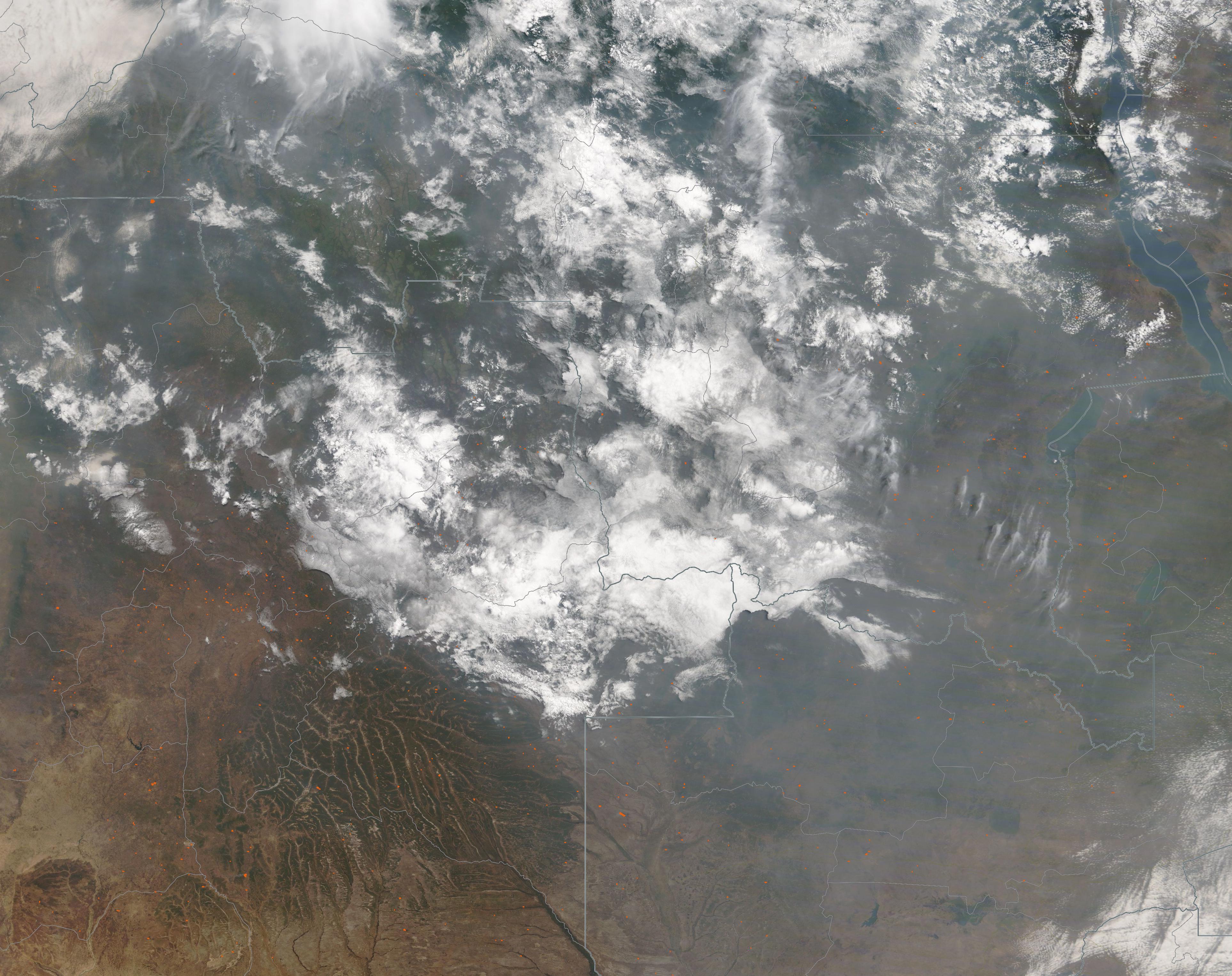
