
Images


September 26, 2020 - Fires in Argentina
 Tweet
Tweet
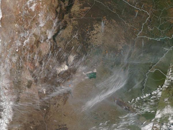
On September 23, 2020, the Moderate Resolution Imaging Spectroradiometer (MODIS) on board NASA’s Terra satellite acquired a true-color image of smoke and fire across central Argentina.
Clusters of small red hot spots, which mark areas of high temperature, dot the region. Smoke rises from these hot spots —as well as some areas too small to have visible hot spots— and is blown long distances by strong winds. While most smoke plumes streak to the southwest, some curl and expand, especially in the east. In the far eastern edge of the image, a few white clouds also form an arc in the prevailing wind.
Warm temperatures combined with very little rainfall have contributed to a severe wildfire season in Argentina, particularly in the Parana River Delta and Buenos Aires and Cordoba Provinces. The United Nations Office for the Coordination of Humanitarian Affairs website Reliefweb reports that several forest fires have been burning in Buenos Aires and Cordoba Provinces since September 18. 2 people have been injured during fire-fighting operations and several communities have been evacuated across Cordoba. As of September 24, most of the major fires in Buenos Aires have been extinguished but active fires remain in Cordoba.
The JRC Global Wildfire System (GWIS) shows hundreds of fires in central Argentina from September 18-25. It also notes that the fire danger forecast for September 24-25 is very high to extreme over eastern Cordoba and moderate to high over Buenos Aires province. Some rain is predicted for September 25, which should assist fire-fighting efforts.
Image Facts
Satellite:
Terra
Date Acquired: 9/23/2020
Resolutions:
1km (341.1 KB), 500m (1.1 MB), 250m (3.8 MB)
Bands Used: 1,4,3
Image Credit:
MODIS Land Rapid Response Team, NASA GSFC
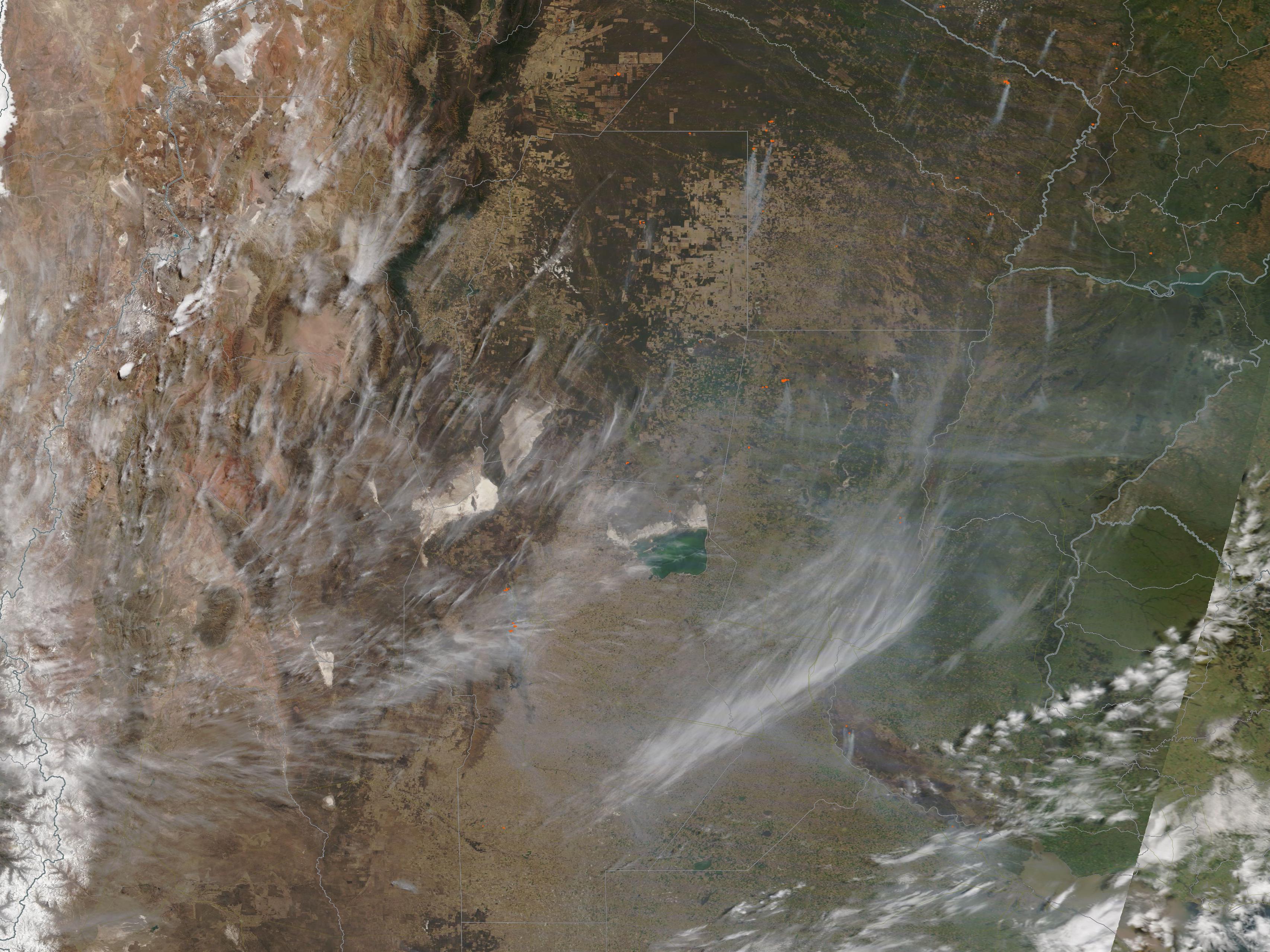
