
Images


November 7, 2020 - Tropical Storm Atsani
 Tweet
Tweet
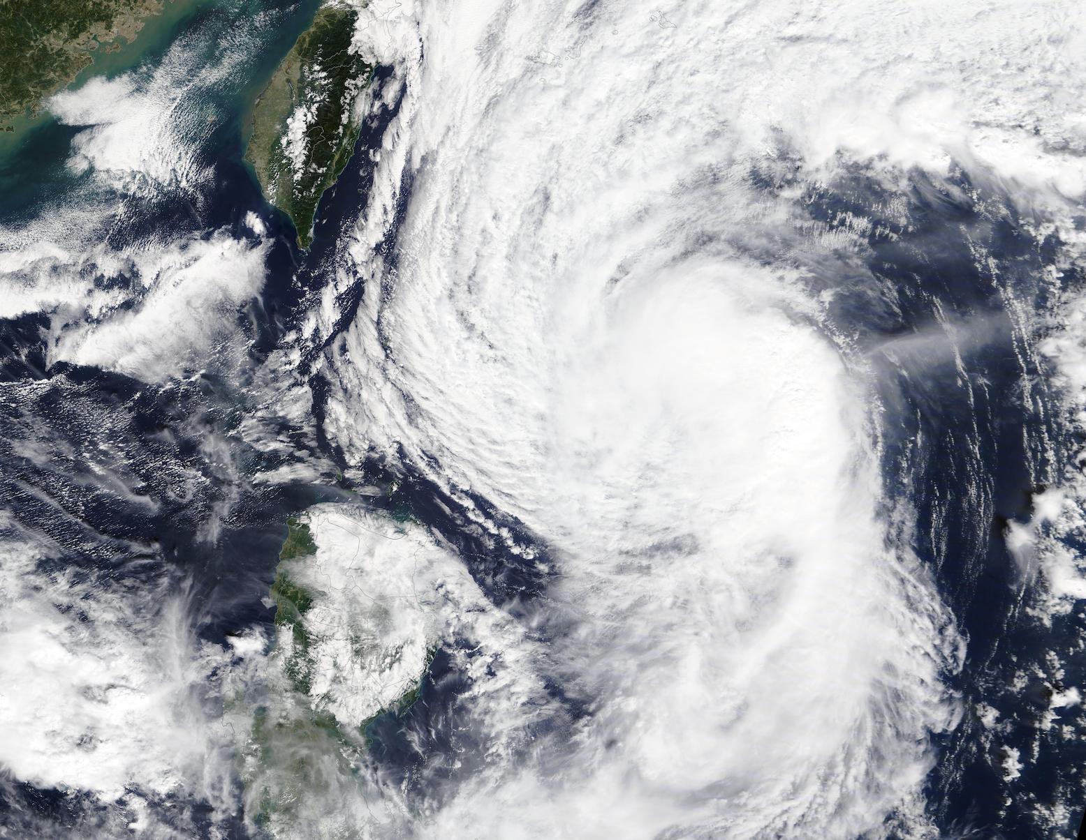
On November 5, 2020, Tropical Storm Atsani was spinning in the Philippine Sea east of Taiwan when the Moderate Resolution Imaging Spectroradiometer (MODIS) on board NASA’s Terra satellite acquired this true-color image. The asymmetric storm’s northwestern convective bands were just offshore of the island of Taiwan while the southwest quadrant remained offshore of the island of Luzon, Philippines.
At 12:00 UTC (7:00 a.m. EST) on November 5, Atsani carried maximum 1-minute sustained winds of 65 mph (130 km/h) and was located about 153 miles east of Itbayat, Philippines. According to the Philippine Atmospheric, Geophysical and Astronomical Services Administration (PAGASA), Tropical Storm Atsani (also known as Siony) made landfall on Misanga Island in Batanes province, Philippines, on the morning of November 6, carrying sustained winds of 95 km/h (59 mph) and gusts of up to 115 km/h (71.5 mph). Strong winds and rains have been reported in the Philippines, but no casualties from Atsani. It is the twentieth named storm of the 2020 Pacific typhoon season and the nineteenth storm to strike the Philippines this season.
According to the Joint Typhoon Warning Center (JTWC) Tropical Storm Atsani is expected to continue tracking slowly west-northwestward through early November 7, after which it is expected to make a sharp southwestward turn as it weakens, then dissipates in the next few days.
Image Facts
Satellite:
Terra
Date Acquired: 11/5/2020
Resolutions:
1km (328.3 KB), 500m (1 MB), 250m (3.1 MB)
Bands Used: 1,4,3
Image Credit:
MODIS Land Rapid Response Team, NASA GSFC
