
Images


December 2, 2020 - The Grand Bahama Bank
 Tweet
Tweet
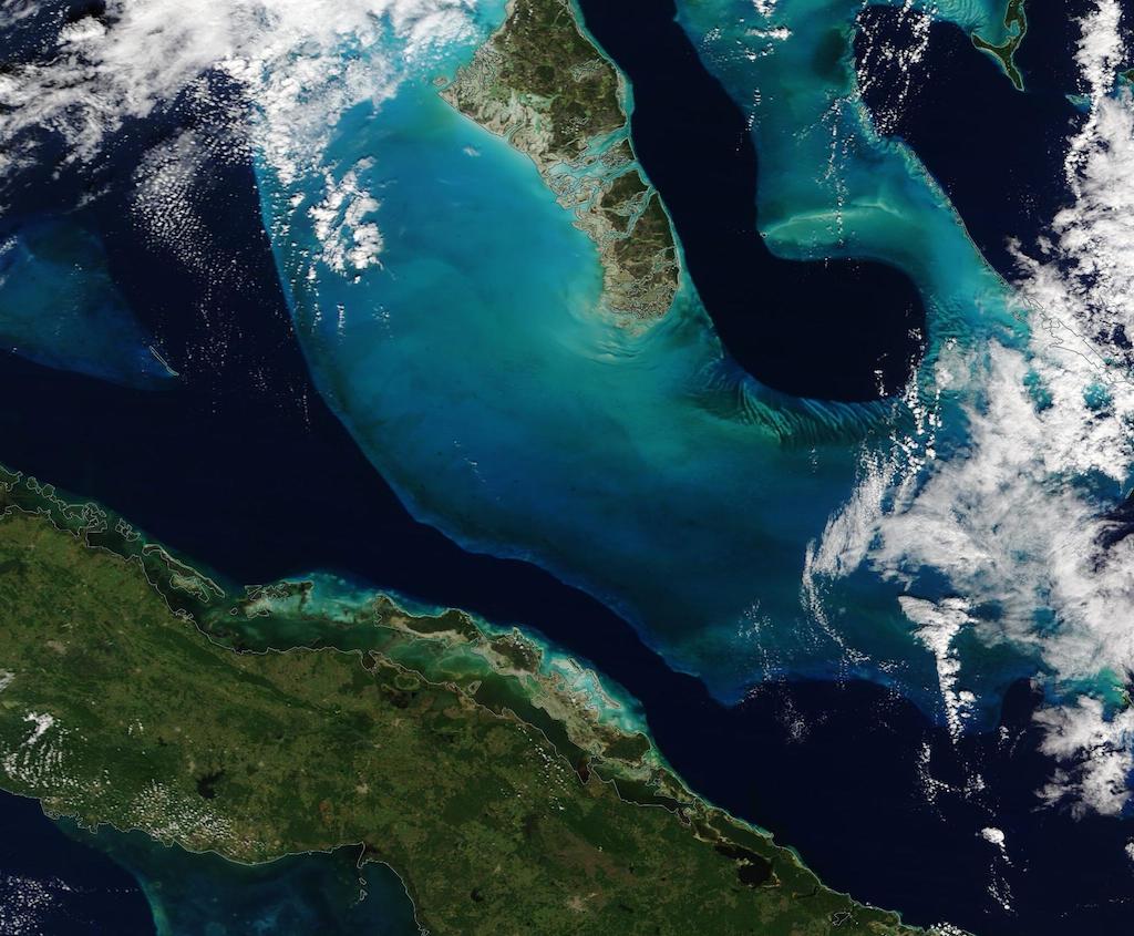
Peacock blue and gem-like greens color the waters off The Bahamas. While the variation of colors and sweeping curves are reminiscent of gentle brush strokes laid down by a master painter, they are the result of a combination of shallow depth, uneven contours of the ocean floor, sea grass banks, and the light-colored sands that form the the Grand Bahama Bank.
The Grand Bahama Bank is a massive underwater hill underlying Andros Island in the west, Eleuthera Island in the east, and multiple islands in between. It reaches almost to northeastern Cuba, which can be seen near the bottom of the image.
In past ice ages, the Grand Bahama Bank was dry land but as ice melted and sea levels rose, the tall hill slowly submerged under the ocean. Today, the bank is covered by water, though it can be as shallow as two meters (seven feet) deep in places, while the surrounding basin drops to depths as low as 4,000 meters (13,100 feet). The bank itself is composed of white carbonate sand and limestone, mainly from the skeletal fragments of corals. Where the depth plunges, the ocean appears deep blue.
Between Andros Island and Eleuthera Island, a long deep, dark region that is known as the “Tongue of the Ocean”. Here the depth drops to 2,000 meters (6,500 feet). An important area rich in sea life, it is home to more than 160 fish and coral species. At the southern edge of the Tongue of the Ocean, colorful wave-shaped ripples can easily be seen from space. These are underwater dunes on the Great Bahama Bank, sculpted by currents over time. Sand and seagrass found in the dunes add to the striking colors of this area. The dunes are partially covered by cloud in this image.
The Moderate Resolution Imaging Spectroradiometer (MODIS) on board NASA’s Terra satellite acquired a true-color image of the Grand Bahama Bank on November 30, 2020.
Image Facts
Satellite:
Terra
Date Acquired: 11/30/2020
Resolutions:
1km (42.1 KB), 500m (138.5 KB), 250m (415.1 KB)
Bands Used: 1,4,3
Image Credit:
MODIS Land Rapid Response Team, NASA GSFC
