
Images


December 7, 2020 - Ice on the Caspian Sea
 Tweet
Tweet
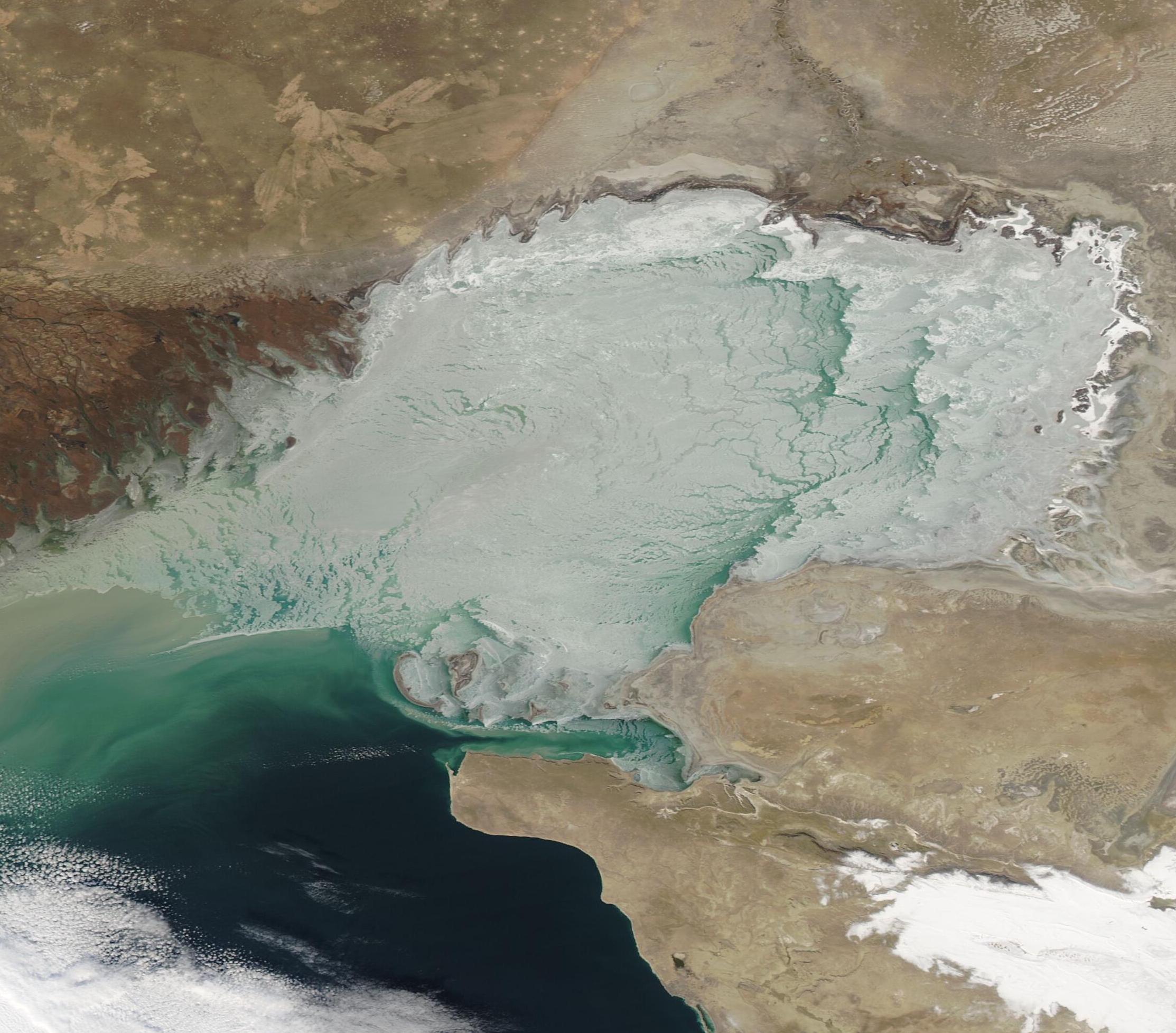
Sitting at the crossroads of Europe and Asia, the Caspian Sea claims the title of the Earth’s largest land-locked inland water body. It covers roughly 143,200 square miles (371,00 sq km) and borders five countries. Russia sits along the northwestern shore, and then, moving clockwise, comes Kazakhstan, Turkmenistan, Iran, and Azerbaijan.
Although it is often called a lake and receives fresh water from roughly 130 rivers, including the mighty Volga, the waters of the Caspian Sea are saline. While the over-all saltiness is about one-third as much as the ocean, the salinity is not uniform. In the north, where the rivers enter, the water is freshest, and the southern waters are saltiest. The depth of the lake changes dramatically between north and south as well. Most of the north area sits over a shelf, leaving a depth of only 10 meters (30 feet) or less. Depth drops to hundreds of meters in the south, reaching as much as 1,000 meters (3,000 feet) in some areas.
As winter comes to the Caspian Sea, frigid temperatures embrace the northern regions first—and often hardest—bringing frost to the land and encouraging ice formation. But more than air temperature affects freeze-up of the Caspian Sea. Salinity and depth also are important factors. Fresh water freezes at 32˚F (0˚C), but when salt is added, the freezing point drops. For every five parts per thousand salt content (salinity), the freezing point drops by 0.5 ˚F (0.28 ˚C). Also, shallower water cools more readily throughout the water column than deeper water, and the rapid cooling of the water column facilitates freezing. These factors explain why the northern Caspian Sea reliably freezes in the wintertime, while the southern section usually remains ice-free.
The Moderate Resolution Imaging Spectroradiometer (MODIS) on board NASA’s Aqua satellite acquired a true-color image of the Caspian Sea on December 3, 2020. Bright white fast ice clings to the shore of Kazakhstan while open water can be seen near the Volga River Delta and southward. Tan sediment pours into the Caspian Sea from the Volga River and changes color to green as it sinks into the blue waters of the Sea.
Image Facts
Satellite:
Aqua
Date Acquired: 12/3/2020
Resolutions:
1km (64.4 KB), 500m (236.9 KB), 250m (731.4 KB)
Bands Used: 1,4,3
Image Credit:
MODIS Land Rapid Response Team, NASA GSFC
