
Images


December 23, 2020 - Iceberg A68A begins to break up
 Tweet
Tweet
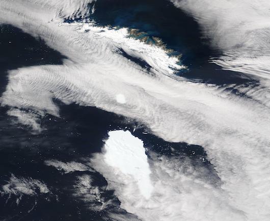
Iceberg A68A was closely approaching South Georgia Island when it pivoted, cracked, then left a large chunk of itself behind. On December 22, 2020, the Moderate Resolution Imaging Spectroradiometer (MODIS) on board NASA’s Terra satellite acquired a true-color image of A68A drifting away from the piece that had broken away.
Thanks to Terra MODIS images acquired each day, we can see the break-up of A68A. On December 16, the northern tip of A68A had approached within 35 miles (56 km) from South Georgia Island – close enough to potentially interact with the relatively shallow shelf that sits underwater off the long island. The image acquired on December 17 confirmed that the tip remained in roughly the same location while the rest of Iceberg A68A drifted southeastward. The tip of the massive A68A is large enough to earn a name of its own – Iceberg A68D.
The fact that A68D stayed nearly stationary in an area likely over the island’s shelf suggests that fracture occurred due to A68A striking the shelf. With the northern tip grounded and the bulk of the ‘berg pulled by a strong current, the separation would have been quickly completed. But if A68D was in fact grounded, it didn’t stay that way long. By December 18, both ‘bergs had moved towards the southeast. And since that time, the distance between the two has increased. On December 22, the distance between A86D the nearest point to South Georgia Island had increased to 52 miles (83.7 km) while the gap between the two icebergs measured about 28 miles (45 km).
Image Facts
Satellite:
Terra
Date Acquired: 12/22/2020
Resolutions:
1km (37.1 KB), 500m (123 KB), 250m (369.9 KB)
Bands Used: 1,4,3
Image Credit:
MODIS Land Rapid Response Team, NASA GSFC
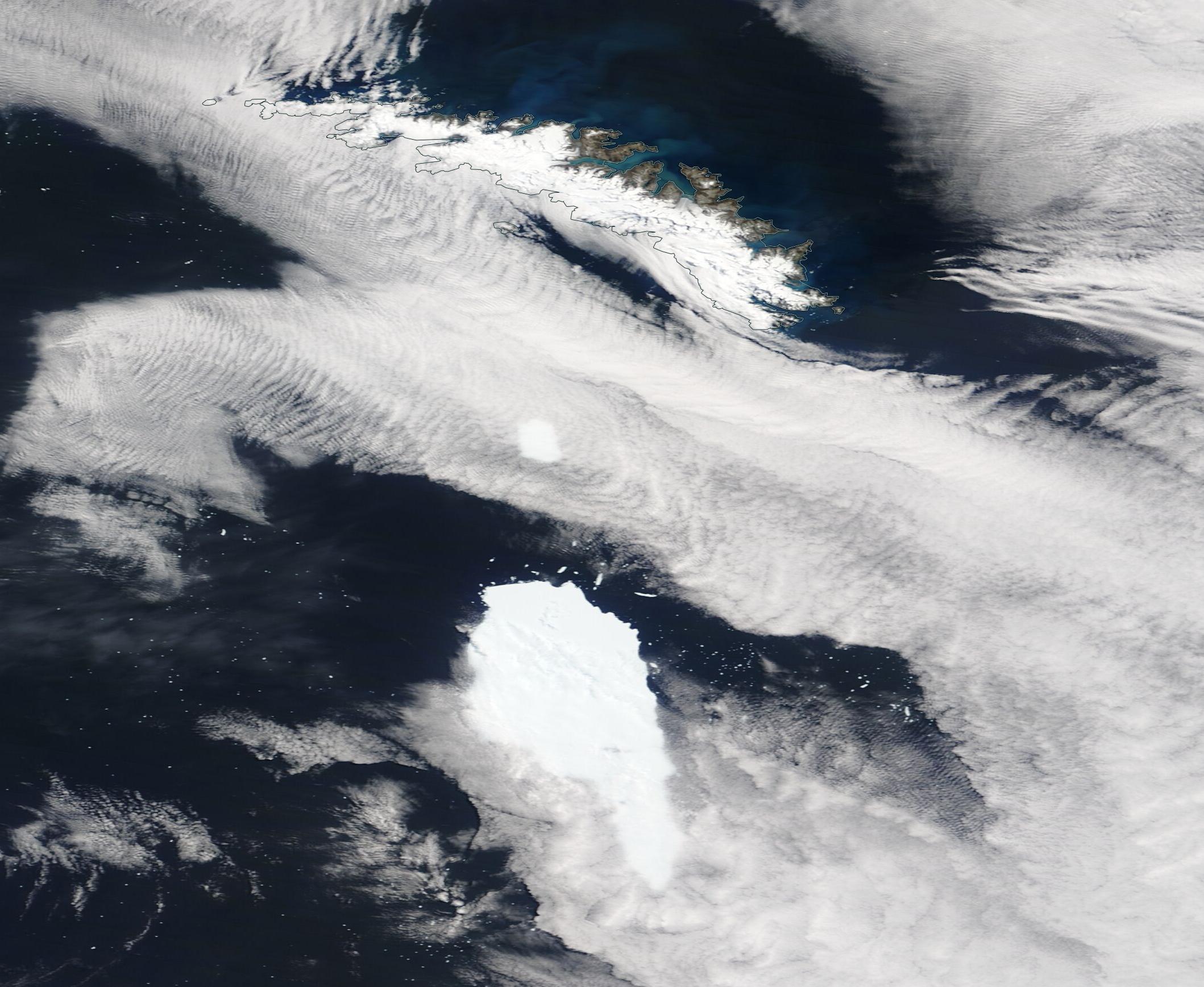
