
Images


January 4, 2021 - The Skagerrak
 Tweet
Tweet
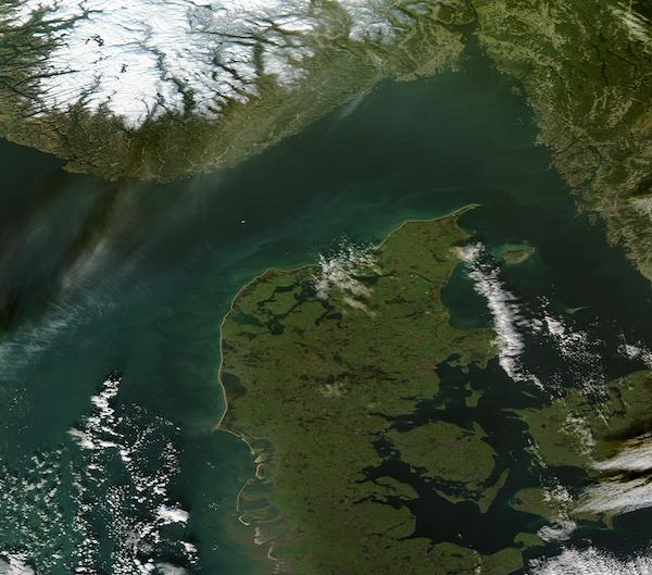
On December 25, 2020, the Moderate Resolution Imaging Spectroradiometer (MODIS) on board NASA’s Aqua satellite captured a true-color image centered on the Skagerrak Strait.
About 150 miles (240 km) long and 80-90 miles (130-145 km) wide, the Skagerrak separates Norway (north) from Denmark (south). Water flowing into the strait from the North Sea first flows eastward through the Skagerrak. Where the strait narrows—between the tip of the Jutland Peninsula and the Swedish coast—the Skagerrak ends, and the Kattegat begins. By flowing southward through the Kattegat, water moves toward the Danish Sounds and the Baltic Sea.
Image Facts
Satellite:
Aqua
Date Acquired: 12/25/2020
Resolutions:
1km (84.2 KB), 500m (295.2 KB), 250m (928.9 KB)
Bands Used: 1,4,3
Image Credit:
MODIS Land Rapid Response Team, NASA GSFC
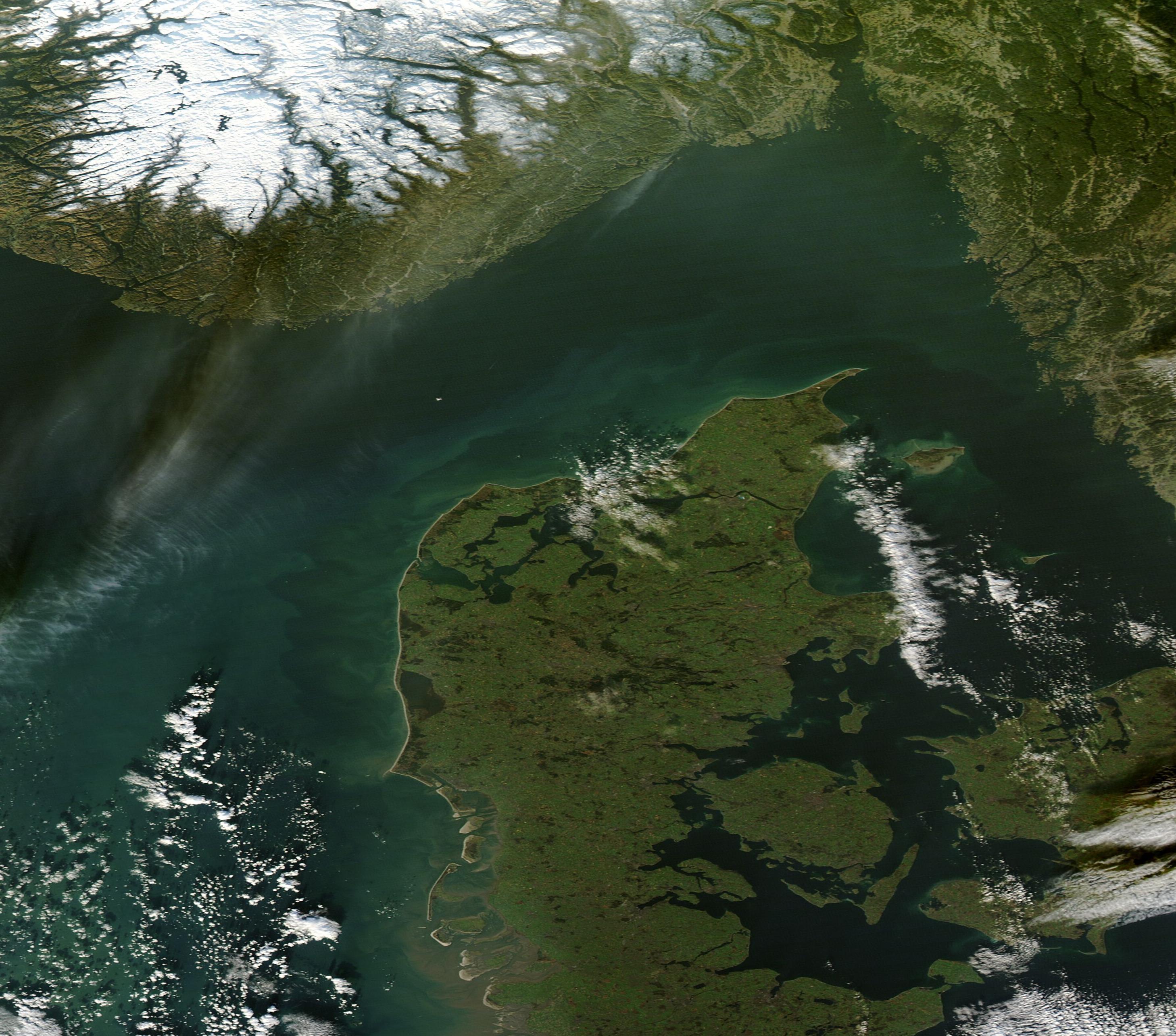
