
Images


May 14, 2021 - Tropical Cyclone Crising (03W)
 Tweet
Tweet
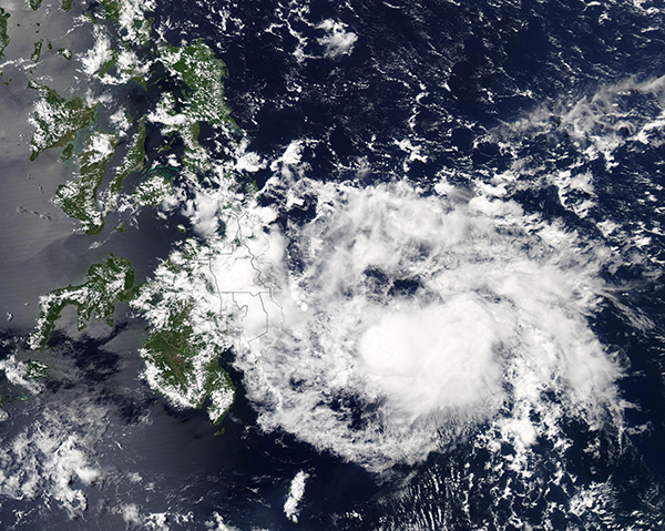
On May 13, 2021, the Moderate Resolution Imaging Spectroradiometer (MODIS) captured a true-color image of Tropical Cyclone Crising (03W) heading towards the Philippines.
The storm formed just east of this position on May 12 and, according to the Philippine Atmospheric, Geophysical and Astronomical Services Administration (PAGASA), made landfall in Northern Baganga, Davao Oriental, Mindanao at about 8:20 p.m. local time (1220 UTC) on May 13. Tropical Cyclone Crising quickly dropped to tropical depression strength once on land. By 2100 UTC on May 13, the system was considered a remnant tropical depression as it moved across the Philippines. It is one of only six storms to make landfall in Mindanao during the month of May since 1948, and the first since 1993.
Wind speeds at landfall were reported to be near 35 mph (56 km/h). While wind damage is unlikely, heavy rains increase the risk of landslides and floods in the islands.
Image Facts
Satellite:
Aqua
Date Acquired: 5/13/2021
Resolutions:
1km (1.5 MB), 500m (4.2 MB), 250m (3.2 MB)
Bands Used: 1,4,3
Image Credit:
MODIS Land Rapid Response Team, NASA GSFC
