
Images


May 15, 2021 - The Congo River
 Tweet
Tweet
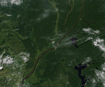
On May 11, 2021, the Moderate Resolution Imaging Spectroradiometer aboard NASA’s Aqua satellite acquired a true-color image of the Congo River, Lake Tumba, Lake Mai-Ndombe and the green lands of the Republic of the Congo (west) and the Democratic Republic of the Congo (east).
The Congo River cuts through clouds, cities, and jungles on its 2,718-mile (4,374-km) journey from the origins in Zambia to the outlet in the Atlantic Ocean. The longest river in Central Africa and the second-longest river in all of Africa (second only to the Nile), the Congo River Basin includes all of the Democratic Republic of the Congo (DRC), and parts of Burundi, Zambia, Angola, Rwanda, Central African Republic, Cameroon, and the Republic of the Congo, thus also earning the title of the African river with the largest basin.
Lake Tumba, combined with the small Lake Tele (located in the Republic of the Congo north of this image), are part of the world’s largest swamp forest and the worlds second-largest wetland area, according to the World Wildlife Fund. This region, spanning about 126,440 square kilometers (48,820 square miles), consists of marshes, seasonally-flooded forests, and meadows. The elongated Lake Mai-Ndombe sits south of Lake Tumba. This long, shallow freshwater lake spans about 2,300 square kilometers (890 square miles) in the dry season, but during the rainy season the lake floods. Seasonal flooding can cause Lake Mai-Ndombe to triple its dry-season size.
Image Facts
Satellite:
Terra
Date Acquired: 5/11/2021
Resolutions:
1km (147.9 KB), 500m (386.5 KB), 250m (227.1 KB)
Bands Used: 1,4,3
Image Credit:
MODIS Land Rapid Response Team, NASA GSFC
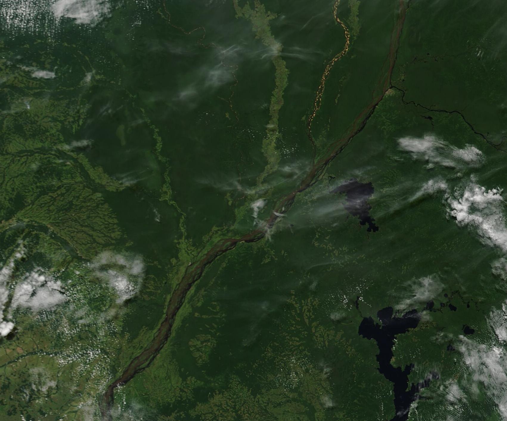
