
Images


August 2, 2021 - Fires in Central Africa
 Tweet
Tweet
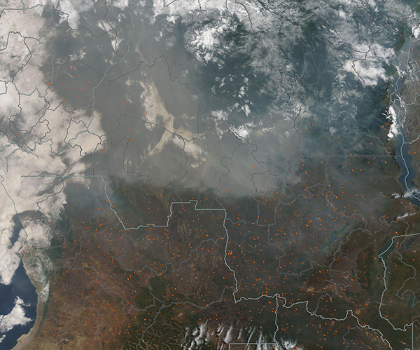
Hundreds of fires light up Central Africa as a thick blanket of smoke shrouds the sky in late July 2021. The Moderate Resolution Imaging Spectroradiometer (MODIS) on board NASA’s Aqua satellite acquired this true-color image on July 30.
Each red “hot spot” marks an area where the thermal bands on the MODIS instrument detected high temperatures. When combined with typical smoke, as in this image, such hot spots mark actively burning fire. Countries captured in this image, all speckled with hot spots, include Angola, Zambia, and Malawi in the south and the Democratic Republic of the Congo (DRC) in the north. The shroud of smoke over DRC is so thick that in many areas it completely obscures the land from view.
While it is not possible to determine how a fire has started from a satellite image, the widespread nature of these fires, their location and the time of year suggests that these are fires that people have intentionally set for agricultural purposes.
Farmers in this region have used fire for thousands of years to clear fields of old crops, prepare fields for new plantings, clear underbrush, and renew pasture or savanna grasslands. While fire is a cheap and efficient way to manage land, especially in the African savanna lands where the ecosystem depends on periodic fires for health, fire also creates hazards, such as pollution from the smoke, release of greenhouse gasses, and degradation of ecosystems. In Central Africa, the fire season typically begins by May and peaks in August.
Image Facts
Satellite:
Aqua
Date Acquired: 7/30/2021
Resolutions:
1km (457.6 KB), 500m (1.5 MB), 250m (4.6 MB)
Bands Used: 1,4,3
Image Credit:
MODIS Land Rapid Response Team, NASA GSFC
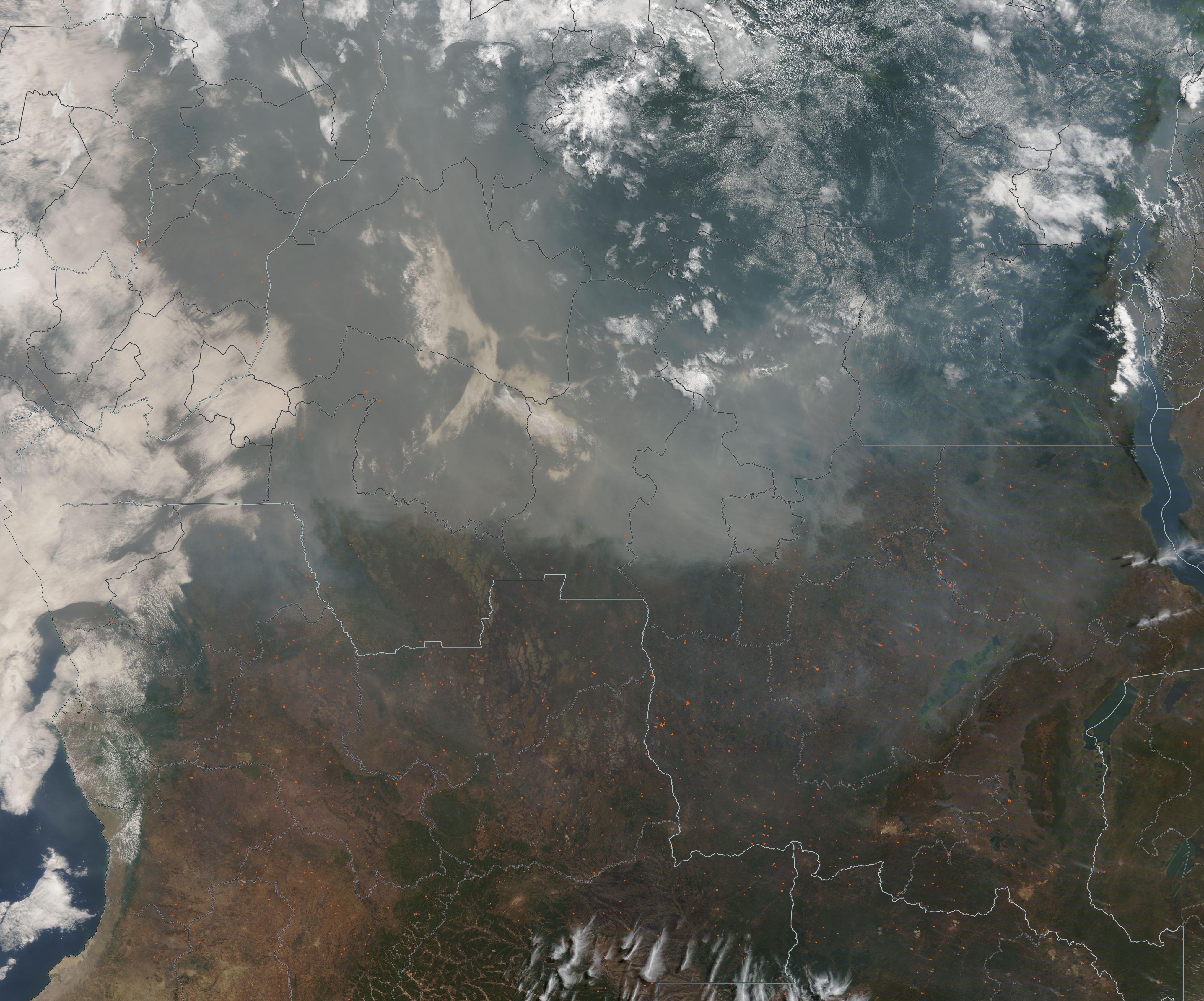
