
Images


December 14, 2021 - Tropical Cyclone Ruby
 Tweet
Tweet
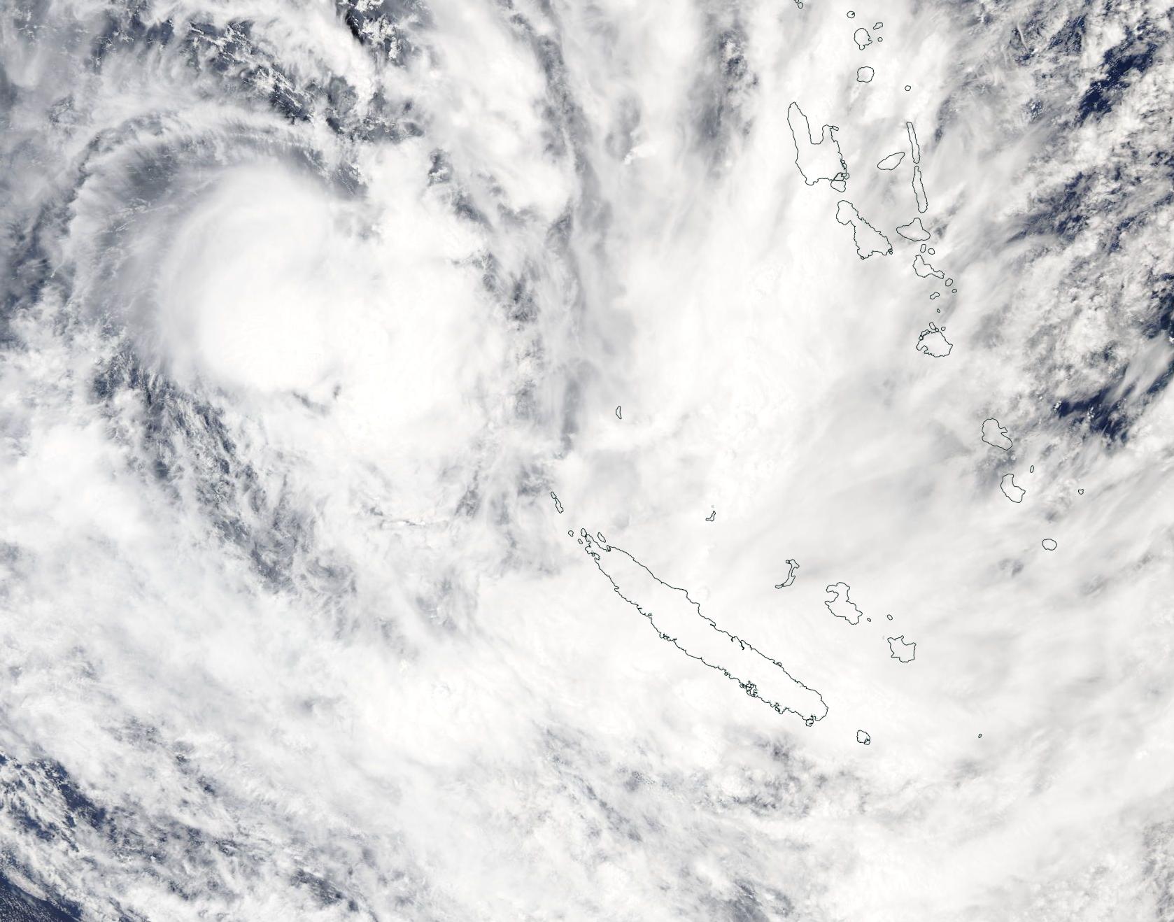
Tropical Cyclone Ruby formed in the Coral Sea east of Australia, north of New Caledonia and west of Vanuatu on December 12, 2021. According to the Joint typhoon warning center (JTWC), at 1500 UTC (10 a.m. EST) on December 13, Ruby was located at 19.2 south and 162.3 east, or 216 miles (443 km) northwest of Noumea, New Caledonia and was moving southeastward at 19.5 mph (31.5 km/h). Maximum sustained winds were estimated at 75 mph (120 km/h), placing it as a Category 1 storm on the Saffir-Simpson Hurricane Wind Scale or a Category 3 storm on the Australian tropical cyclone intensity Scale.
Tropical Cyclone Ruby is likely to move across New Caledonia prior to facing increasing wind shear. By late on December 14 or early December 15, Ruby will begin to interact with subtropical westerlies as well as passing over cooler waters. Increasing vertical wind shear will rapidly weaken the storm before it reaches New Zealand, but the JTWC expects Ruby to remain a storm-force subtropical low as it approaches New Zealand. Not only will Ruby impact the islands of New Caledonia with heavy rain and strong wind, it is expected to also bring downpours to New Zealand. In Australia, it is likely to serve as part of the formation of an “atmospheric river” that will bring rain to northeastern Australia.
The Moderate Resolution Imaging Spectroradiometer (MODIS) on board NASA’s Aqua satellite acquired a true-color image of Tropical Storm Ruby on the morning of December 13. The compact storm sported a distinct and cloud-filled eye as it moved toward the large island of Grande Terre, New Caledonia.
Image Facts
Satellite:
Aqua
Date Acquired: 12/13/2021
Resolutions:
1km (206.3 KB), 500m (600.3 KB), 250m (1.7 MB)
Bands Used: 1,4,3
Image Credit:
MODIS Land Rapid Response Team, NASA GSFC
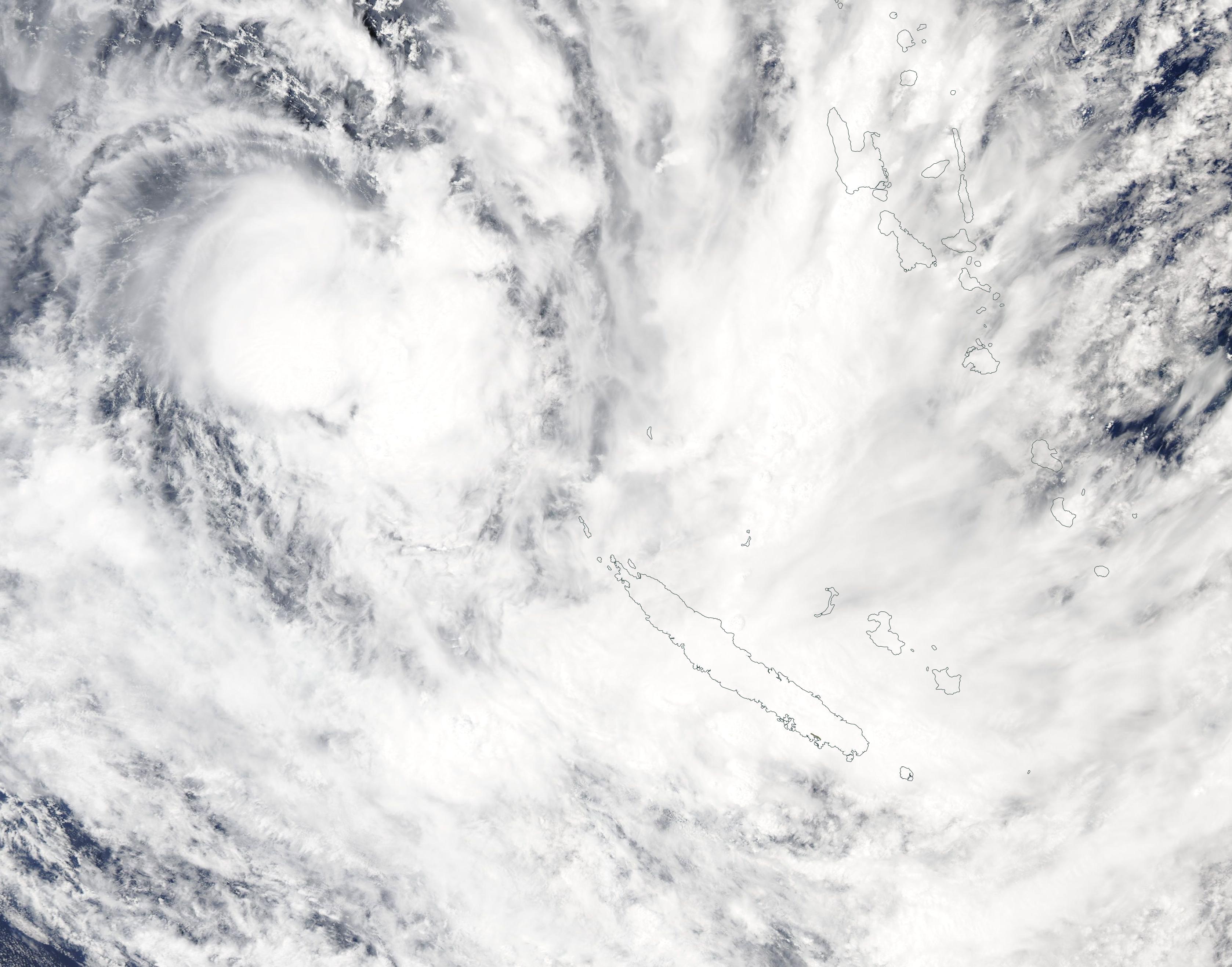
