
Images


January 2, 2022 - Mexico
 Tweet
Tweet
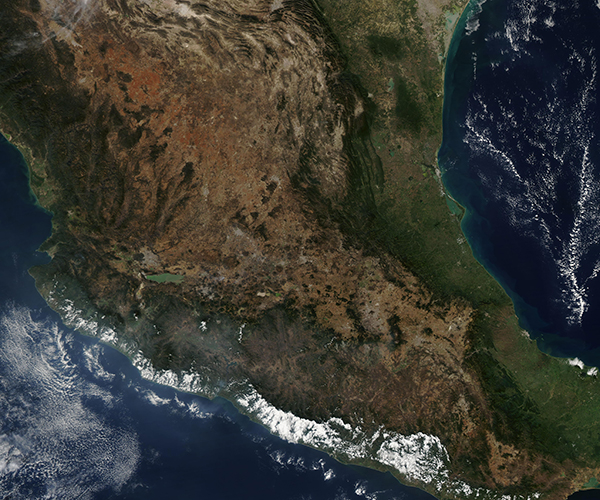
On December 25, 2021, the Moderate Resolution Imaging Spectroradiometer (MODIS) on board NASA's Terra satellite acquired a true-color image of much of Mexico.
The wide central plateau fills the center of the country, bounded by the mountains of the Sierra Madre Occidental range in the west and the Sierra Madre Oriental in the east. The different colors of the landscape broadly correlate with climate zones. Forests and coastal plains, both rich in precipitation and vegetation, appear green. Tans and browns mark the arid desert country and scrubland that stretches from north of Mexico City to the border between the United States and Mexico. White clouds cover the coastal plain in the southwest, along the Pacific Ocean. The Gulf of Mexico sits in the east.
Image Facts
Satellite:
Terra
Date Acquired: 12/25/2021
Resolutions:
1km (1.4 MB), 500m (4.1 MB), 250m (3 MB)
Bands Used: 1,4,3
Image Credit:
MODIS Land Rapid Response Team, NASA GSFC
