
Images


March 12, 2022 - Tropical Cyclone Gombe over Mozambique
 Tweet
Tweet
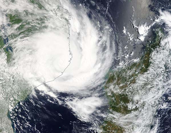
After soaking northern Madagascar earlier in the week, Tropical Cyclone Gombe made landfall over the central Nampula Province, Mozambique on March 11, 2022. As the storm came ashore, it carried maximum sustained winds of about 190 km/h (118 mph), which places it as a Category 3 storm on the Saffir-Simpson Hurricane Wind Scale. There were two fatalities in Madagascar, according to ReliefWeb. At least seven deaths have been reported in Madagascar as of the evening of March 11.
Once Gombe crossed the Mozambique coast, it moved inland and quickly weakened, becoming a tropical depression. Tropical depressions are cyclones with maximum sustained winds of 38 mph (61 km/h). While wind speeds have dropped precipitously, the storm is still carrying torrential rains, and may cause flooding both in Mozambique and Malawi.
The Joint Typhoon Warning Center (JTWC) expects Gombe to continue to unravel as it moves over land and should dissipate by March 12. The remnant of the system will turn to the south and then southeastward over the next two days then re-enter the Mozambique Channel as a weak tropical depression in the next few days.
The Moderate Resolution Imaging Spectroradiometer (MODIS) on board NASA’s Terra satellite acquired a true-color image of Tropical Cyclone Gombe shortly after landfall on March 11. At that time, the storm retained a cloud-filled center and convective bands winding tightly into the center. Rain bands from Gombe stretched over half of the Mozambique Channel and inland to Lake Malawi, a distance of more than 1,000 km (620 miles).
Image Facts
Satellite:
Terra
Date Acquired: 3/11/2022
Resolutions:
1km (448.7 KB), 500m (1.4 MB), 250m (4.3 MB)
Bands Used: 1,4,3
Image Credit:
MODIS Land Rapid Response Team, NASA GSFC
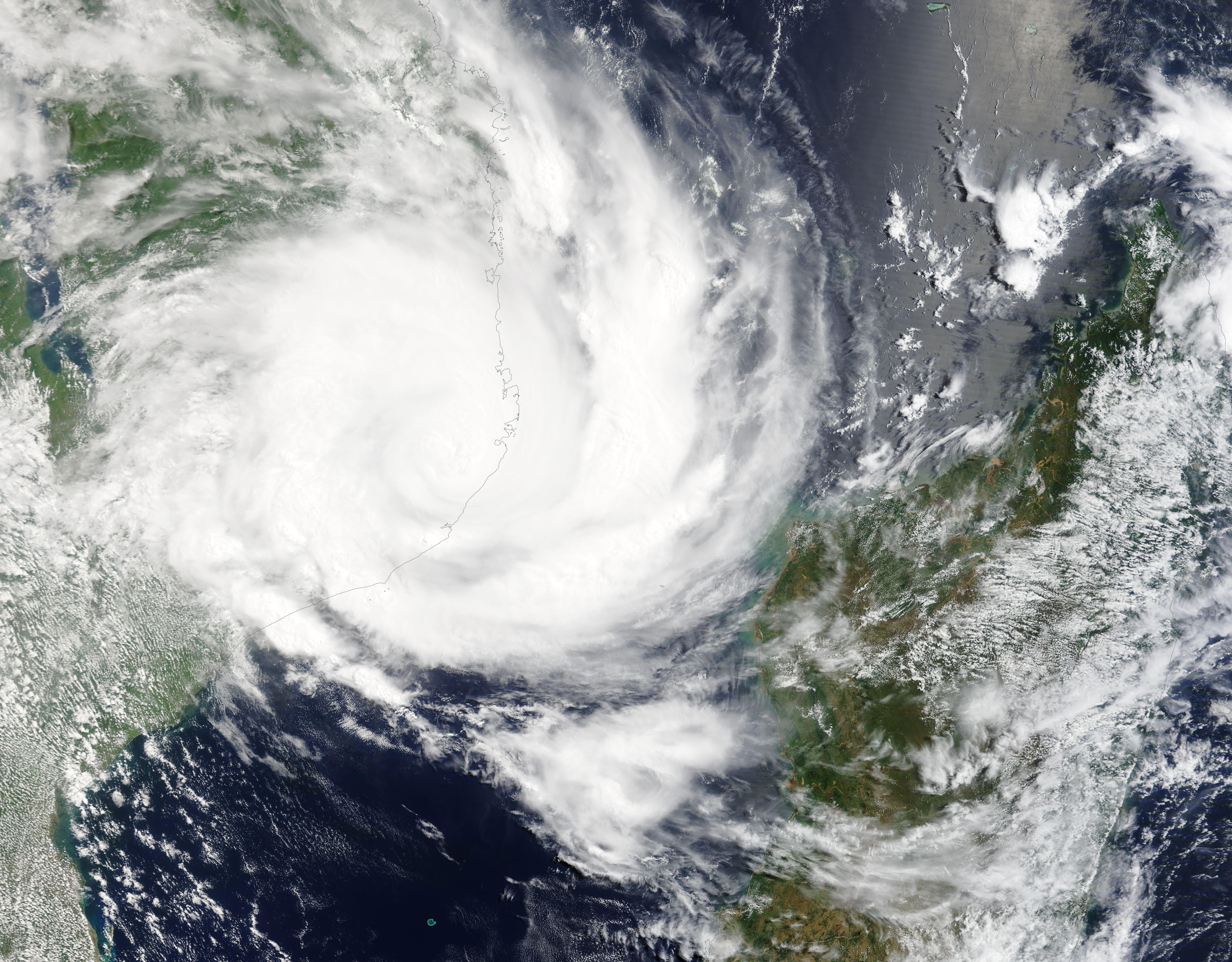
