
Images


April 11, 2022 - Greening in Southern United States
 Tweet
Tweet
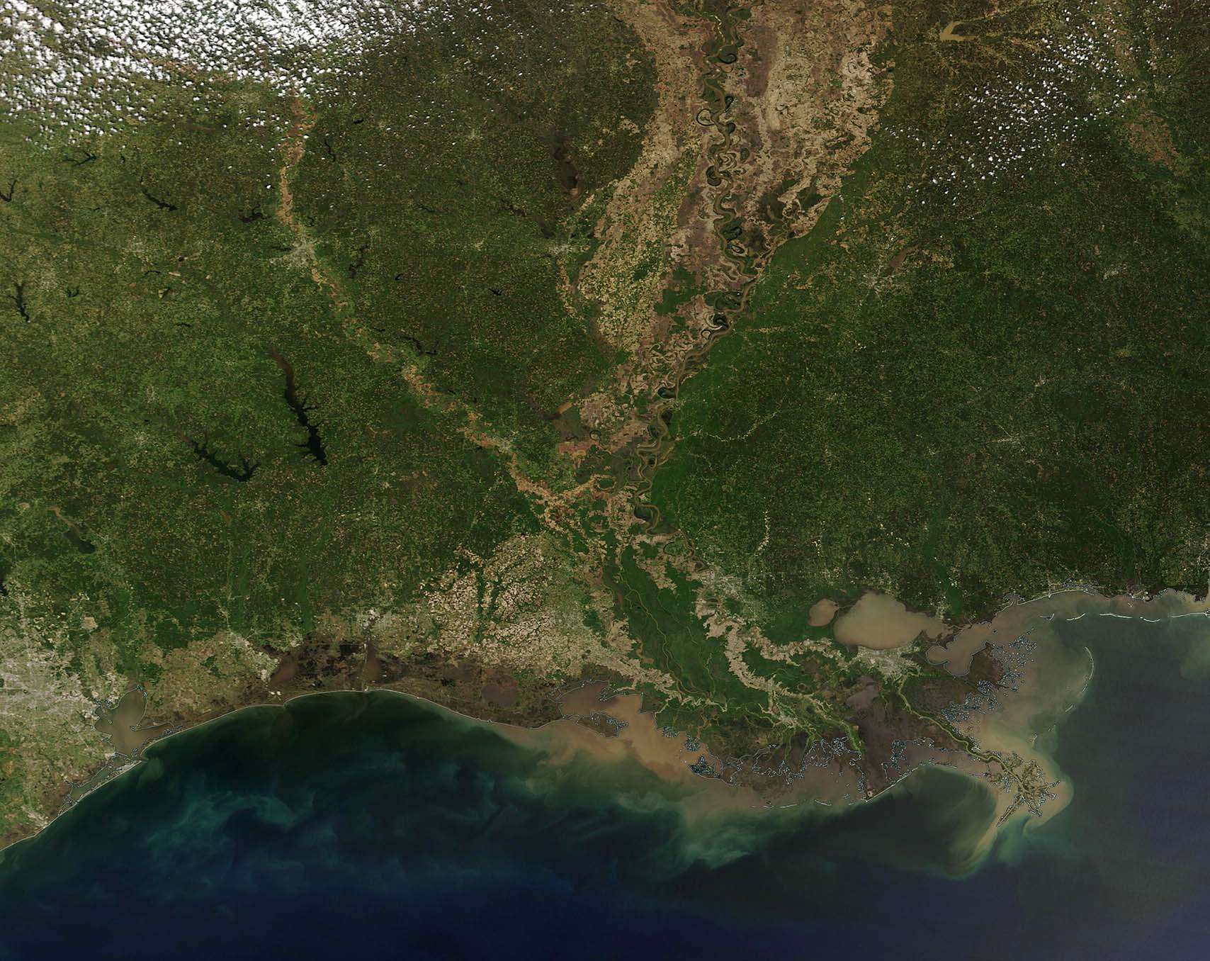
Each year, rising temperatures rise, lengthening daylight, and spring rains bring a flush of green across the United States. Starting in the far south and traveling northward following winter’s retreat, new leaves and fresh plant growth color the landscape so brightly that the change is easily seen from space.
On April 7, 2022, the Moderate Resolution Imaging Spectroradiometer (MODIS) acquired a true-color image of a clear spring day over the southern United States. The image centers on the Mississippi River Valley, a rich agricultural region. The long Mississippi River winds through the valley and carries substantial mud-brown sediment which it has picked up as snow melt and spring rains washed soils into the rolling river. Much of the valley still retains the tan hue of fallow fields, but green patches mark early growth of crops and pasture.
While this single image gives a clear view of spring in the South, to understand the change in the landscape over time, it’s necessary to view two images. Thanks to the NASA Worldview App, a comparison between this springtime image and one acquired on February 28 can be viewed simply by clicking here. Although this region of the southern United States retains green color year-round, thanks to few frosty nights, the landscape in the February image clearly shows more browns and tans, and less green than the April landscape.
Image Facts
Satellite:
Terra
Date Acquired: 4/7/2022
Resolutions:
1km (141.6 KB), 500m (351.1 KB), 250m (1.1 MB)
Bands Used: 1,4,3
Image Credit:
MODIS Land Rapid Response Team, NASA GSFC
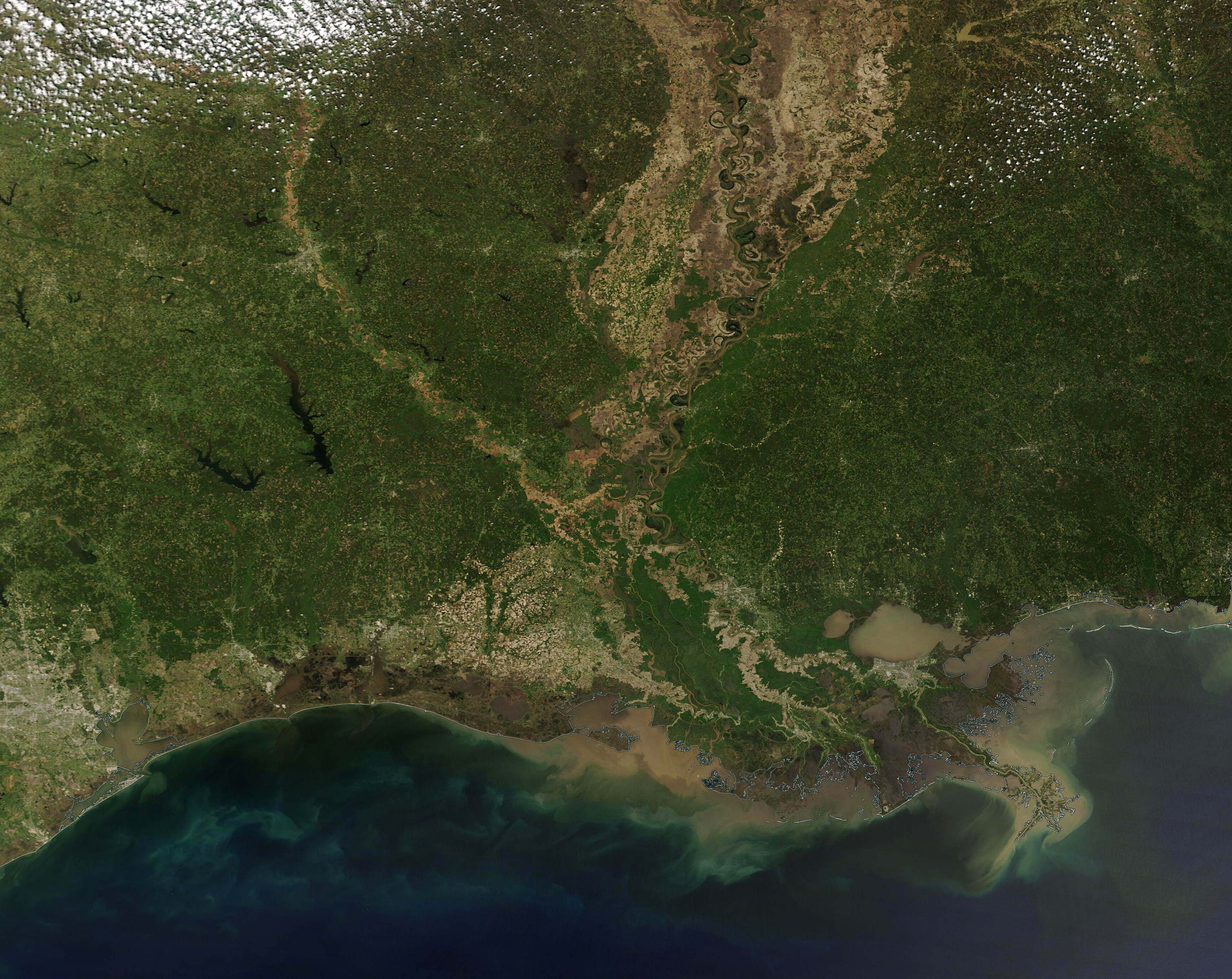
