
Images


April 12, 2022 - Battle of the Seasons in Michigan
 Tweet
Tweet
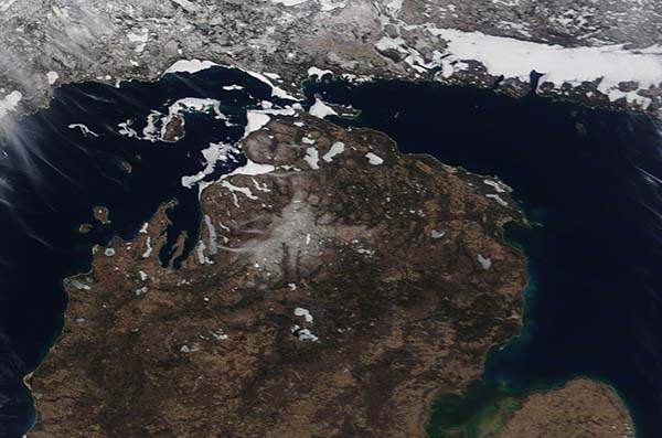
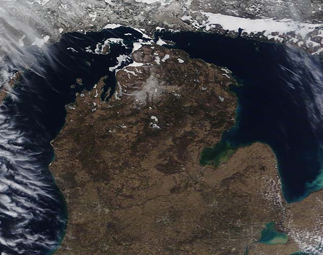
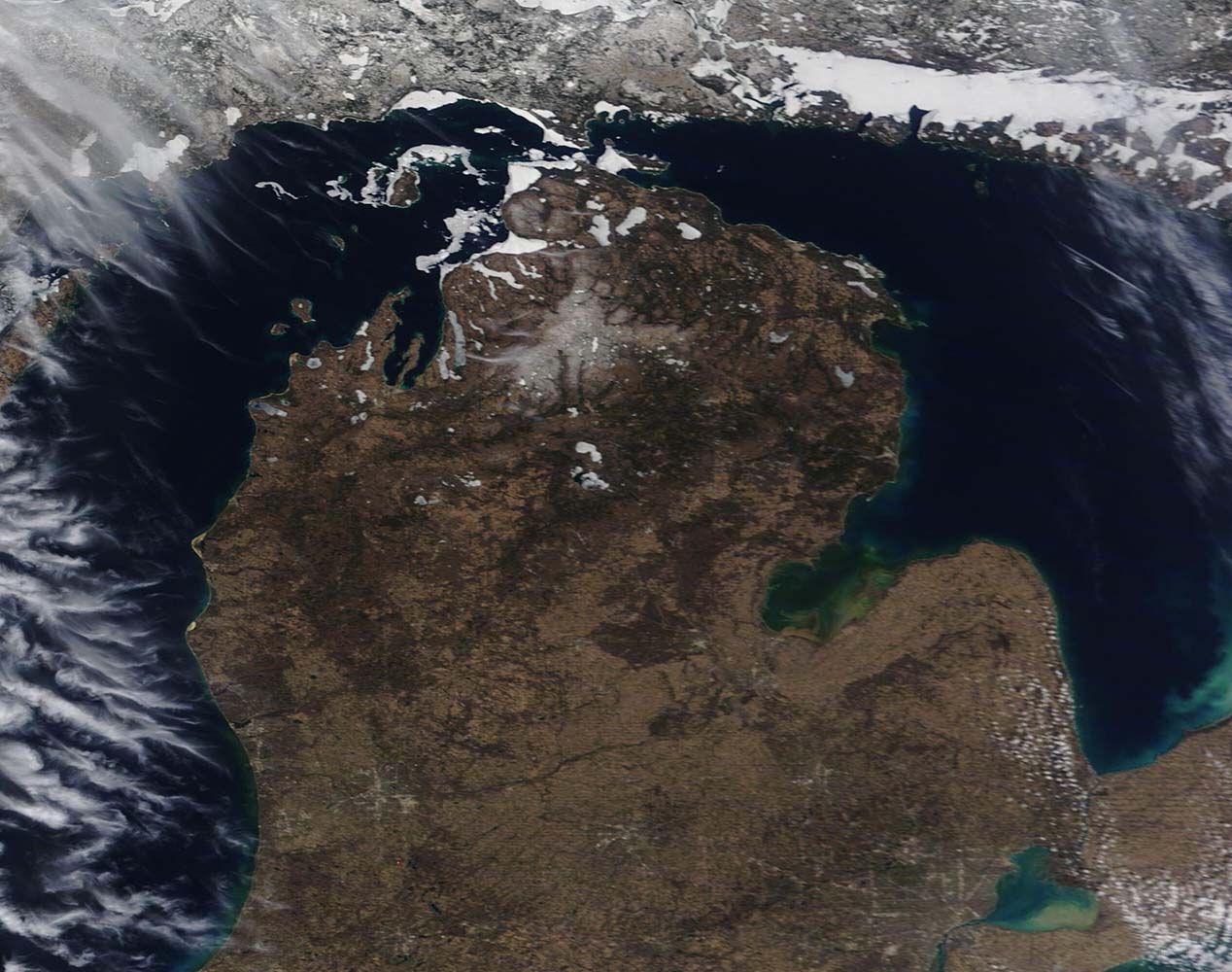
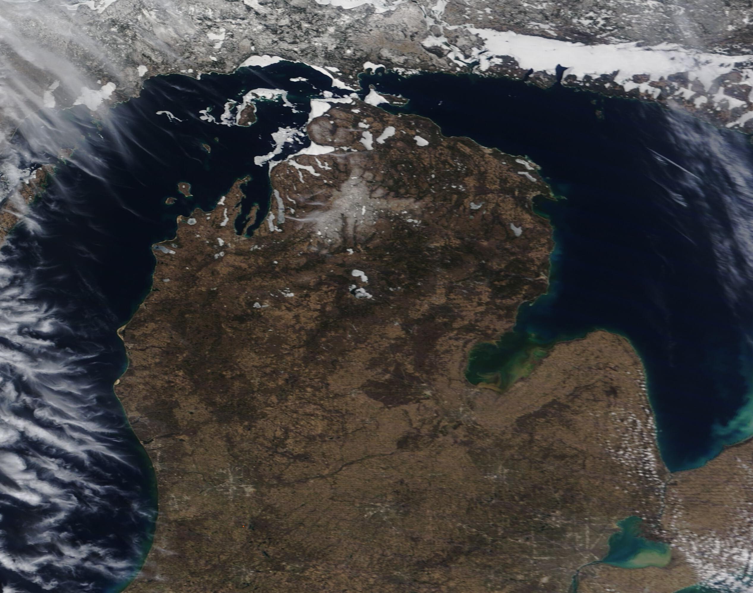
Winter and spring battled for control of northern Michigan in early April 2022. On April 11, the Moderate Resolution Imaging Spectroradiometer (MODIS) on board NASA’s Terra satellite acquired a true-color image showing this transitional time, when snow covers the Upper Peninsula and ice remains on bits of northern Lake Huron and Lake Michigan, despite warming temperatures and lengthening days that have already raised water temperatures and melted most lake ice.
In this image, Michigan’s Upper Peninsula (UP) sits in the upper left (northwest). A small amount of ice clings to the coastlines in the Straits of Mackinac, which separates the UP from lower Michigan and several rafts of ice float on the waters of northeastern Lake Michigan. In the northeast, the waters between Canada’s Manitoulin Island and the Ontario coast appear to remain solidly frozen although more southerly waters appear ice-free. Lakes across the northern tip of the “mitten” of Michigan also remain ice-covered and a swath of snow can be seen at high elevations.
Local weather reporting on mlive.com suggested that Michigan’s winter-spring wrestling match will continue over the next week, with a weather-making large storm system set to bring three distinct weather patterns within the next seven days. These include, “springy showers and storms, warmth and yes eventually colder air with snow showers”.
Image Facts
Satellite:
Terra
Date Acquired: 4/10/2022
Resolutions:
1km (82.3 KB), 500m (190.8 KB), 250m (493.1 KB)
Bands Used: 1,4,3
Image Credit:
MODIS Land Rapid Response Team, NASA GSFC
