
Images


June 28, 2022 - Swirls off the Pacific Northwest
 Tweet
Tweet
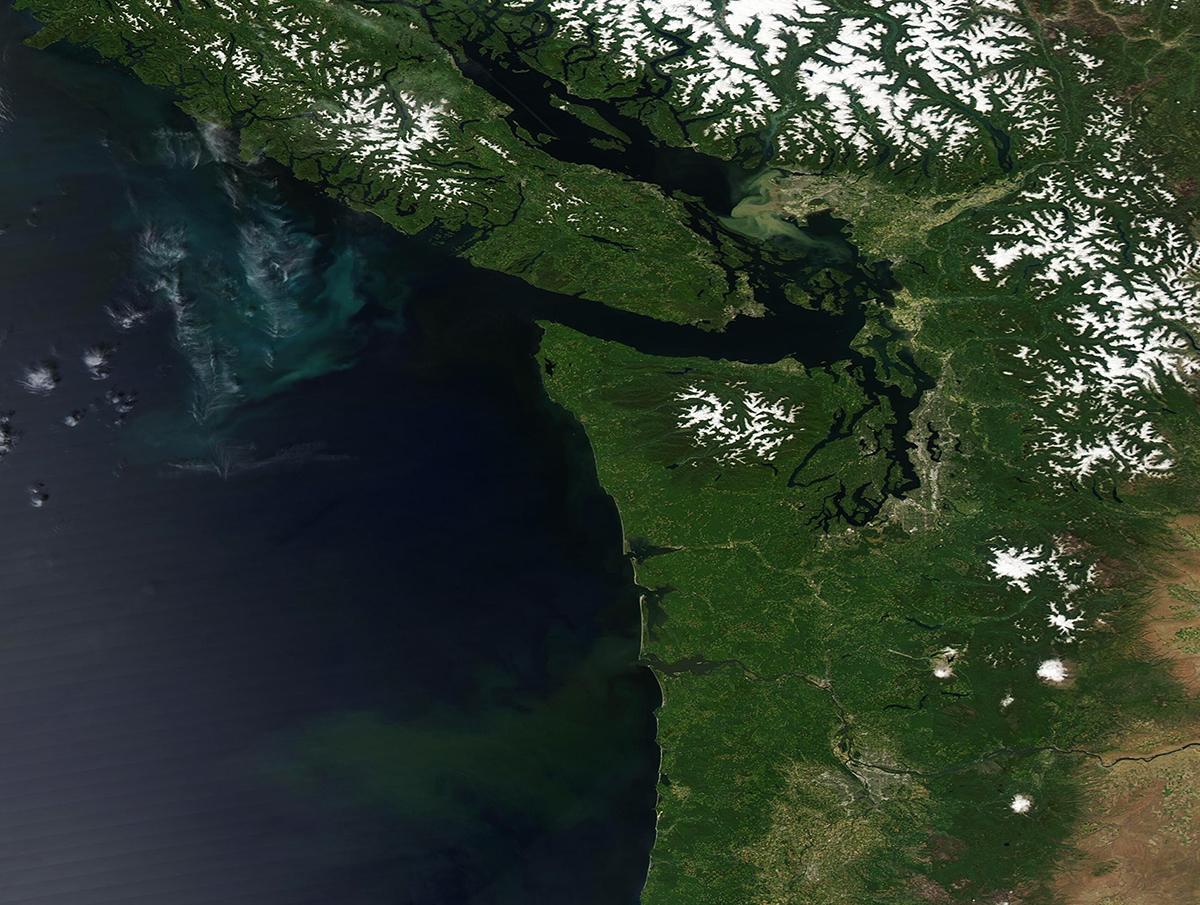
Few clouds floated in the sky off the coast of the Pacific Northwest on June 26, 2022, when the Moderate Resolution Imaging Spectroradiometer (MODIS) on the Aqua satellite acquired a stunning and rare clear-sky, true-color image of the region.
On land, the image captures a view of the Canadian province of British Columbia (north), including Vancouver Island, and the U.S. state of Washington and part of northern Oregon. The verdant deep greens are coastal forest, both along the coast and on the lower mountain elevations. Even though it is early summer, the high elevations remain white with ice and snow. Low valleys and agricultural lands appear lighter green.
South of Vancouver Island, sparse lines of cloud hover over a large bloom of phytoplankton that tints the water with swirls of green and turquoise. These microscopic plant-like organisms live in these waters in small numbers year-round, but when upper layers of water are loaded with nutrients (usually due to upwelling of cool, nutrient-rich water from deep in the sea to the surface) and the water temperature and sunlight hours are favorable, phytoplankton can reproduce explosively to create massive “blooms” that can easily be seen from space. Blooms are common in this location, especially in spring and summer.
Image Facts
Satellite:
Aqua
Date Acquired: 6/26/2022
Resolutions:
1km (510.2 KB), 500m (1.3 MB), 250m (3 MB)
Bands Used: 1,4,3
Image Credit:
MODIS Land Rapid Response Team, NASA GSFC
