
Images


August 4, 2022 - Hurricane Frank
 Tweet
Tweet
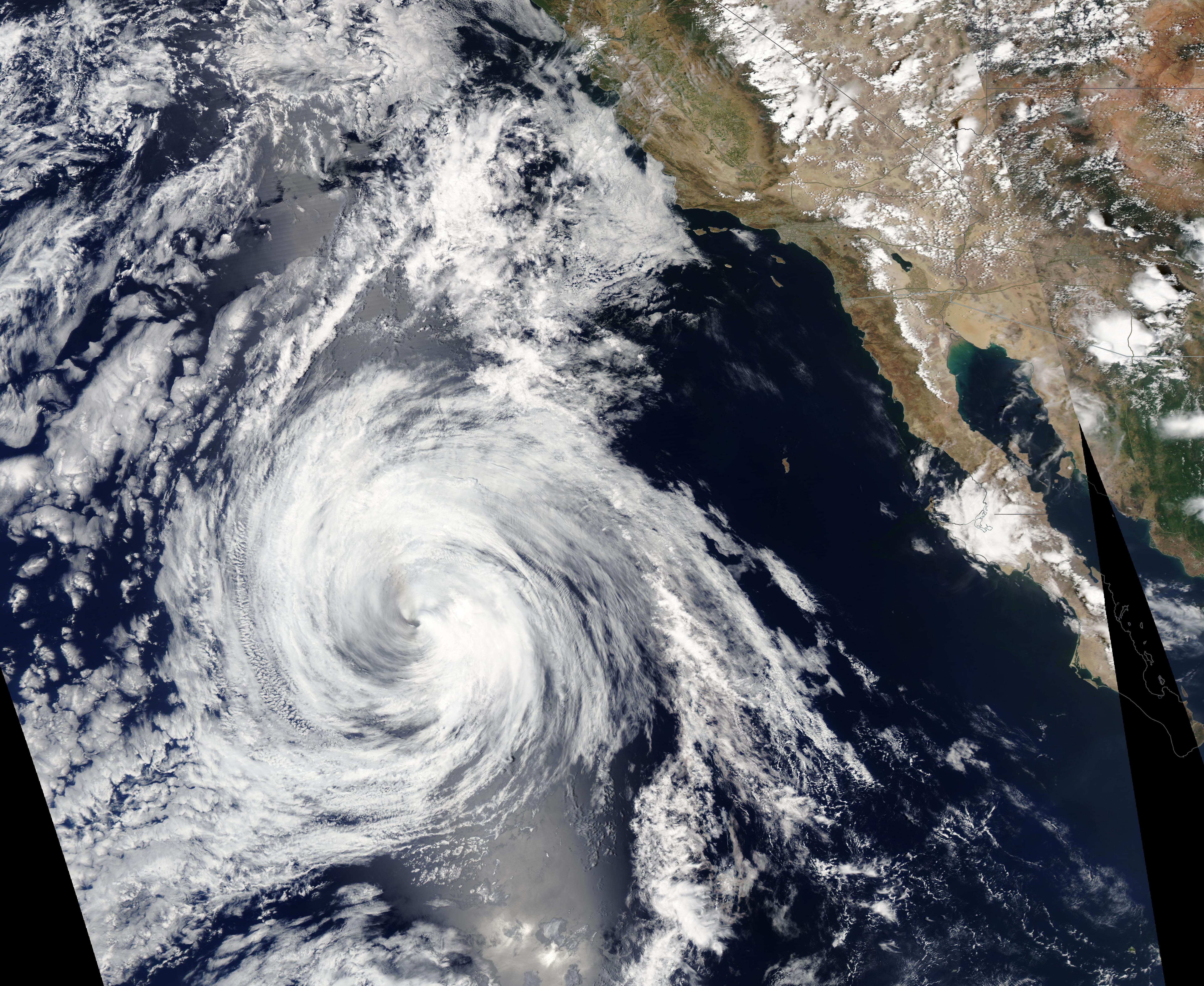
Hurricane Frank was a short-lived storm, forming over the Pacific Ocean off of central Mexico as Tropical Storm Frank on July 26 and degenerating into a post-tropical cyclone on August 2. Frank became a Category 1 hurricane on July 29 as maximum sustained winds of 75 mph. It reached peak strength of 90 mph on July 31 as it moved over the Pacific Ocean west of, and parallel to, Baja California. By August 1, Hurricane Frank was facing increasing wind shear and began to rapidly deteriorate.
At 2100 UTC (5:00 p.m. EDT) on August 2 the National Hurricane Center (NHC) issued its final advisory on Frank. At that time, the storm was located about 715 mi (1,155 km) southwest of San Diego, California. Maximum sustained winds were 40 mph (65 km/h), and it was moving to the northwest at 12 mph (19 km/h).
The Moderate Resolution Imaging Spectroradiometer (MODIS) on board NASA’s Aqua satellite acquired a true-color image of Tropical Storm Frank as it was weakening on August 2. While wind speeds had dropped substantially from peak strength, the system retained a symmetrical shape as well as rotation of convective bands into a distinct center.
Image Facts
Satellite:
Aqua
Date Acquired: 8/2/2022
Resolutions:
1km (4.5 MB), 500m (3.5 MB),
Bands Used: 1,4,3
Image Credit:
MODIS Land Rapid Response Team, NASA GSFC
